


<< Text Pages >> Oakham Timber Circle - Timber Circle in England in Leicestershire and Rutland
Submitted by vicky on Thursday, 04 March 2004 Page Views: 6717
Neolithic and Bronze AgeSite Name: Oakham Timber CircleCountry: England
NOTE: This site is 3.194 km away from the location you searched for.
County: Leicestershire and Rutland Type: Timber Circle
Nearest Town: Oakham
Map Ref: SK867095 Landranger Map Number: 141
Latitude: 52.676277N Longitude: 0.719115W
Condition:
| 5 | Perfect |
| 4 | Almost Perfect |
| 3 | Reasonable but with some damage |
| 2 | Ruined but still recognisable as an ancient site |
| 1 | Pretty much destroyed, possibly visible as crop marks |
| 0 | No data. |
| -1 | Completely destroyed |
| 5 | Superb |
| 4 | Good |
| 3 | Ordinary |
| 2 | Not Good |
| 1 | Awful |
| 0 | No data. |
| 5 | Can be driven to, probably with disabled access |
| 4 | Short walk on a footpath |
| 3 | Requiring a bit more of a walk |
| 2 | A long walk |
| 1 | In the middle of nowhere, a nightmare to find |
| 0 | No data. |
| 5 | co-ordinates taken by GPS or official recorded co-ordinates |
| 4 | co-ordinates scaled from a detailed map |
| 3 | co-ordinates scaled from a bad map |
| 2 | co-ordinates of the nearest village |
| 1 | co-ordinates of the nearest town |
| 0 | no data |
Internal Links:
External Links:
Timber Circle in Rutland
Have you visited this site? Please add a comment below.
You may be viewing yesterday's version of this page. To see the most up to date information please register for a free account.
Do not use the above information on other web sites or publications without permission of the contributor.
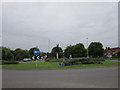
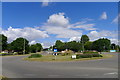
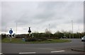
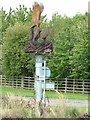
Nearby Images from Geograph Britain and Ireland:
©2012(licence)
©2016(licence)
©2019(licence)
©2010(licence)
©2010(licence)
The above images may not be of the site on this page, they are loaded from Geograph.
Please Submit an Image of this site or go out and take one for us!
Click here to see more info for this site
Nearby sites
Key: Red: member's photo, Blue: 3rd party photo, Yellow: other image, Green: no photo - please go there and take one, Grey: site destroyed
Download sites to:
KML (Google Earth)
GPX (GPS waypoints)
CSV (Garmin/Navman)
CSV (Excel)
To unlock full downloads you need to sign up as a Contributory Member. Otherwise downloads are limited to 50 sites.
Turn off the page maps and other distractions
Nearby sites listing. In the following links * = Image available
100m W 271° Our Lady's Well (Oakham)* Holy Well or Sacred Spring (SK866095)
2.4km NW 316° Langham Lodge Long Barrow (SK850112)
4.3km N 10° Ashwell Wishing Well* Holy Well or Sacred Spring (SK874137)
4.5km SW 231° The Braunston Goddess* Sculptured Stone (SK8324606581)
7.1km SSW 198° Ridlington settlement Misc. Earthwork (SK846027)
7.2km SSE 158° The Old Maze* Turf Maze (SK8954902833)
7.6km NE 49° Greetham* Holy Well or Sacred Spring (SK924146)
8.4km E 98° Sheela-Na-Gig (Empingham)* Sculptured Stone (SK951085)
10.3km ESE 116° Wytchley Warren (Edith Weston) Cairn (SK961052)
10.8km WNW 284° Burrough-on-the-hill* Hillfort (SK761119)
12.2km NW 309° Burton Lazars Stockwell* Holy Well or Sacred Spring (SK770170)
13.5km ESE 123° Tixover Grange Long Barrow (SK981023)
14.6km E 83° Walk Farm Enclosure Ancient Village or Settlement (TF012116)
14.8km ENE 65° Holy Well (Careby and Aunby) Holy Well or Sacred Spring (TF00031598)
15.4km N 357° St Bartholomew (Sproxton)* Ancient Cross (SK8566624904)
15.6km WNW 285° Folville Cross* Ancient Cross (SK715134)
15.9km S 169° The Jo Stone* Natural Stone / Erratic / Other Natural Feature (SP8995293949)
16.2km WSW 247° Billesdon Cross* Ancient Cross (SK7191302822)
16.2km WSW 237° St John The Baptist (Rolleston)* Ancient Cross (SK7326200402)
16.3km S 187° Great Easton Roman Well* Holy Well or Sacred Spring (SP850933)
16.5km N 11° Fish Well* Holy Well or Sacred Spring (SK89602578)
17.4km SE 137° Blatherwycke stone cross Marker Stone (SP988969)
18.3km WNW 283° The Blue Stone (Gaddesby)* Standing Stone (Menhir) (SK687132)
18.3km ENE 71° Careby Camp* Hillfort (TF040157)
18.4km N 1° King Lud’s Intrenchments Misc. Earthwork (SK867279)
View more nearby sites and additional images


 We would like to know more about this location. Please feel free to add a brief description and any relevant information in your own language.
 Wir möchten mehr über diese Stätte erfahren. Bitte zögern Sie nicht, eine kurze Beschreibung und relevante Informationen in Deutsch hinzuzufügen.
 Nous aimerions en savoir encore un peu sur les lieux. S'il vous plaît n'hesitez pas à ajouter une courte description et tous les renseignements pertinents dans votre propre langue.
 Quisieramos informarnos un poco más de las lugares. No dude en añadir una breve descripción y otros datos relevantes en su propio idioma.