


<< Text Pages >> Dun Ban (Camascross) - Stone Fort or Dun in Scotland in Isle of Skye
Submitted by Andy B on Tuesday, 19 October 2010 Page Views: 3171
Multi-periodSite Name: Dun Ban (Camascross)Country: Scotland
NOTE: This site is 2.403 km away from the location you searched for.
County: Isle of Skye Type: Stone Fort or Dun
Map Ref: NG70121065
Latitude: 57.129081N Longitude: 5.799989W
Condition:
| 5 | Perfect |
| 4 | Almost Perfect |
| 3 | Reasonable but with some damage |
| 2 | Ruined but still recognisable as an ancient site |
| 1 | Pretty much destroyed, possibly visible as crop marks |
| 0 | No data. |
| -1 | Completely destroyed |
| 5 | Superb |
| 4 | Good |
| 3 | Ordinary |
| 2 | Not Good |
| 1 | Awful |
| 0 | No data. |
| 5 | Can be driven to, probably with disabled access |
| 4 | Short walk on a footpath |
| 3 | Requiring a bit more of a walk |
| 2 | A long walk |
| 1 | In the middle of nowhere, a nightmare to find |
| 0 | No data. |
| 5 | co-ordinates taken by GPS or official recorded co-ordinates |
| 4 | co-ordinates scaled from a detailed map |
| 3 | co-ordinates scaled from a bad map |
| 2 | co-ordinates of the nearest village |
| 1 | co-ordinates of the nearest town |
| 0 | no data |
Be the first person to rate this site - see the 'Contribute!' box in the right hand menu.
Internal Links:
External Links:
Stone Fort or Dun in Isle of Skye
The site of Dun Ban is a flat-topped rock rising some 40 ft above the sea and 25 ft above the neck joining it to the mainland. The summit, an irregular oval, measuring about 60 ft in length along its main axis, ENE-WSW, and some 30 ft in breadth, has been surrounded by a drystone wall on the edge of the rock. It can be traced for the greater part of the circumference except at the NE extremity. The name Dun Ban (white fort) is accounted for by the rock being partly composed of white quartz.
Source: Canmore
You may be viewing yesterday's version of this page. To see the most up to date information please register for a free account.
Do not use the above information on other web sites or publications without permission of the contributor.
Nearby Images from Geograph Britain and Ireland:
©2007(licence)
©2009(licence)
©2009(licence)
©2011(licence)
©2009(licence)
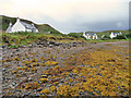
The above images may not be of the site on this page, they are loaded from Geograph.
Please Submit an Image of this site or go out and take one for us!
Click here to see more info for this site
Nearby sites
Key: Red: member's photo, Blue: 3rd party photo, Yellow: other image, Green: no photo - please go there and take one, Grey: site destroyed
Download sites to:
KML (Google Earth)
GPX (GPS waypoints)
CSV (Garmin/Navman)
CSV (Excel)
To unlock full downloads you need to sign up as a Contributory Member. Otherwise downloads are limited to 50 sites.
Turn off the page maps and other distractions
Nearby sites listing. In the following links * = Image available
2.4km WSW 246° Dun Knock (Toravaig)* Stone Fort or Dun (NG679098)
2.9km SW 215° Dun Choinnich* Broch or Nuraghe (NG68290834)
5.5km SW 225° Dun Faich Stone Fort or Dun (NG66020697)
7.0km S 177° Dun Ban (Doune)* Stone Fort or Dun (NG70110362)
7.3km W 278° Meal-da-Bheinn* Stone Circle (NG629121)
7.4km SW 225° Dun Ela* Stone Fort or Dun (NG64640569)
8.6km WNW 284° Teampuill Chaon* Early Christian Sculptured Stone (NG61831321)
8.8km NW 322° Heaste Stone Standing Stone (Menhir) (NG6505117847)
8.8km WNW 285° Tobar Chaon* Holy Well or Sacred Spring (NG61711340)
9.2km SW 219° Cists near Armadale Pier Burial Chamber or Dolmen (NG640038)
9.3km SW 220° Armadale Bay Cairn Cairn (NG63680390)
9.7km W 279° Inver Aulavaig 2* Cairn (NG6059112629)
9.8km W 278° Inver Aulavaig 1* Cairn (NG60441259)
9.9km WNW 302° Dun Boreraig Stone* Standing Stone (Menhir) (NG61951638)
10.2km WNW 300° Dun Boreraig Fort* Hillfort (NG615162)
10.2km SW 219° Dun Acardinon* Stone Fort or Dun (NG63250305)
11.0km W 265° Cnoc an Temple* Burial Chamber or Dolmen (NG591104)
12.3km SW 219° Dun Chlo (Tormore)* Stone Fort or Dun (NG618015)
12.5km WNW 300° Dun Kearstack* Hillfort (NG596175)
12.6km NW 317° Kilchrist, Glebe* Stone Circle (NG61972027)
13.3km NNW 341° Achadh A'chuirn* Chambered Cairn (NG66422343)
13.5km NW 324° Suardal* Chambered Cairn (NG62722203)
13.6km SW 221° Dun A'Chleirich* Stone Fort or Dun (NG60590091)
13.7km N 351° Tobar Ashik* Holy Well or Sacred Spring (NG6873324291)
14.0km NW 307° High Pasture Cave* Cave or Rock Shelter (NG59431971)
View more nearby sites and additional images


 We would like to know more about this location. Please feel free to add a brief description and any relevant information in your own language.
 Wir möchten mehr über diese Stätte erfahren. Bitte zögern Sie nicht, eine kurze Beschreibung und relevante Informationen in Deutsch hinzuzufügen.
 Nous aimerions en savoir encore un peu sur les lieux. S'il vous plaît n'hesitez pas à ajouter une courte description et tous les renseignements pertinents dans votre propre langue.
 Quisieramos informarnos un poco más de las lugares. No dude en añadir una breve descripción y otros datos relevantes en su propio idioma.