


<< Text Pages >> Yeld Wood - Stone Row / Alignment in England in Herefordshire
Submitted by hanterman on Monday, 26 February 2007 Page Views: 5279
Neolithic and Bronze AgeSite Name: Yeld Wood Alternative Name: The Yeld StoneCountry: England
NOTE: This site is 3.975 km away from the location you searched for.
County: Herefordshire Type: Stone Row / Alignment
Nearest Town: Kington
Map Ref: SO26995724
Latitude: 52.208525N Longitude: 3.069876W
Condition:
| 5 | Perfect |
| 4 | Almost Perfect |
| 3 | Reasonable but with some damage |
| 2 | Ruined but still recognisable as an ancient site |
| 1 | Pretty much destroyed, possibly visible as crop marks |
| 0 | No data. |
| -1 | Completely destroyed |
| 5 | Superb |
| 4 | Good |
| 3 | Ordinary |
| 2 | Not Good |
| 1 | Awful |
| 0 | No data. |
| 5 | Can be driven to, probably with disabled access |
| 4 | Short walk on a footpath |
| 3 | Requiring a bit more of a walk |
| 2 | A long walk |
| 1 | In the middle of nowhere, a nightmare to find |
| 0 | No data. |
| 5 | co-ordinates taken by GPS or official recorded co-ordinates |
| 4 | co-ordinates scaled from a detailed map |
| 3 | co-ordinates scaled from a bad map |
| 2 | co-ordinates of the nearest village |
| 1 | co-ordinates of the nearest town |
| 0 | no data |
Internal Links:
External Links:
Stone Row / Alignment in Herefordshire
A stone first spotted on the Ordinance Survey first edition map for the area is on further inspection the well weathered remains of a standing stone. Now just 0.5 m in height i think it was never more than 2.0m tall. Not known to be on a parish or other known boundary. Purpose and period unknown, or is it.
You may be viewing yesterday's version of this page. To see the most up to date information please register for a free account.
Do not use the above information on other web sites or publications without permission of the contributor.
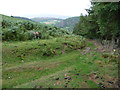
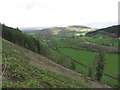
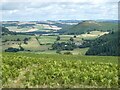
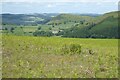
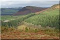
Nearby Images from Geograph Britain and Ireland:
©2011(licence)
©2015(licence)
©2021(licence)
©2022(licence)
©2018(licence)
The above images may not be of the site on this page, they are loaded from Geograph.
Please Submit an Image of this site or go out and take one for us!
Click here to see more info for this site
Nearby sites
Key: Red: member's photo, Blue: 3rd party photo, Yellow: other image, Green: no photo - please go there and take one, Grey: site destroyed
Download sites to:
KML (Google Earth)
GPX (GPS waypoints)
CSV (Garmin/Navman)
CSV (Excel)
To unlock full downloads you need to sign up as a Contributory Member. Otherwise downloads are limited to 50 sites.
Turn off the page maps and other distractions
Nearby sites listing. In the following links * = Image available
1.0km WSW 244° The Whet Stone (Hergest Ridge)* Natural Stone / Erratic / Other Natural Feature (SO26055680)
1.7km NE 34° Bradnor Hill 1 Stone Row / Alignment (SO27945860)
2.7km NNW 342° Walton Cursus Cursus (SO26195978)
2.7km N 349° Walton Green Cursus (SO26525989)
2.7km NW 312° Old Radnor Church* Standing Stone (Menhir) (SO24995909)
2.8km N 356° Walton Cursus Cursus (SO26826001)
3.2km NNW 326° Walton Palisaded Enclosure* Timber Circle (SO25235996)
3.6km NW 318° Knapp Mount Barrow* Barrow Cemetery (SO2458659975)
3.8km NNW 348° Hindwell Causewayed Enclosure* Causewayed Enclosure (SO26246092)
3.8km NNW 334° Hindwell Farm 1* Round Barrow(s) (SO25376064)
3.8km NNW 335° Hindwell Enclosure* Timber Circle (SO2544560720)
3.9km NW 314° Harpton Round Barrows* Round Barrow(s) (SO24225998)
4.0km NNE 21° Burfa Camp* Hillfort (SO285610)
4.1km NNW 329° Hindwell Cursus* Cursus (SO24926074)
4.1km NNW 333° Hindwell Farm 2* Round Barrow(s) (SO25226091)
4.1km NNW 341° Hindwell Ash* Round Barrow(s) (SO25706111)
4.1km NW 322° Hindwell Cursus* Cursus (SO24496052)
4.1km N 349° Knobley Stone* Standing Stone (Menhir) (SO26296132)
4.2km NNW 330° The Hindwell Stone* Standing Stone (Menhir) (SO24916093)
4.3km NW 325° Four Stones (Powys)* Stone Circle (SO24576080)
4.4km NW 326° Four Stones Barrow Cemetary* Barrow Cemetery (SO24596091)
4.5km NNW 334° Upper Ninepence barrow and Neolithic enclosure Round Barrow(s) (SO251613)
5.8km NNW 332° Crossfield Lane Barrow (Kinnerton)* Round Barrow(s) (SO24356243)
6.0km NNW 335° Kinnerton* Standing Stones (SO24566274)
6.4km N 356° Castle Ring (Powys)* Hillfort (SO26646360)
View more nearby sites and additional images


 We would like to know more about this location. Please feel free to add a brief description and any relevant information in your own language.
 Wir möchten mehr über diese Stätte erfahren. Bitte zögern Sie nicht, eine kurze Beschreibung und relevante Informationen in Deutsch hinzuzufügen.
 Nous aimerions en savoir encore un peu sur les lieux. S'il vous plaît n'hesitez pas à ajouter une courte description et tous les renseignements pertinents dans votre propre langue.
 Quisieramos informarnos un poco más de las lugares. No dude en añadir una breve descripción y otros datos relevantes en su propio idioma.