

<< Our Photo Pages >> Notgrove - Long Barrow in England in Gloucestershire
Submitted by Mr_Nakajima on Wednesday, 12 November 2003 Page Views: 19202
Neolithic and Bronze AgeSite Name: Notgrove Alternative Name: Notgrove ICountry: England County: Gloucestershire Type: Long Barrow
Nearest Town: Bourton-on-the-Water Nearest Village: Notgrove
Map Ref: SP096212 Landranger Map Number: 163
Latitude: 51.889275N Longitude: 1.861916W
Condition:
| 5 | Perfect |
| 4 | Almost Perfect |
| 3 | Reasonable but with some damage |
| 2 | Ruined but still recognisable as an ancient site |
| 1 | Pretty much destroyed, possibly visible as crop marks |
| 0 | No data. |
| -1 | Completely destroyed |
| 5 | Superb |
| 4 | Good |
| 3 | Ordinary |
| 2 | Not Good |
| 1 | Awful |
| 0 | No data. |
| 5 | Can be driven to, probably with disabled access |
| 4 | Short walk on a footpath |
| 3 | Requiring a bit more of a walk |
| 2 | A long walk |
| 1 | In the middle of nowhere, a nightmare to find |
| 0 | No data. |
| 5 | co-ordinates taken by GPS or official recorded co-ordinates |
| 4 | co-ordinates scaled from a detailed map |
| 3 | co-ordinates scaled from a bad map |
| 2 | co-ordinates of the nearest village |
| 1 | co-ordinates of the nearest town |
| 0 | no data |
Internal Links:
External Links:
I have visited· I would like to visit
NDM visited on 1st Feb 2023 - their rating: Access: 4
Richard13 visited on 1st Jun 2014 - their rating: Cond: 1 Amb: 2 Access: 5
4clydesdale7 visited on 31st Aug 2011 - their rating: Cond: 2 Amb: 2 Access: 5 The GCC Tomb Raider has not been here yet - just general decay
SteveC visited on 26th May 2010 - their rating: Cond: 2 Amb: 3 Access: 5
woodini254 visited on 14th Nov 1993 - their rating: Cond: 3 Amb: 3 Access: 5 This long barrow can be found close to a layby, not much to be seen other than a large mound of grass.
jeniferj visited - their rating: Cond: 2 Amb: 2 Access: 5
TheCaptain mdensham have visited here
Average ratings for this site from all visit loggers: Condition: 2 Ambience: 2.4 Access: 4.83
")
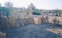
Notgrove barrow is open for display but has been completely filled in, and the baggy, amorphous mound that is there now bears no resemblance to the original monument - I know because I stood on top of it with a plan and couldn't identify anything! It looks like a grassed-over gravel heap than a barrow.
The only information provided on-site is on a notice-board and is only a few sentences long. There is no plan or reconstruction, it and spends as many words saying when and why it was filled in as it does describing the barrow. All very disappointing.
The site does, however, have spectacular views in all directions and is easy to access. I wouldn't go out of my way to visit it, but if passing it is worth while calling in to get a feel for its position in the landscape.
There is a lay-by on the main road next to the barrow and then a short walk of a few dozen meters down the road to the entrance.
excavation report of it in the 1936 Archaeologica.
You may be viewing yesterday's version of this page. To see the most up to date information please register for a free account.
")
")
")
")
")
")
")
")
")
")
")
")
")
")
")
")
")
")
")
")
")
Do not use the above information on other web sites or publications without permission of the contributor.
Click here to see more info for this site
Nearby sites
Key: Red: member's photo, Blue: 3rd party photo, Yellow: other image, Green: no photo - please go there and take one, Grey: site destroyed
Download sites to:
KML (Google Earth)
GPX (GPS waypoints)
CSV (Garmin/Navman)
CSV (Excel)
To unlock full downloads you need to sign up as a Contributory Member. Otherwise downloads are limited to 50 sites.
![]()
Turn off the page maps and other distractions
Nearby sites listing. In the following links * = Image available
2.8km WNW 285° Slade Barn Chambered Cairn (SP069219)
3.2km SW 225° Hazleton North* Chambered Tomb (SP073189)
3.3km WSW 240° Penhill Farm Bowl Barrow* Round Barrow(s) (SP06761954)
3.3km N 0° Guiting Power Round Barrow 3* Timber Circle (SP096245)
3.4km SW 225° Hazleton South* Chambered Tomb (SP072188)
3.5km NNW 341° Greenfield Hill Barn Round Barrow* Round Barrow(s) (SP0844224465)
3.6km NW 323° Roel Farm Bowl Barrow* Round Barrow(s) (SP0740324085)
4.8km E 97° Cold Aston* Chambered Tomb (SP14342065)
5.0km SSE 154° Leygore Manor* Chambered Tomb (SP1178816648)
5.2km S 171° Burn Ground* Chambered Cairn (SP104161)
5.2km SSW 192° Cheltenham Road Plantation* Chambered Cairn (SP085161)
5.2km SSE 152° Leygore Manor II* Chambered Tomb (SP121166)
5.4km S 191° Furzenhill Barn* Chambered Tomb (SP086159)
5.6km NE 36° Huntsmans Quarry Timber Circle (SP129257)
5.8km WNW 303° Roel Camp* Hillfort (SP04682434)
5.9km NNW 335° Guiting Wood Bowl Barrow* Round Barrow(s) (SP0710826545)
6.2km S 188° Hangman's Stone (Northleach)* Standing Stone (Menhir) (SP087151)
6.2km NE 35° Cow Common Barrow Cemetery* Barrow Cemetery (SP132263)
6.3km SSE 154° Norbury Hillfort Barrow* Chambered Tomb (SP124155)
6.4km SSE 150° Norbury Hillfort (Farmington)* Hillfort (SP128157)
6.5km NE 46° New Close Chambered Tomb (SP143257)
6.6km NE 46° Eyeford Chambered Cairn (SP143258)
6.7km NE 36° Cow Common Long Barrow* Chambered Cairn (SP135266)
6.9km NE 41° Swell Wold round barrow* Round Barrow(s) (SP14132648)
7.2km SW 221° Sales Lot Chambered Cairn (SP04871578)
View more nearby sites and additional images


 We would like to know more about this location. Please feel free to add a brief description and any relevant information in your own language.
 Wir möchten mehr über diese Stätte erfahren. Bitte zögern Sie nicht, eine kurze Beschreibung und relevante Informationen in Deutsch hinzuzufügen.
 Nous aimerions en savoir encore un peu sur les lieux. S'il vous plaît n'hesitez pas à ajouter une courte description et tous les renseignements pertinents dans votre propre langue.
 Quisieramos informarnos un poco más de las lugares. No dude en añadir una breve descripción y otros datos relevantes en su propio idioma.