 with our Megalithic Portal iPhone app")


<< Text Pages >> Cunninghar - Stone Circle in Scotland in Clackmannanshire
Submitted by Anne T on Wednesday, 03 March 2004 Page Views: 8132
Neolithic and Bronze AgeSite Name: Cunninghar Alternative Name: Druidical Circle (Tilicoultry)Country: Scotland County: Clackmannanshire Type: Stone Circle
Nearest Town: Tilicoultry
Map Ref: NS92569708 Landranger Map Number: 58
Latitude: 56.154256N Longitude: 3.731214W
Condition:
| 5 | Perfect |
| 4 | Almost Perfect |
| 3 | Reasonable but with some damage |
| 2 | Ruined but still recognisable as an ancient site |
| 1 | Pretty much destroyed, possibly visible as crop marks |
| 0 | No data. |
| -1 | Completely destroyed |
| 5 | Superb |
| 4 | Good |
| 3 | Ordinary |
| 2 | Not Good |
| 1 | Awful |
| 0 | No data. |
| 5 | Can be driven to, probably with disabled access |
| 4 | Short walk on a footpath |
| 3 | Requiring a bit more of a walk |
| 2 | A long walk |
| 1 | In the middle of nowhere, a nightmare to find |
| 0 | No data. |
| 5 | co-ordinates taken by GPS or official recorded co-ordinates |
| 4 | co-ordinates scaled from a detailed map |
| 3 | co-ordinates scaled from a bad map |
| 2 | co-ordinates of the nearest village |
| 1 | co-ordinates of the nearest town |
| 0 | no data |
Internal Links:
External Links:
Stone Circle in Clackmannanshire
This now destroyed stone circle is described on The Northern Antiquarian's (TNA) page for Cunninghar, Tillicoultry, Clackmannanshire. They have a photograph of the one remaining stone to be found on an "elevated piece of ground above the north-side of the main road between Tillicoultry and Dollar", together it's location on the 1866 OS map and a brief archaeology & history.
It is also recorded as Canmore ID 48255, an extract of which reads: "A stone circle, the two diameters of which were estimated in 1898 as 106' NW - SE by 96' NE - SW. At that date the site of the circle was shown by one remaining stone (NS 9256 9708) (five feet from which a large cinerary urn was found in 1894) and the visible sites of some of the others, together with part of a small embankment which ran round the circle. According to a forester on the estate none of the stones which formed the circle was over 3' high; they were 4' to 5' apart and were broken up for building stones and some used to cover a water-pen near Tillicoultry House in the mid-19th century ... Near the centre, a cist, 4'9" by 2'6" by 2' deep was found in 1894 containing a food vessel and a contracted skeleton."
Note: Have you visited this site? Do you have any historical illustrations of this stone? Any comments or photographs to add?
You may be viewing yesterday's version of this page. To see the most up to date information please register for a free account.
Do not use the above information on other web sites or publications without permission of the contributor.
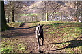
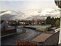
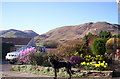
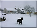
Nearby Images from Geograph Britain and Ireland:
©2009(licence)
©2014(licence)
©2009(licence)
©2009(licence)
©2009(licence)
The above images may not be of the site on this page, they are loaded from Geograph.
Please Submit an Image of this site or go out and take one for us!
Click here to see more info for this site
Nearby sites
Key: Red: member's photo, Blue: 3rd party photo, Yellow: other image, Green: no photo - please go there and take one, Grey: site destroyed
Download sites to:
KML (Google Earth)
GPX (GPS waypoints)
CSV (Garmin/Navman)
CSV (Excel)
To unlock full downloads you need to sign up as a Contributory Member. Otherwise downloads are limited to 50 sites.
Turn off the page maps and other distractions
Nearby sites listing. In the following links * = Image available
468m NNW 339° Tillicoultry House Carving (Tillicoultry) Rock Art (NS92409752)
1.5km WNW 284° Lady's Well (Tillicoultry) Holy Well or Sacred Spring (NS91119749)
1.8km SE 135° Balhearty Standing Stone (Menhir) (NS9378295816)
2.2km N 349° Eliston West (Tilicoultry) Cairn (NS92209924)
2.6km NE 36° White Stane of Tam Baird (Dollar) Natural Stone / Erratic / Other Natural Feature (NS9413599110)
3.7km S 180° Grassmainston Well (Clackmannan) Holy Well or Sacred Spring (NS9247893403)
3.7km ENE 74° Cairnpark (Dollar) Cairn (NS96189802)
3.7km W 271° St Serf's Well (Alva) Holy Well or Sacred Spring (NS88819723)
4.1km W 280° Ladies Well (Alva) Holy Well or Sacred Spring (NS88579788)
4.1km W 275° Dwarf's Tomb (Alva) Burial Chamber or Dolmen (NS88489754)
4.2km ENE 57° Castle Campbell (Dollar) Rock Art (NS96139928)
4.3km ENE 66° Moir's Well (Dollar) Holy Well or Sacred Spring (NS9653598711)
4.4km ENE 62° Wizard's Stone (Dollar)* Natural Stone / Erratic / Other Natural Feature (NS96569904)
4.7km NE 47° Butter Well (Dollar) Holy Well or Sacred Spring (NN96100018)
4.7km ENE 64° Deil's Cradle (Dollar)* Natural Stone / Erratic / Other Natural Feature (NS96869906)
4.9km SSW 202° Hawk Hill (Alloa) Stone Circle (NS906926)
5.0km SSW 207° Parkmill Cross (Alloa) Ancient Cross (NS9013392661)
5.1km S 185° Hawk Hill Stone Circle (NS920920)
5.4km SSW 194° Mercat Cross (Clackmannan)* Ancient Cross (NS9111091889)
5.4km SSW 194° Stone of Mannan* Standing Stone (Menhir) (NS91119188)
5.5km SW 218° Hawk Hill Cairn (Alloa) Cairn (NS89119282)
5.6km SSW 193° Lady Well (Clackmannan) Holy Well or Sacred Spring (NS91129166)
6.2km NE 45° Maiden's Well (Glendevon) Holy Well or Sacred Spring (NN97030139)
6.4km ENE 61° Castleton (Dollar)* Standing Stone (Menhir) (NN9828400060)
6.5km NE 41° Garchel Burn (Glendevon) Ancient Village or Settlement (NN96960182)
View more nearby sites and additional images


 We would like to know more about this location. Please feel free to add a brief description and any relevant information in your own language.
 Wir möchten mehr über diese Stätte erfahren. Bitte zögern Sie nicht, eine kurze Beschreibung und relevante Informationen in Deutsch hinzuzufügen.
 Nous aimerions en savoir encore un peu sur les lieux. S'il vous plaît n'hesitez pas à ajouter une courte description et tous les renseignements pertinents dans votre propre langue.
 Quisieramos informarnos un poco más de las lugares. No dude en añadir una breve descripción y otros datos relevantes en su propio idioma.