


<< Text Pages >> Holsworthy St Peter’s Well - Holy Well or Sacred Spring in England in Devon
Submitted by HOLYWELL on Thursday, 03 April 2008 Page Views: 6134
Springs and Holy WellsSite Name: Holsworthy St Peter’s WellCountry: England
NOTE: This site is 1.295 km away from the location you searched for.
County: Devon Type: Holy Well or Sacred Spring
Nearest Village: Holsworthy
Map Ref: SS345038
Latitude: 50.810048N Longitude: 4.350424W
Condition:
| 5 | Perfect |
| 4 | Almost Perfect |
| 3 | Reasonable but with some damage |
| 2 | Ruined but still recognisable as an ancient site |
| 1 | Pretty much destroyed, possibly visible as crop marks |
| 0 | No data. |
| -1 | Completely destroyed |
| 5 | Superb |
| 4 | Good |
| 3 | Ordinary |
| 2 | Not Good |
| 1 | Awful |
| 0 | No data. |
| 5 | Can be driven to, probably with disabled access |
| 4 | Short walk on a footpath |
| 3 | Requiring a bit more of a walk |
| 2 | A long walk |
| 1 | In the middle of nowhere, a nightmare to find |
| 0 | No data. |
| 5 | co-ordinates taken by GPS or official recorded co-ordinates |
| 4 | co-ordinates scaled from a detailed map |
| 3 | co-ordinates scaled from a bad map |
| 2 | co-ordinates of the nearest village |
| 1 | co-ordinates of the nearest town |
| 0 | no data |
Internal Links:
External Links:
Holy Well or Sacred Spring in Devon
This well lies in the private house called Petersville which was built in the 1950s. At that time the well which was a stone lined structure was very overgrown and the present owner rebuilt it as a wishing well. Although it is a shame that the original structure was lost it is good to see that people will restore such sites and that is to be commended.
You may be viewing yesterday's version of this page. To see the most up to date information please register for a free account.
Do not use the above information on other web sites or publications without permission of the contributor.
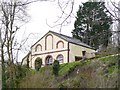
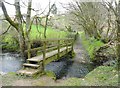
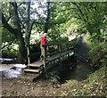
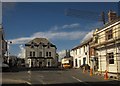
Nearby Images from Geograph Britain and Ireland:
©2010(licence)
©2010(licence)
©2018(licence)

©2009(licence)
©2013(licence)
The above images may not be of the site on this page, they are loaded from Geograph.
Please Submit an Image of this site or go out and take one for us!
Click here to see more info for this site
Nearby sites
Key: Red: member's photo, Blue: 3rd party photo, Yellow: other image, Green: no photo - please go there and take one, Grey: site destroyed
Download sites to:
KML (Google Earth)
GPX (GPS waypoints)
CSV (Garmin/Navman)
CSV (Excel)
To unlock full downloads you need to sign up as a Contributory Member. Otherwise downloads are limited to 50 sites.
Turn off the page maps and other distractions
Nearby sites listing. In the following links * = Image available
4.3km NW 326° Ugworthy Beacon Barrows* Round Barrow(s) (SS3217607440)
4.4km SSW 213° Affaland Moor Bowl Barrow* Round Barrow(s) (SS3196200184)
5.8km N 354° High Barrow* Round Barrow(s) (SS3410209563)
7.4km SSW 205° St Denis Well, Holy Well, Sacred Spring* Holy Well or Sacred Spring (SX3109797178)
8.0km ENE 74° Holemoor Well* Holy Well or Sacred Spring (SS423057)
9.0km SW 217° Mount Pleasant Barrows* Barrow Cemetery (SX28769679)
9.3km ESE 116° Halwill Churchyard Cross* Ancient Cross (SX4272799412)
9.3km ESE 116° Halwill Village Cross* Ancient Cross (SX4275199393)
9.7km SW 235° St Anne's Well (Whitstone)* Holy Well or Sacred Spring (SX263985)
9.9km WSW 244° Froxton Wood Castle Hillfort (SX2543099705)
10.1km WSW 244° Hilton Wood Castle* Hillfort (SX25229969)
10.2km SW 221° Kiddy Barrow* Barrow Cemetery (SX27499637)
10.2km W 279° St Swithin's Well (Launcells)* Holy Well or Sacred Spring (SS244057)
10.3km NNW 347° St Peter's Well (Bradworthy)* Holy Well or Sacred Spring (SS325139)
10.6km ESE 107° Halwill Great Barrows* Barrow Cemetery (SS4449200306)
10.6km NE 36° St Petrock's Well Devon* Holy Well or Sacred Spring (SS4095912219)
10.7km SW 221° Wilsworthy Cross Barrows* Barrow Cemetery (SX2716496017)
10.8km ENE 58° Devil's Stone, Shebbear* Standing Stone (Menhir) (SS43880925)
11.7km NW 316° Taylors Cross Tumuli* Round Barrow(s) (SS2669012535)
11.8km SW 217° Chelsfield Barrows* Barrow Cemetery (SX27049467)
12.2km WNW 284° Stamford Hill settlement* Ancient Village or Settlement (SS22750705)
12.2km W 268° Marhamchurch Medieval cross* Ancient Cross (SS22300369)
12.8km WNW 286° Earthquake Cist* Cist (SS22250773)
13.2km W 272° Neet Valley stone, Bude Standing Stone (Menhir) (SS21320474)
13.3km WSW 240° Ashbury hillfort* Hillfort (SX228975)
View more nearby sites and additional images


 We would like to know more about this location. Please feel free to add a brief description and any relevant information in your own language.
 Wir möchten mehr über diese Stätte erfahren. Bitte zögern Sie nicht, eine kurze Beschreibung und relevante Informationen in Deutsch hinzuzufügen.
 Nous aimerions en savoir encore un peu sur les lieux. S'il vous plaît n'hesitez pas à ajouter une courte description et tous les renseignements pertinents dans votre propre langue.
 Quisieramos informarnos un poco más de las lugares. No dude en añadir una breve descripción y otros datos relevantes en su propio idioma.