


<< Our Photo Pages >> Feldom Ranges 20d - Rock Art in England in Yorkshire (North)
Submitted by SolarMegalith on Wednesday, 03 July 2013 Page Views: 2066
Rock ArtSite Name: Feldom Ranges 20d Alternative Name: Gayles Moor D17 (Beckensall and Laurie 1998)Country: England County: Yorkshire (North) Type: Rock Art
Nearest Town: Richmond Nearest Village: Gayles
Map Ref: NZ1086106083
Latitude: 54.450029N Longitude: 1.83401W
Condition:
| 5 | Perfect |
| 4 | Almost Perfect |
| 3 | Reasonable but with some damage |
| 2 | Ruined but still recognisable as an ancient site |
| 1 | Pretty much destroyed, possibly visible as crop marks |
| 0 | No data. |
| -1 | Completely destroyed |
| 5 | Superb |
| 4 | Good |
| 3 | Ordinary |
| 2 | Not Good |
| 1 | Awful |
| 0 | No data. |
| 5 | Can be driven to, probably with disabled access |
| 4 | Short walk on a footpath |
| 3 | Requiring a bit more of a walk |
| 2 | A long walk |
| 1 | In the middle of nowhere, a nightmare to find |
| 0 | No data. |
| 5 | co-ordinates taken by GPS or official recorded co-ordinates |
| 4 | co-ordinates scaled from a detailed map |
| 3 | co-ordinates scaled from a bad map |
| 2 | co-ordinates of the nearest village |
| 1 | co-ordinates of the nearest town |
| 0 | no data |
Internal Links:
External Links:
I have visited· I would like to visit
SolarMegalith visited on 17th Jun 2013 - their rating: Cond: 4 Amb: 4 Access: 3
")
This large boulder is decorated with four cup-marks, one of them has a fain single ring (probably incomplete or partly eroded). The panel is located in the danger area of MOD DTE North.
Beckensall and Laurie (1998) recorded this panel as Gayles Moor D17.
Reference:
Brown, P. and B. 2008. "Prehistoric Rock Art in the Northern Dales". Stroud: Tempus, p. 241.
You may be viewing yesterday's version of this page. To see the most up to date information please register for a free account.
")
")
Do not use the above information on other web sites or publications without permission of the contributor.
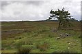
Nearby Images from Geograph Britain and Ireland:
©2008(licence)
©2008(licence)
©2008(licence)
©2008(licence)
©2008(licence)
The above images may not be of the site on this page, they are loaded from Geograph.
Please Submit an Image of this site or go out and take one for us!
Click here to see more info for this site
Nearby sites
Key: Red: member's photo, Blue: 3rd party photo, Yellow: other image, Green: no photo - please go there and take one, Grey: site destroyed
Download sites to:
KML (Google Earth)
GPX (GPS waypoints)
CSV (Garmin/Navman)
CSV (Excel)
To unlock full downloads you need to sign up as a Contributory Member. Otherwise downloads are limited to 50 sites.
Turn off the page maps and other distractions
Nearby sites listing. In the following links * = Image available
320m E 100° Feldom Ranges 13d* Rock Art (NZ1117706029)
448m ESE 113° Feldom Ranges 14a* Rock Art (NZ1127405907)
604m E 85° Feldom Ranges 12a* Rock Art (NZ1146406138)
617m ESE 104° Feldom Ranges 15e* Rock Art (NZ1146105932)
628m ESE 104° Feldom Ranges 15d* Rock Art (NZ1147105928)
632m ESE 106° Feldom Ranges 15c* Rock Art (NZ1146905905)
692m E 88° Feldom Ranges 6a* Rock Art (NZ1155506105)
717m ENE 75° Feldom Ranges 8a* Rock Art (NZ1155606266)
806m E 92° Feldom Ranges 6c* Rock Art (NZ1166906063)
819m ESE 108° Feldom Ranges 5a* Rock Art (NZ1164405835)
1.4km SE 125° Gayles Moor Slab Rock Art (NZ1200005300)
1.5km NNE 14° Castle Steads* Hillfort (NZ112075)
1.6km ESE 114° Feldom Ranges 17b* Rock Art (NZ1229205448)
2.5km NNE 15° Dalton Portable 1 & 2 Rock Art (NZ1150008500)
3.0km NNE 31° The Dalton Stone Rock Art (NZ1240008700)
4.5km WNW 300° Barningham Moor 116* Rock Art (NZ0696908335)
4.6km WNW 299° Barningham Moor 115* Rock Art (NZ0685908311)
4.7km W 278° Frankinshaw* Cairn (NZ06170672)
4.8km NNW 329° Barningham Modern Stone Circle* Modern Stone Circle etc (NZ084102)
4.9km NW 317° Brown Hill (Barningham) Ancient Village or Settlement (NZ0749809706)
4.9km NNW 332° St Michael & All Angels (Barningham)* Ancient Cross (NZ0853110448)
5.1km NW 319° Barningham Moor 96* Rock Art (NZ0749909926)
5.1km ENE 62° Mainsgill Farm* Modern Stone Circle etc (NZ154085)
5.1km NW 318° Barningham Moor 1. Rock Art (NZ0742809924)
5.2km WNW 288° Barningham Moor 62* Rock Art (NZ0587807638)
View more nearby sites and additional images


 We would like to know more about this location. Please feel free to add a brief description and any relevant information in your own language.
 Wir möchten mehr über diese Stätte erfahren. Bitte zögern Sie nicht, eine kurze Beschreibung und relevante Informationen in Deutsch hinzuzufügen.
 Nous aimerions en savoir encore un peu sur les lieux. S'il vous plaît n'hesitez pas à ajouter une courte description et tous les renseignements pertinents dans votre propre langue.
 Quisieramos informarnos un poco más de las lugares. No dude en añadir una breve descripción y otros datos relevantes en su propio idioma.