


<< Our Photo Pages >> Hussey Well - Holy Well or Sacred Spring in England in Kent
Submitted by HOLYWELl on Saturday, 26 July 2008 Page Views: 5862
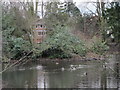
Springs and Holy WellsSite Name: Hussey Well Alternative Name: Jacob's wellCountry: England
NOTE: This site is 0.554 km away from the location you searched for.
County: Kent Type: Holy Well or Sacred Spring
Nearest Town: Bromley Nearest Village: Hayes
Map Ref: TQ402662
Latitude: 51.377548N Longitude: 0.013053E
Condition:
| 5 | Perfect |
| 4 | Almost Perfect |
| 3 | Reasonable but with some damage |
| 2 | Ruined but still recognisable as an ancient site |
| 1 | Pretty much destroyed, possibly visible as crop marks |
| 0 | No data. |
| -1 | Completely destroyed |
| 5 | Superb |
| 4 | Good |
| 3 | Ordinary |
| 2 | Not Good |
| 1 | Awful |
| 0 | No data. |
| 5 | Can be driven to, probably with disabled access |
| 4 | Short walk on a footpath |
| 3 | Requiring a bit more of a walk |
| 2 | A long walk |
| 1 | In the middle of nowhere, a nightmare to find |
| 0 | No data. |
| 5 | co-ordinates taken by GPS or official recorded co-ordinates |
| 4 | co-ordinates scaled from a detailed map |
| 3 | co-ordinates scaled from a bad map |
| 2 | co-ordinates of the nearest village |
| 1 | co-ordinates of the nearest town |
| 0 | no data |
Internal Links:
External Links:
")
Its waters were thought medicinal and much renowned. It takes its name frolm a 19th Century Rector and a repairer...but it is much older.
You may be viewing yesterday's version of this page. To see the most up to date information please register for a free account.
")
Do not use the above information on other web sites or publications without permission of the contributor.
TheCaptain has found this location on Google Street View:
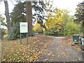
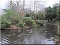
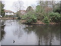
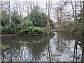
Nearby Images from Geograph Britain and Ireland:
©2016(licence)
©2011(licence)
©2011(licence)
©2011(licence)
©2011(licence)
The above images may not be of the site on this page, they are loaded from Geograph.
Please Submit an Image of this site or go out and take one for us!
Click here to see more info for this site
Nearby sites
Key: Red: member's photo, Blue: 3rd party photo, Yellow: other image, Green: no photo - please go there and take one, Grey: site destroyed
Download sites to:
KML (Google Earth)
GPX (GPS waypoints)
CSV (Garmin/Navman)
CSV (Excel)
To unlock full downloads you need to sign up as a Contributory Member. Otherwise downloads are limited to 50 sites.
Turn off the page maps and other distractions
Nearby sites listing. In the following links * = Image available
1.1km SSW 203° Hayes Common 1* Ancient Village or Settlement (TQ398652)
1.2km SSE 151° Hayes Common 2 Ancient Village or Settlement (TQ408652)
2.8km SE 144° Caesar's Well* Holy Well or Sacred Spring (TQ419640)
3.0km NNE 13° St Blaise's well Holy Well or Sacred Spring (TQ40806911)
3.0km SE 141° Caesar's Camp (Keston) Hillfort (TQ422639)
3.2km SSE 160° Warbank Ancient Village or Settlement (TQ414632)
4.5km NE 45° Chislehurst Caves Cave or Rock Shelter (TQ433695)
5.6km NE 46° Mound Chislehurst Artificial Mound (TQ441702)
6.1km ENE 63° Hobling Well Holy Well or Sacred Spring (TQ456691)
6.3km E 89° Bromley Museum Museum (TQ465665)
7.1km WSW 246° Croham Hurst* Round Barrow(s) (TQ338632)
9.2km SSW 195° Nore Hill Bronze Age Enclosure Misc. Earthwork (TQ380573)
9.4km NNW 344° Hilly Fields Stone Circle* Modern Stone Circle etc (TQ374752)
9.7km SW 236° Riddlesdown Newe Ditch* Misc. Earthwork (TQ3230460572)
9.9km ENE 65° Chalk Wood Denehole Ancient Mine, Quarry or other Industry (TQ491706)
10.2km WNW 286° Pollards Hill Hillfort (TQ303688)
11.0km N 354° Greenwich Park Barrows* Barrow Cemetery (TQ3883677128)
11.2km ENE 63° Joyden's Wood Ancient Village or Settlement (TQ501715)
11.3km ENE 67° Stonebill Green Deneholes Ancient Mine, Quarry or other Industry (TQ505709)
11.5km NNE 20° Shrewsbury Tumulus* Round Barrow(s) (TQ439771)
11.6km SSE 154° Holy Well (Westerham) Holy Well or Sacred Spring (TQ455559)
12.0km ENE 58° Cavey's Springs Deneholes Ancient Mine, Quarry or other Industry (TQ502728)
12.4km W 264° Queen Anne's Well (Carshalton)* Holy Well or Sacred Spring (TQ279645)
12.8km SSW 194° St. Thomas's Well (Godstone) Holy Well or Sacred Spring (TQ375537)
12.9km NNE 27° Winn's Common Tumulus* Round Barrow(s) (TQ457779)
View more nearby sites and additional images


 We would like to know more about this location. Please feel free to add a brief description and any relevant information in your own language.
 Wir möchten mehr über diese Stätte erfahren. Bitte zögern Sie nicht, eine kurze Beschreibung und relevante Informationen in Deutsch hinzuzufügen.
 Nous aimerions en savoir encore un peu sur les lieux. S'il vous plaît n'hesitez pas à ajouter une courte description et tous les renseignements pertinents dans votre propre langue.
 Quisieramos informarnos un poco más de las lugares. No dude en añadir una breve descripción y otros datos relevantes en su propio idioma.