 with our Megalithic Portal iPhone app")


<< Text Pages >> Leac nan Cailleacha Dubha - Standing Stones in Scotland in North Uist
Submitted by Andy B on Sunday, 22 December 2002 Page Views: 5257
Neolithic and Bronze AgeSite Name: Leac nan Cailleacha Dubha Alternative Name: VallayCountry: Scotland County: North Uist Type: Standing Stones
Map Ref: NF79087650 Landranger Map Number: 18
Latitude: 57.663553N Longitude: 7.383812W
Condition:
| 5 | Perfect |
| 4 | Almost Perfect |
| 3 | Reasonable but with some damage |
| 2 | Ruined but still recognisable as an ancient site |
| 1 | Pretty much destroyed, possibly visible as crop marks |
| 0 | No data. |
| -1 | Completely destroyed |
| 5 | Superb |
| 4 | Good |
| 3 | Ordinary |
| 2 | Not Good |
| 1 | Awful |
| 0 | No data. |
| 5 | Can be driven to, probably with disabled access |
| 4 | Short walk on a footpath |
| 3 | Requiring a bit more of a walk |
| 2 | A long walk |
| 1 | In the middle of nowhere, a nightmare to find |
| 0 | No data. |
| 5 | co-ordinates taken by GPS or official recorded co-ordinates |
| 4 | co-ordinates scaled from a detailed map |
| 3 | co-ordinates scaled from a bad map |
| 2 | co-ordinates of the nearest village |
| 1 | co-ordinates of the nearest town |
| 0 | no data |
Internal Links:
External Links:
Pair of Standing Stones in North Uist
Aubrey Burl lists these as a stone pair in his Stone Rows book and gives the location as NF785763, which is incorrect. He also relates a legend of the stones being "where two old women milking other people's cows were killed and buried". (RCAHMS 1928)
The current RCAHMS states: These two stones, 0.5m apart, were located at NF 7908 7650. The northernmost stone measures 1.6m high by 1.1m wide by 0.2m thick: the other measures 1.4m high by 0.9m wide and 0.2m thick. They probably represent the remains of a burial-chamber. Their name could not be confirmed.
Source: Canmore
You may be viewing yesterday's version of this page. To see the most up to date information please register for a free account.
Do not use the above information on other web sites or publications without permission of the contributor.
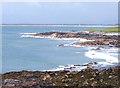
Nearby Images from Geograph Britain and Ireland:
©2012(licence)
©2012(licence)
©2008(licence)
©2012(licence)
©2012(licence)
The above images may not be of the site on this page, they are loaded from Geograph.
Please Submit an Image of this site or go out and take one for us!
Click here to see more info for this site
Nearby sites
Key: Red: member's photo, Blue: 3rd party photo, Yellow: other image, Green: no photo - please go there and take one, Grey: site destroyed
Download sites to:
KML (Google Earth)
GPX (GPS waypoints)
CSV (Garmin/Navman)
CSV (Excel)
To unlock full downloads you need to sign up as a Contributory Member. Otherwise downloads are limited to 50 sites.
Turn off the page maps and other distractions
Nearby sites listing. In the following links * = Image available
581m SW 232° Rudh' An Duin Stone Fort or Dun (NF7859376180)
1.6km SE 134° Sollas, Machair Leathann Ancient Village or Settlement (NF80117533)
2.0km WSW 251° Vallay (N Uist) Rock Art (NF77137600)
2.2km WSW 257° Bac Mic Connain Stone Fort or Dun (NF76947619)
2.2km SE 126° Dun Skellor Broch or Nuraghe (NF80757507)
2.6km SW 235° Geirisclett* Chambered Cairn (NF76847520)
2.6km WSW 240° Bac Mhic Connain Ancient Village or Settlement (NF76737537)
2.9km SW 215° Garry Iochdrach Ancient Village or Settlement (NF77237427)
3.1km SSW 207° Eilean Maleit Ancient Village or Settlement (NF77487388)
3.1km SW 216° Cnoc A'Comhdhalach Ancient Village or Settlement (NF77087415)
3.2km SW 225° Airigh Mhic Ruairidh* Stone Fort or Dun (NF76597440)
3.4km ESE 113° Dun Toloman Stone Fort or Dun (NF82077492)
3.7km ENE 58° Udal (Grenitote)* Ancient Village or Settlement (NF82387822)
4.3km SSW 209° Buaile Risary Cup Marked Stone Rock Art (NF76697293)
4.3km SSW 209° Buaile Risary Wheelhouse Ancient Village or Settlement (NF76677291)
6.1km WSW 252° Dun Scolpaig* Stone Fort or Dun (NF7310375028)
6.5km SSW 194° Toroghas* Standing Stones (NF77007029)
6.7km SW 214° Cleithreabhal* Chambered Cairn (NF749713)
6.7km SSW 213° South Clettraval* Standing Stone (Menhir) (NF75017118)
6.7km SSW 211° Clettraval South* Burial Chamber or Dolmen (NF75167101)
7.4km E 93° Druim na h-Uamha earth house* Souterrain (Fogou, Earth House) (NF86457546)
7.4km S 179° Bheinn a Charra* Standing Stone (Menhir) (NF7865569075)
7.9km ESE 120° Barpa nam Feannag* Chambered Cairn (NF85687204)
8.1km ESE 112° Maari Standing Stone (Menhir) (NF864729)
8.6km SE 128° Skeal Traval* Stone Row / Alignment (NF8538370672)
View more nearby sites and additional images


 We would like to know more about this location. Please feel free to add a brief description and any relevant information in your own language.
 Wir möchten mehr über diese Stätte erfahren. Bitte zögern Sie nicht, eine kurze Beschreibung und relevante Informationen in Deutsch hinzuzufügen.
 Nous aimerions en savoir encore un peu sur les lieux. S'il vous plaît n'hesitez pas à ajouter une courte description et tous les renseignements pertinents dans votre propre langue.
 Quisieramos informarnos un poco más de las lugares. No dude en añadir una breve descripción y otros datos relevantes en su propio idioma.