


<< Our Photo Pages >> Traveller's Hill - Round Barrow(s) in England in Suffolk
Submitted by Tragic on Tuesday, 20 December 2005 Page Views: 5987
Neolithic and Bronze AgeSite Name: Traveller's HillCountry: England County: Suffolk Type: Round Barrow(s)
Nearest Town: Thetford Nearest Village: Wordwell
Map Ref: TL842745
Latitude: 52.337647N Longitude: 0.702292E
Condition:
| 5 | Perfect |
| 4 | Almost Perfect |
| 3 | Reasonable but with some damage |
| 2 | Ruined but still recognisable as an ancient site |
| 1 | Pretty much destroyed, possibly visible as crop marks |
| 0 | No data. |
| -1 | Completely destroyed |
| 5 | Superb |
| 4 | Good |
| 3 | Ordinary |
| 2 | Not Good |
| 1 | Awful |
| 0 | No data. |
| 5 | Can be driven to, probably with disabled access |
| 4 | Short walk on a footpath |
| 3 | Requiring a bit more of a walk |
| 2 | A long walk |
| 1 | In the middle of nowhere, a nightmare to find |
| 0 | No data. |
| 5 | co-ordinates taken by GPS or official recorded co-ordinates |
| 4 | co-ordinates scaled from a detailed map |
| 3 | co-ordinates scaled from a bad map |
| 2 | co-ordinates of the nearest village |
| 1 | co-ordinates of the nearest town |
| 0 | no data |
Be the first person to rate this site - see the 'Contribute!' box in the right hand menu.
Internal Links:
External Links:
I have visited· I would like to visit
kith visited on 18th Sep 2011 - their rating: Cond: 3 Amb: 3 Access: 3 Forest trees now cleared with occasional trees left in place. The area has been marked off and is now long grass plus other natural colonization.
mrcrow have visited here
")
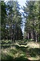
Travellers Hill - This one is marked on OS Pathfinder 963. It is in Kings Forest (Thetford Forest), not far from the West Stow Saxon village. To reach it, park at Kings Picnic Place on the B1106, from there its a 20 to 25 minute brisk walk. Access is normally open unless forestry operations forbid it. Another tumulus is marked only 20 metres away, but nothing remains of it on the surface.
You may be viewing yesterday's version of this page. To see the most up to date information please register for a free account.
")
")
Do not use the above information on other web sites or publications without permission of the contributor.
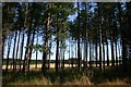
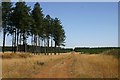
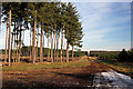
Nearby Images from Geograph Britain and Ireland:
©2006(licence)
©2006(licence)
©2006(licence)
©2009(licence)
©2006(licence)
The above images may not be of the site on this page, they are loaded from Geograph.
Please Submit an Image of this site or go out and take one for us!
Click here to see more info for this site
Nearby sites
Key: Red: member's photo, Blue: 3rd party photo, Yellow: other image, Green: no photo - please go there and take one, Grey: site destroyed
Download sites to:
KML (Google Earth)
GPX (GPS waypoints)
CSV (Garmin/Navman)
CSV (Excel)
To unlock full downloads you need to sign up as a Contributory Member. Otherwise downloads are limited to 50 sites.
Turn off the page maps and other distractions
Nearby sites listing. In the following links * = Image available
2.2km ESE 113° Seven hills, Rymer Barrow Cemetery (TL863737)
3.2km SSW 192° The Hill of Health* Round Barrow(s) (TL8365171319)
3.9km SSE 162° Ingham Puddingstone* Marker Stone (TL8556770828)
3.9km WSW 248° West Stow Field Barrow* Round Barrow(s) (TL806729)
4.4km E 96° Black Hill-Suffolk* Round Barrow(s) (TL886742)
4.9km SW 226° West Stow* Ancient Village or Settlement (TL808710)
5.1km NNE 31° Millfield Barn Round Barrow(s) (TL86717898)
5.1km NNE 31° Mill House Barrow Round Barrow(s) (TL867790)
5.4km E 96° Troston Mount* Round Barrow(s) (TL896741)
5.5km SSE 165° Timworth Puddingstone* Marker Stone (TL8580969281)
5.6km NNE 26° Barnham Puddingstone Marker Stone (TL865796)
5.7km E 86° Honington Barrows Round Barrow(s) (TL899751)
5.8km SSW 195° Fornham All Saints A Cursus Cursus (TL829688)
6.0km SW 216° Flempton Cursus Cursus (TL808695)
6.6km S 190° Fornham All Saints B Cursus Cursus (TL83346794)
6.9km NE 43° Barnham Heath Pit Natural Stone / Erratic / Other Natural Feature (TL887797)
6.9km S 187° Fornham All Saints C Cursus Cursus (TL83636765)
7.3km S 183° Fornham All Saints A Cursus Cursus (TL841672)
7.6km SSE 165° Hall Farm Puddingstone Marker Stone (TL864672)
8.3km NNE 17° Thetford Barrow Round Barrow(s) (TL86358256)
8.4km WNW 284° How Hill Round Barrow(s) (TL75987626)
8.9km NNE 24° Thetford Castle* Hillfort (TL875828)
8.9km SSE 150° St. John's Well (Suffolk)* Holy Well or Sacred Spring (TL889669)
9.1km NNE 19° Thetford Puddingstones* Marker Stone (TL8684583181)
9.3km NE 44° Seven Hills Barrow Cemetery Barrow Cemetery (TL904814)
View more nearby sites and additional images


 We would like to know more about this location. Please feel free to add a brief description and any relevant information in your own language.
 Wir möchten mehr über diese Stätte erfahren. Bitte zögern Sie nicht, eine kurze Beschreibung und relevante Informationen in Deutsch hinzuzufügen.
 Nous aimerions en savoir encore un peu sur les lieux. S'il vous plaît n'hesitez pas à ajouter une courte description et tous les renseignements pertinents dans votre propre langue.
 Quisieramos informarnos un poco más de las lugares. No dude en añadir una breve descripción y otros datos relevantes en su propio idioma.