

<< Our Photo Pages >> Blood Hill - Round Barrow(s) in England in Norfolk
Submitted by Tragic on Tuesday, 27 December 2005 Page Views: 9847
Neolithic and Bronze AgeSite Name: Blood Hill Alternative Name: BloodhillCountry: England County: Norfolk Type: Round Barrow(s)
Nearest Town: Thetford
Map Ref: TL84078765
Latitude: 52.455778N Longitude: 0.707608E
Condition:
| 5 | Perfect |
| 4 | Almost Perfect |
| 3 | Reasonable but with some damage |
| 2 | Ruined but still recognisable as an ancient site |
| 1 | Pretty much destroyed, possibly visible as crop marks |
| 0 | No data. |
| -1 | Completely destroyed |
| 5 | Superb |
| 4 | Good |
| 3 | Ordinary |
| 2 | Not Good |
| 1 | Awful |
| 0 | No data. |
| 5 | Can be driven to, probably with disabled access |
| 4 | Short walk on a footpath |
| 3 | Requiring a bit more of a walk |
| 2 | A long walk |
| 1 | In the middle of nowhere, a nightmare to find |
| 0 | No data. |
| 5 | co-ordinates taken by GPS or official recorded co-ordinates |
| 4 | co-ordinates scaled from a detailed map |
| 3 | co-ordinates scaled from a bad map |
| 2 | co-ordinates of the nearest village |
| 1 | co-ordinates of the nearest town |
| 0 | no data |
Internal Links:
External Links:
I have visited· I would like to visit
Couplands visited on 13th May 2023 - their rating: Cond: 2 Amb: 4 Access: 3
")
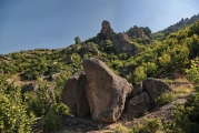
Like many barrows, Blood Hill has been used as a marker for parish boundaries. Emaciated, it was already worn down by the open sandy conditions of the Brecks - famous for sand-blows before 20th century afforestation. It became forgotten under the tree cover, and for some decades, a forestry ride went straight over top of it, causing more damage. However, it has since been protected, and has been fenced around, and marked by an information board.
A medieval satellite hamlet of Thetford called St Helens, was located nearby, around the big chalk pit near the railway line.
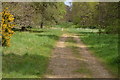
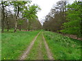
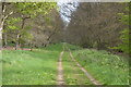
Located in Forestry Enterprise's Thetford Forest Park, access is public and free - pending on any forestry operations. A public trail named the Hereward Way passes nearby. Park on the A134 (parking space for a few cars) at the entrance of Hereward Way (ride 21) - but do not block access for forestry vehicles - alternatively park at north end of Two Mile Bottom picnic spot and cross the road. The barrow is around 700 metres away from the road.
You may be viewing yesterday's version of this page. To see the most up to date information please register for a free account.
Do not use the above information on other web sites or publications without permission of the contributor.
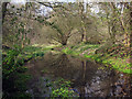
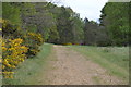
Nearby Images from Geograph Britain and Ireland:
©2017(licence)
©2017(licence)
©2017(licence)
©2013(licence)
©2017(licence)
The above images may not be of the site on this page, they are loaded from Geograph.
Please Submit an Image of this site or go out and take one for us!
Click here to see more info for this site
Nearby sites
Key: Red: member's photo, Blue: 3rd party photo, Yellow: other image, Green: no photo - please go there and take one, Grey: site destroyed
Download sites to:
KML (Google Earth)
GPX (GPS waypoints)
CSV (Garmin/Navman)
CSV (Excel)
To unlock full downloads you need to sign up as a Contributory Member. Otherwise downloads are limited to 50 sites.
Turn off the page maps and other distractions
Nearby sites listing. In the following links * = Image available
3.1km NW 309° Grimes Puddingstone Marker Stone (TL816895)
3.2km NW 314° Grime's Graves Flint Mines* Ancient Mine, Quarry or other Industry (TL817898)
3.4km ENE 73° Mickle Hill Tumulus* Round Barrow(s) (TL873888)
4.4km NW 306° Grimes Graves Barrows* Round Barrow(s) (TL804901)
5.3km SSE 150° Thetford Puddingstones* Marker Stone (TL8684583181)
5.4km W 278° Pepper Hill* Round Barrow(s) (TL787882)
5.6km SSE 158° Thetford Barrow Round Barrow(s) (TL86358256)
5.7km W 260° Brandon Heritage Museum Museum (TL785865)
5.9km SSE 147° Thetford Castle* Hillfort (TL875828)
7.2km E 88° East Wretham Heath Earthwork* Misc. Earthwork (TL91278814)
7.4km N 349° Lynford Middle Paleolithic Site* Not Known (by us) (TL82409484)
7.4km WSW 251° White Hill, Suffolk* Round Barrow(s) (TL77168497)
8.4km SSE 165° Barnham Puddingstone Marker Stone (TL865796)
8.9km SE 137° Seven Hills Barrow Cemetery Barrow Cemetery (TL904814)
9.0km SSE 165° Mill House Barrow Round Barrow(s) (TL867790)
9.1km SSE 165° Millfield Barn Round Barrow(s) (TL86717898)
9.2km SSE 152° Barnham Heath Pit Natural Stone / Erratic / Other Natural Feature (TL887797)
9.3km E 95° Peddars Way* Ancient Trackway (TL9341287119)
11.1km NNE 13° Little Cressingham Barrow Cemetery* Barrow Cemetery (TL861986)
12.2km E 85° Larling Heath Tumulus Round Barrow(s) (TL96268912)
12.7km NNE 27° Merton Stone* Natural Stone / Erratic / Other Natural Feature (TL895991)
12.8km ESE 113° West Harling Heath Barrows Round Barrow(s) (TL96068320)
13.1km S 182° Traveller's Hill* Round Barrow(s) (TL842745)
13.4km E 100° Mickelmoor Hill Settlement Ancient Village or Settlement (TL974857)
13.6km SE 125° Knettishall bowl barrow* Round Barrow(s) (TL9546280239)
View more nearby sites and additional images


 We would like to know more about this location. Please feel free to add a brief description and any relevant information in your own language.
 Wir möchten mehr über diese Stätte erfahren. Bitte zögern Sie nicht, eine kurze Beschreibung und relevante Informationen in Deutsch hinzuzufügen.
 Nous aimerions en savoir encore un peu sur les lieux. S'il vous plaît n'hesitez pas à ajouter une courte description et tous les renseignements pertinents dans votre propre langue.
 Quisieramos informarnos un poco más de las lugares. No dude en añadir una breve descripción y otros datos relevantes en su propio idioma.