


<< Our Photo Pages >> Beachy Brow Tumulus - Round Barrow(s) in England in East Sussex
Submitted by coldrum on Friday, 25 July 2008 Page Views: 3027
Neolithic and Bronze AgeSite Name: Beachy Brow TumulusCountry: England County: East Sussex Type: Round Barrow(s)
Nearest Town: Willingdon
Map Ref: TV5830099690
Latitude: 50.775193N Longitude: 0.243813E
Condition:
| 5 | Perfect |
| 4 | Almost Perfect |
| 3 | Reasonable but with some damage |
| 2 | Ruined but still recognisable as an ancient site |
| 1 | Pretty much destroyed, possibly visible as crop marks |
| 0 | No data. |
| -1 | Completely destroyed |
| 5 | Superb |
| 4 | Good |
| 3 | Ordinary |
| 2 | Not Good |
| 1 | Awful |
| 0 | No data. |
| 5 | Can be driven to, probably with disabled access |
| 4 | Short walk on a footpath |
| 3 | Requiring a bit more of a walk |
| 2 | A long walk |
| 1 | In the middle of nowhere, a nightmare to find |
| 0 | No data. |
| 5 | co-ordinates taken by GPS or official recorded co-ordinates |
| 4 | co-ordinates scaled from a detailed map |
| 3 | co-ordinates scaled from a bad map |
| 2 | co-ordinates of the nearest village |
| 1 | co-ordinates of the nearest town |
| 0 | no data |
Be the first person to rate this site - see the 'Contribute!' box in the right hand menu.
Internal Links:
External Links:
I have visited· I would like to visit
jonm visited on 21st Oct 2012 - their rating: Cond: 2 Amb: 4 Access: 2
")
Tumulus, recorded as Pastscape Monument No. 469931, which tells us this bowl barrow is "on the scrub-covered crest of Beachy Brow. It measures c12.0m in diameter by 1.0m high, with a large hollow in the centre".
The barrow is also scheduled as Historic England List ID 1019247, which adds: "The mound is surrounded by a ditch from which material used to construct the barrow was excavated. This has become infilled over the years, but will survive as a buried feature around 2m wide. The South Downs Way, a long distance track, has been constructed across the western part of the ditch, causing some disturbance to the monument".
You may be viewing yesterday's version of this page. To see the most up to date information please register for a free account.
")
Do not use the above information on other web sites or publications without permission of the contributor.
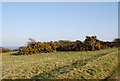
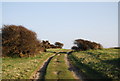
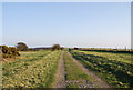
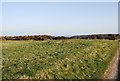
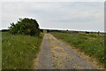
Nearby Images from Geograph Britain and Ireland:
©2010(licence)
©2010(licence)
©2010(licence)
©2010(licence)
©2021(licence)
The above images may not be of the site on this page, they are loaded from Geograph.
Please Submit an Image of this site or go out and take one for us!
Click here to see more info for this site
Nearby sites
Key: Red: member's photo, Blue: 3rd party photo, Yellow: other image, Green: no photo - please go there and take one, Grey: site destroyed
Download sites to:
KML (Google Earth)
GPX (GPS waypoints)
CSV (Garmin/Navman)
CSV (Excel)
To unlock full downloads you need to sign up as a Contributory Member. Otherwise downloads are limited to 50 sites.
Turn off the page maps and other distractions
Nearby sites listing. In the following links * = Image available
352m NNW 347° Foxholes-Beachy Brow Tumuli* Round Barrow(s) (TQ58210003)
620m S 180° Crunden's Bottom Summit* Artificial Mound (TV58329907)
759m NNW 346° Foxholes-Beachy intermediate tumulus* Round Barrow(s) (TQ58090042)
832m SSE 167° Eastbourne Downs Staging Tumuli Artificial Mound (TV5851698886)
853m NNW 348° Fox Holes Tumuli* Barrow Cemetery (TQ58100052)
912m S 169° Eastbourne Downs Tumuli* Barrow Cemetery (TV585988)
1.1km NNW 346° Bourne to Foxholes Tumuli group* Artificial Mound (TQ58010070)
1.1km S 171° Eastbourne Downs Upper Tumuli group* Artificial Mound (TV585986)
1.3km NW 316° Willingdon Hill Upper Tumuli Group* Artificial Mound (TQ57390058)
1.3km NNW 329° Bourne South West (Possible Tumulus)* Misc. Earthwork (TQ57580079)
1.4km NW 308° Willingdon Hill Tumuli* Barrow Cemetery (TQ57210050)
1.4km NNW 337° Bourne Hill Tumulus* Round Barrow(s) (TQ57700096)
1.4km NNW 338° Borne Hill secondary tumulus* Round Barrow(s) (TQ57730098)
1.5km SSE 164° Pashley Cross-Dyke* Misc. Earthwork (TV58789823)
1.6km SSE 157° Warren Tumuli and Cross Dyke* Barrow Cemetery (TV590982)
1.8km WNW 288° Willingdon Hill Cross Dyke* Misc. Earthwork (TQ56600017)
1.8km N 359° Babylon Down Tumuli* Barrow Cemetery (TQ582015)
2.1km S 169° Warren Hill Upper Tumuli Group* Artificial Mound (TV58769769)
2.1km NW 321° Willingdon Bottom Field System Misc. Earthwork (TQ569013)
2.2km S 183° Warren Hill/Middle Brow Tumuli Group Artificial Mound (TV58269748)
2.3km SSE 166° Warren Hill Low Tumulus (Black Robin Farm)* Artificial Mound (TV58949745)
2.4km SSE 168° Warren Hill/ Black Robin Tumuli Group* Misc. Earthwork (TV58859740)
2.4km N 354° Cold Crouch Tumulus* Round Barrow(s) (TQ5796602062)
2.4km N 359° Butts Lane Hollows* Misc. Earthwork (TQ58180212)
2.6km SSE 161° Black Robin Bottom Tumulus* Round Barrow(s) (TV592973)
View more nearby sites and additional images


 We would like to know more about this location. Please feel free to add a brief description and any relevant information in your own language.
 Wir möchten mehr über diese Stätte erfahren. Bitte zögern Sie nicht, eine kurze Beschreibung und relevante Informationen in Deutsch hinzuzufügen.
 Nous aimerions en savoir encore un peu sur les lieux. S'il vous plaît n'hesitez pas à ajouter une courte description et tous les renseignements pertinents dans votre propre langue.
 Quisieramos informarnos un poco más de las lugares. No dude en añadir una breve descripción y otros datos relevantes en su propio idioma.