


<< Our Photo Pages >> Millpond Wood Barrow - Round Barrow(s) in England in Kent
Submitted by coldrum on Sunday, 06 November 2011 Page Views: 4579
Neolithic and Bronze AgeSite Name: Millpond Wood Barrow Alternative Name: Wilderness BarrowCountry: England County: Kent Type: Round Barrow(s)
Map Ref: TQ53815661
Latitude: 51.287861N Longitude: 0.204320E
Condition:
| 5 | Perfect |
| 4 | Almost Perfect |
| 3 | Reasonable but with some damage |
| 2 | Ruined but still recognisable as an ancient site |
| 1 | Pretty much destroyed, possibly visible as crop marks |
| 0 | No data. |
| -1 | Completely destroyed |
| 5 | Superb |
| 4 | Good |
| 3 | Ordinary |
| 2 | Not Good |
| 1 | Awful |
| 0 | No data. |
| 5 | Can be driven to, probably with disabled access |
| 4 | Short walk on a footpath |
| 3 | Requiring a bit more of a walk |
| 2 | A long walk |
| 1 | In the middle of nowhere, a nightmare to find |
| 0 | No data. |
| 5 | co-ordinates taken by GPS or official recorded co-ordinates |
| 4 | co-ordinates scaled from a detailed map |
| 3 | co-ordinates scaled from a bad map |
| 2 | co-ordinates of the nearest village |
| 1 | co-ordinates of the nearest town |
| 0 | no data |
Internal Links:
External Links:
I have visited· I would like to visit
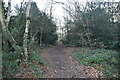
Jonik visited on 30th Dec 2014 - their rating: Cond: 3 Amb: 3 Access: 4 Situated in a small, protected patch of old, mixed woodland. I found the site quiet and atmospheric on this December afternoon despite the nearby housing. There are no signs to say what the site is.
")
From Exploring Kent's Past:
"Tumulus excavated by Lewis Abbott who found traces of cremation and "thousands" of burnt flints, including pygmies, which are in the British and Canterbury Museums. The tumulus was 80-90ft in diameter, 5.5ft high, and planted with firs. Lewis Abbott mentions "two other barrows in the neighbourhood not yet explored."
The published feature is a flat-topped sub-circular mound measuring some 33.0m in diameter E-W, 28.0m in diameter N-S and 1.5m in height on a prominent E-W sandy ridge. It has no trace of a ditch. This is presumably the mound excavated by Lewis Abbott but the other two "in the neighbourhood" were not traced. Points and microliths of Horsham type still occur in the sandy surface of the mound and similar implements with cores and flakes were found in recent years when trees were grubbed up to make gardens for the council houses on the S. side of the site: these latter are now in Sevenoaks Public Library and Museum.
Ninety-eight Mesolithic artefacts from Wilderness Barrow opened by W J L Abbot are in the British Museum; Tunbridge Wells Museum holds another 125 artefacts according to R M Jacobi.
The monument includes a bowl barrow situated on the crest of a prominent sandy ridge. The barrow has an oval mound 33m east-west by 28m north-south and is 1.8m high. Surrounding this is a ditch from which material was quarried during the construction of the monument. Although no longer visible at ground level, having become infilled over the years, the ditch survives as a buried feature c.3m wide. The barrow was partially excavated in the 1890s when traces of a cremation burial were discovered beneath the mound. Hundreds of pieces of worked flint and tools dating to the Mesolithic period were also discovered in the make-up of the mound and surrounding area, showing that the barrow was constructed on a much earlier flint-working site. Excluded from the scheduling are all fences and fence posts although the ground beneath them is included."
Read More at Exploring Kent's Past.
You may be viewing yesterday's version of this page. To see the most up to date information please register for a free account.
Do not use the above information on other web sites or publications without permission of the contributor.
Nearby Images from Geograph Britain and Ireland:
©2023(licence)
©2023(licence)
©2016(licence)
©2016(licence)
©2023(licence)
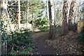
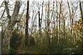
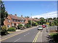
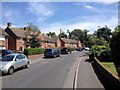
The above images may not be of the site on this page, they are loaded from Geograph.
Please Submit an Image of this site or go out and take one for us!
Click here to see more info for this site
Nearby sites
Key: Red: member's photo, Blue: 3rd party photo, Yellow: other image, Green: no photo - please go there and take one, Grey: site destroyed
Download sites to:
KML (Google Earth)
GPX (GPS waypoints)
CSV (Garmin/Navman)
CSV (Excel)
To unlock full downloads you need to sign up as a Contributory Member. Otherwise downloads are limited to 50 sites.
Turn off the page maps and other distractions
Nearby sites listing. In the following links * = Image available
733m WNW 287° Saint John's Spring (Greatness) Holy Well or Sacred Spring (TQ531568)
2.7km NE 41° St Edith's Well (Kemsing)* Holy Well or Sacred Spring (TQ5548458678)
2.7km NNW 348° St Thomas a Becket's Well* Holy Well or Sacred Spring (TQ532592)
2.9km NNW 342° Colet's Well* Holy Well or Sacred Spring (TQ5283459333)
3.0km N 2° Stumblebury Round Barrow(s) (TQ53845966)
4.4km E 97° Oldbury Hillfort* Hillfort (TQ582562)
4.7km E 94° Oldbury Rock Shelters* Cave or Rock Shelter (TQ5848056439)
5.3km E 100° Redwell springs Holy Well or Sacred Spring (TQ591558)
7.4km ESE 118° Plaxtol Not Known (by us) (TQ605533)
7.8km ENE 72° Gateway granites* Ancient Trackway (TQ61175924)
8.3km W 267° Holy Well (Westerham) Holy Well or Sacred Spring (TQ455559)
8.9km N 3° Eynsford Stone* Natural Stone / Erratic / Other Natural Feature (TQ540655)
10.4km ENE 76° Mount Mead* Round Barrow(s) (TQ63835933)
10.5km WSW 247° Squerries Park Camp Hillfort (TQ44285222)
11.7km E 79° Chestnuts* Long Barrow (TQ65265917)
11.8km E 79° Addington Long Barrow* Long Barrow (TQ65335910)
12.1km SSW 200° The Chiding stone* Natural Stone / Erratic / Other Natural Feature (TQ50064509)
12.3km NW 325° Bromley Museum Museum (TQ465665)
12.3km ENE 73° Addington Sarsens Natural Stone / Erratic / Other Natural Feature (TQ65516047)
12.3km ENE 72° Coldrum* Chambered Tomb (TQ65446072)
12.3km ENE 65° White Horse Wood Barrow Round Barrow(s) (TQ649621)
12.9km N 9° Sutton At Hone Enclosures Ancient Village or Settlement (TQ555694)
12.9km ENE 72° Ryarsh Sarson Stones Natural Stone / Erratic / Other Natural Feature (TQ66076089)
13.4km ESE 106° Pizien Well Holy Well or Sacred Spring (TQ668533)
13.5km ENE 62° Cock Adam Shaw Natural Stone / Erratic / Other Natural Feature (TQ65576323)
View more nearby sites and additional images


 We would like to know more about this location. Please feel free to add a brief description and any relevant information in your own language.
 Wir möchten mehr über diese Stätte erfahren. Bitte zögern Sie nicht, eine kurze Beschreibung und relevante Informationen in Deutsch hinzuzufügen.
 Nous aimerions en savoir encore un peu sur les lieux. S'il vous plaît n'hesitez pas à ajouter une courte description et tous les renseignements pertinents dans votre propre langue.
 Quisieramos informarnos un poco más de las lugares. No dude en añadir una breve descripción y otros datos relevantes en su propio idioma.