 with our Megalithic Portal iPhone app")


<< Our Photo Pages >> Earl's Hill - Round Barrow(s) in England in Hertfordshire
Submitted by vicky on Sunday, 21 July 2002 Page Views: 5267
Neolithic and Bronze AgeSite Name: Earl's Hill Alternative Name: One Tree HillCountry: England County: Hertfordshire Type: Round Barrow(s)
Nearest Town: Royston
Map Ref: TL3445240335 Landranger Map Number: 154
Latitude: 52.045111N Longitude: 0.040907W
Condition:
| 5 | Perfect |
| 4 | Almost Perfect |
| 3 | Reasonable but with some damage |
| 2 | Ruined but still recognisable as an ancient site |
| 1 | Pretty much destroyed, possibly visible as crop marks |
| 0 | No data. |
| -1 | Completely destroyed |
| 5 | Superb |
| 4 | Good |
| 3 | Ordinary |
| 2 | Not Good |
| 1 | Awful |
| 0 | No data. |
| 5 | Can be driven to, probably with disabled access |
| 4 | Short walk on a footpath |
| 3 | Requiring a bit more of a walk |
| 2 | A long walk |
| 1 | In the middle of nowhere, a nightmare to find |
| 0 | No data. |
| 5 | co-ordinates taken by GPS or official recorded co-ordinates |
| 4 | co-ordinates scaled from a detailed map |
| 3 | co-ordinates scaled from a bad map |
| 2 | co-ordinates of the nearest village |
| 1 | co-ordinates of the nearest town |
| 0 | no data |
Internal Links:
External Links:
I have visited· I would like to visit
GP1 visited on 1st Mar 2015 - their rating: Cond: 3 Amb: 4 Access: 4
")
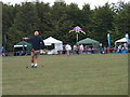
Earl's Hill is also known locally as One Tree Hill, though the tree has long gone. The barrow is the most prominent of all on the Heath as it sits on the horizon, unobscured by the surrounding golf course. There is a four sided metal seat on top of the barrow.
You may be viewing yesterday's version of this page. To see the most up to date information please register for a free account.
")
")
")
Do not use the above information on other web sites or publications without permission of the contributor.
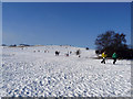
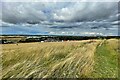
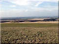
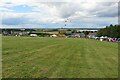
Nearby Images from Geograph Britain and Ireland:
©2009(licence)
©2023(licence)
©2005(licence)
©2023(licence)
©2011(licence)
The above images may not be of the site on this page, they are loaded from Geograph.
Please Submit an Image of this site or go out and take one for us!
Click here to see more info for this site
Nearby sites
Key: Red: member's photo, Blue: 3rd party photo, Yellow: other image, Green: no photo - please go there and take one, Grey: site destroyed
Download sites to:
KML (Google Earth)
GPX (GPS waypoints)
CSV (Garmin/Navman)
CSV (Excel)
To unlock full downloads you need to sign up as a Contributory Member. Otherwise downloads are limited to 50 sites.
Turn off the page maps and other distractions
Nearby sites listing. In the following links * = Image available
35m NNE 24° Earl's Hill earthwork* Misc. Earthwork (TL3446540367)
279m WSW 258° Rumbolds Mount Round Barrow(s) (TL34184027)
343m WSW 243° Therfield Heath Long Barrow* Barrow Cemetery (TL34154017)
361m WSW 258° Therfield Heath Five Hills* Barrow Cemetery (TL34104025)
376m SE 136° The Two Hills* Barrow Cemetery (TL34724007)
435m ENE 77° Royston Cricket Pitch Barrow Misc. Earthwork (TL3487540441)
1.1km ENE 71° Icenhilde Street Chambered Tomb (TL3550640735)
1.2km W 261° The Mile Ditches* Misc. Earthwork (TL3330440132)
1.2km ENE 67° Royston and District Museum and Art Gallery* Museum (TL3552240812)
1.2km ENE 74° Royston Stone* Natural Stone / Erratic / Other Natural Feature (TL3559440696)
1.2km ENE 74° Royston Cave* Cave or Rock Shelter (TL3561640698)
1.2km WSW 255° Pen Hills* Barrow Cemetery (TL33263999)
1.3km NE 56° Royston Ermine Street Barrow Long Barrow (TL3549241079)
1.4km WSW 244° The Devil's Hopscotch* Misc. Earthwork (TL3317939681)
1.4km WSW 241° Church Hill (Royston)* Chambered Tomb (TL3320939600)
2.6km WSW 251° The Thrift Round Barrow(s) (TL320394)
2.7km W 267° Highfield Farm Barrow Cemetery (TL3178840128)
2.9km SE 133° Reed Round Barrows Round Barrow(s) (TL36613844)
3.0km NW 304° Limeloe Hill Round Barrow(s) (TL3193241949)
3.2km WSW 237° Lower Thrift Farm Barrow Round Barrow(s) (TL3184438531)
3.4km ESE 113° Whiteley Hill Springfield style enclosure Ancient Village or Settlement (TL3760739122)
3.4km ESE 113° Whiteley Hill Barrow Cemetery Barrow Cemetery (TL3760739122)
3.5km NNW 336° Bassingbourn Village College ditches Misc. Earthwork (TL3293643488)
3.8km WSW 237° Coombe Farm Round Barrow(s) (TL313382)
4.0km WSW 252° Morden Grange Round Barrow(s) (TL30653901)
View more nearby sites and additional images


 We would like to know more about this location. Please feel free to add a brief description and any relevant information in your own language.
 Wir möchten mehr über diese Stätte erfahren. Bitte zögern Sie nicht, eine kurze Beschreibung und relevante Informationen in Deutsch hinzuzufügen.
 Nous aimerions en savoir encore un peu sur les lieux. S'il vous plaît n'hesitez pas à ajouter une courte description et tous les renseignements pertinents dans votre propre langue.
 Quisieramos informarnos un poco más de las lugares. No dude en añadir una breve descripción y otros datos relevantes en su propio idioma.