


<< Text Pages >> Caesar's Well (Wimbledon) - Holy Well or Sacred Spring in England in Greater London
Submitted by HOLYWELL on Thursday, 03 April 2008 Page Views: 15990
Springs and Holy WellsSite Name: Caesar's Well (Wimbledon) Alternative Name: Robin Hood's Well, Springpond WellCountry: England County: Greater London Type: Holy Well or Sacred Spring
Nearest Village: Wimbledon
Map Ref: TQ22377151
Latitude: 51.429391N Longitude: 0.241166W
Condition:
| 5 | Perfect |
| 4 | Almost Perfect |
| 3 | Reasonable but with some damage |
| 2 | Ruined but still recognisable as an ancient site |
| 1 | Pretty much destroyed, possibly visible as crop marks |
| 0 | No data. |
| -1 | Completely destroyed |
| 5 | Superb |
| 4 | Good |
| 3 | Ordinary |
| 2 | Not Good |
| 1 | Awful |
| 0 | No data. |
| 5 | Can be driven to, probably with disabled access |
| 4 | Short walk on a footpath |
| 3 | Requiring a bit more of a walk |
| 2 | A long walk |
| 1 | In the middle of nowhere, a nightmare to find |
| 0 | No data. |
| 5 | co-ordinates taken by GPS or official recorded co-ordinates |
| 4 | co-ordinates scaled from a detailed map |
| 3 | co-ordinates scaled from a bad map |
| 2 | co-ordinates of the nearest village |
| 1 | co-ordinates of the nearest town |
| 0 | no data |
Internal Links:
External Links:
Sacred Spring in Greater London
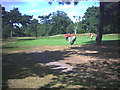
One of many springs that arise on the common, being named such being about 400 yards due north of an iron age Hill fort called Caesar's Camp, dated c 250 BCE. The well was long called, on very little provenance, Robin Hood Well. This may suggest that the well has long pagan history
The well was part of plan to provide Chelsea with water via a London aqueduct company. This scheme failed, and in 1872 the brick surround was replaced by the present structure of twelve massive slabs radiating from the lip of the well.
The well is now filled with black sludge, and one is less likely to test the claim that the water has medicinal properties.
You may be viewing yesterday's version of this page. To see the most up to date information please register for a free account.
Do not use the above information on other web sites or publications without permission of the contributor.
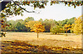
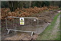
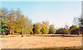
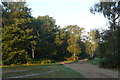
Nearby Images from Geograph Britain and Ireland:
©2015(licence)
©2019(licence)
©2015(licence)
©2009(licence)
©2005(licence)
The above images may not be of the site on this page, they are loaded from Geograph.
Please Submit an Image of this site or go out and take one for us!
Click here to see more info for this site
Nearby sites
Key: Red: member's photo, Blue: 3rd party photo, Yellow: other image, Green: no photo - please go there and take one, Grey: site destroyed
Download sites to:
KML (Google Earth)
GPX (GPS waypoints)
CSV (Garmin/Navman)
CSV (Excel)
To unlock full downloads you need to sign up as a Contributory Member. Otherwise downloads are limited to 50 sites.
Turn off the page maps and other distractions
Nearby sites listing. In the following links * = Image available
411m S 177° Caesar's Camp (Wimbledon)* Hillfort (TQ224711)
1.5km NNE 18° Putney Heath Round Barrow(s) (TQ22797295)
2.9km WSW 257° King Clump Artificial Mound (TQ195708)
3.5km W 281° Richmond Park Long Barrow Artificial Mound (TQ189721)
4.1km WNW 295° King Henry's Mound* Artificial Mound (TQ18607315)
4.6km SSE 154° Morden Park* Artificial Mound (TQ245674)
4.7km WSW 242° Kingston Museum* Museum (TQ1830169219)
5.1km WSW 243° King Stone (Kingston-upon-Thames)* Marker Stone (TQ1786769069)
5.6km NW 306° Museum of Richmond* Museum (TQ1774374697)
6.2km W 261° Barrow Hill (Teddington)* Round Barrow(s) (TQ16287037)
8.4km ESE 110° Pollards Hill Hillfort (TQ303688)
8.8km NNE 30° London Natural History Museum* Museum (TQ266792)
8.8km S 184° Ewell Springs (Surrey)* Holy Well or Sacred Spring (TQ219627)
8.8km NE 40° Tutankhamun: Treasures of the Golden Pharaoh exhibition, Saatchi Gallery* Museum (TQ279784)
8.8km S 185° Bourne Hall Museum* Museum (TQ218627)
8.9km SE 143° Queen Anne's Well (Carshalton)* Holy Well or Sacred Spring (TQ279645)
9.0km S 182° Hatch Furlong Ritual Shafts* Misc. Earthwork (TQ223625)
9.1km NNE 25° St Govor's Well* Holy Well or Sacred Spring (TQ2605079887)
10.2km NW 322° Elthorne Park Sarsen* Natural Stone / Erratic / Other Natural Feature (TQ15927947)
10.2km NE 51° Mesolithic structure near Vauxhall bridge* Timber Circle (TQ30217814)
10.9km N 6° Kensal Green* Modern Stone Circle etc (TQ233824)
11.1km SSE 168° Gally Hills Barrow Cemetery (TQ249607)
12.1km NE 56° Cuming Museum Museum (TQ322786)
12.1km NE 44° Cleopatra's Needle (London)* Standing Stone (Menhir) (TQ3054380516)
12.2km NE 36° The One and The Many* Modern Stone Circle etc (TQ2926981650)
View more nearby sites and additional images


 We would like to know more about this location. Please feel free to add a brief description and any relevant information in your own language.
 Wir möchten mehr über diese Stätte erfahren. Bitte zögern Sie nicht, eine kurze Beschreibung und relevante Informationen in Deutsch hinzuzufügen.
 Nous aimerions en savoir encore un peu sur les lieux. S'il vous plaît n'hesitez pas à ajouter une courte description et tous les renseignements pertinents dans votre propre langue.
 Quisieramos informarnos un poco más de las lugares. No dude en añadir una breve descripción y otros datos relevantes en su propio idioma.