


<< Our Photo Pages >> Fiskerton Iron Age causeway - Ancient Village or Settlement in England in Lincolnshire
Submitted by Andy B on Friday, 03 November 2017 Page Views: 3148
Iron Age and Later PrehistorySite Name: Fiskerton Iron Age causewayCountry: England County: Lincolnshire Type: Ancient Village or Settlement
Map Ref: TF05007159
Latitude: 53.230979N Longitude: 0.428455W
Condition:
| 5 | Perfect |
| 4 | Almost Perfect |
| 3 | Reasonable but with some damage |
| 2 | Ruined but still recognisable as an ancient site |
| 1 | Pretty much destroyed, possibly visible as crop marks |
| 0 | No data. |
| -1 | Completely destroyed |
| 5 | Superb |
| 4 | Good |
| 3 | Ordinary |
| 2 | Not Good |
| 1 | Awful |
| 0 | No data. |
| 5 | Can be driven to, probably with disabled access |
| 4 | Short walk on a footpath |
| 3 | Requiring a bit more of a walk |
| 2 | A long walk |
| 1 | In the middle of nowhere, a nightmare to find |
| 0 | No data. |
| 5 | co-ordinates taken by GPS or official recorded co-ordinates |
| 4 | co-ordinates scaled from a detailed map |
| 3 | co-ordinates scaled from a bad map |
| 2 | co-ordinates of the nearest village |
| 1 | co-ordinates of the nearest town |
| 0 | no data |
Internal Links:
External Links:
I have visited· I would like to visit
Catrinm would like to visit
")
Lying between the posts were horizontal timbers which had been pegged into the ground forming a firm walkway over the boggy ground. There were two major phases of repair where vertical timbers had been replaced and when the horizontals rotted they had been consolidated with a layer of limestone chips.
Finds include bone needles, pottery, and domestic and military metalwork, four axes and a hammer, a file with a decorated bone handle and a pruning hook. Four iron swords, two in scabbards, three socketed iron spear heads, and various items of horse furniture were also recovered. This leads to speculation about the importance of the causeway. It may have been a main route across the river which needed defending.
Further investigation of the Fiskerton causeway to the north of the River Witham was conducted in 2007. Four trial trenches were excavated to assess the preservation of the monument, and the impact of land management changes over the previous 25 years on the remains. The study concluded that although previous ploughing regimes have caused an appreciable loss of stratigraphy and destruction to the monument, the lower deposits survived in good condition. It was recommended that timbers recovered in the investigation should be subjected to high precision radiocarbon dating, to help clarify the construction sequence and relationships of the various causeway elements.
Source: Lincolnshire HER
You may be viewing yesterday's version of this page. To see the most up to date information please register for a free account.
")
")
")
Do not use the above information on other web sites or publications without permission of the contributor.
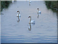
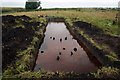
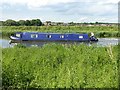
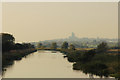
Nearby Images from Geograph Britain and Ireland:
©2007(licence)
©2014(licence)
©2012(licence)
©2016(licence)
©2016(licence)
The above images may not be of the site on this page, they are loaded from Geograph.
Please Submit an Image of this site or go out and take one for us!
Click here to see more info for this site
Nearby sites
Key: Red: member's photo, Blue: 3rd party photo, Yellow: other image, Green: no photo - please go there and take one, Grey: site destroyed
Download sites to:
KML (Google Earth)
GPX (GPS waypoints)
CSV (Garmin/Navman)
CSV (Excel)
To unlock full downloads you need to sign up as a Contributory Member. Otherwise downloads are limited to 50 sites.
Turn off the page maps and other distractions
Nearby sites listing. In the following links * = Image available
3.2km WSW 259° Washingborough Ancient Settlement* Ancient Village or Settlement (TF019709)
4.6km W 265° Lincoln Greetwell Henge/disc barrow* Barrow Cemetery (TF00407110)
7.3km W 271° The Collection, Lincoln* Museum (SK9771471547)
9.2km WSW 254° Lincoln stone circle* Modern Stone Circle etc (SK962689)
11.8km NW 307° St Pancras Well* Holy Well or Sacred Spring (SK954785)
12.6km NNE 21° Wickenby Ancient Village or Settlement (TF0928883432)
16.4km WNW 290° South Ingleby Tumulus Misc. Earthwork (SK8946576860)
17.1km E 85° Baumber Cursus* Cursus (TF22067350)
19.4km NNW 340° Newell's Well (Glentham) Holy Well or Sacred Spring (SK981897)
20.3km E 91° West Ashby Henge (TF25347168)
20.6km NNW 334° Aisthorpe springs Holy Well or Sacred Spring (SK956899)
20.6km NE 54° Burgh Top* Round Barrow(s) (TF21458406)
21.0km NE 52° Burgh on Bain* Long Barrow (TF21298497)
21.9km SSE 164° Anwick Drake Stones* Natural Stone / Erratic / Other Natural Feature (TF114506)
22.6km NNE 24° Walesby All Saints church carvings* Sculptured Stone (TF1382892388)
22.8km NNW 330° St. Helen's Well (Hemswell)* Holy Well or Sacred Spring (SK932911)
23.6km WSW 253° Besthorpe Ancient Village or Settlement (SK825641)
23.8km NE 51° Grims Mound* Round Barrow(s) (TF23258693)
24.0km NNE 32° Bully Hill (Tealby)* Round Barrow(s) (TF17279227)
25.3km WSW 240° Langford, Brough and Glebe Farm sites on the A46* Ancient Village or Settlement (SK833584)
25.4km E 94° Newell Spring* Holy Well or Sacred Spring (TF3041770472)
25.5km NNE 31° Lud well (Stainton-Le-Vale)* Holy Well or Sacred Spring (TF17629376)
26.2km NNE 20° Hills Brough* Long Barrow (TF1337396415)
26.6km ENE 68° Tathwell Long Barrow* Long Barrow (TF29458225)
27.1km ESE 113° Revesby Barrows* Round Barrow(s) (TF3029361632)
View more nearby sites and additional images


 We would like to know more about this location. Please feel free to add a brief description and any relevant information in your own language.
 Wir möchten mehr über diese Stätte erfahren. Bitte zögern Sie nicht, eine kurze Beschreibung und relevante Informationen in Deutsch hinzuzufügen.
 Nous aimerions en savoir encore un peu sur les lieux. S'il vous plaît n'hesitez pas à ajouter une courte description et tous les renseignements pertinents dans votre propre langue.
 Quisieramos informarnos un poco más de las lugares. No dude en añadir una breve descripción y otros datos relevantes en su propio idioma.