

<< Other Photo Pages >> Folkton Round Barrow - Round Barrow(s) in England in Yorkshire (North)
Submitted by vicky on Friday, 04 January 2019 Page Views: 10366
Neolithic and Bronze AgeSite Name: Folkton Round Barrow Alternative Name: The Folkton Drum, Folkton DrumsCountry: England
NOTE: This site is 0.2 km away from the location you searched for.
County: Yorkshire (North) Type: Round Barrow(s)
Map Ref: TA059778 Landranger Map Number: 101
Latitude: 54.185052N Longitude: 0.3787W
Condition:
| 5 | Perfect |
| 4 | Almost Perfect |
| 3 | Reasonable but with some damage |
| 2 | Ruined but still recognisable as an ancient site |
| 1 | Pretty much destroyed, possibly visible as crop marks |
| 0 | No data. |
| -1 | Completely destroyed |
| 5 | Superb |
| 4 | Good |
| 3 | Ordinary |
| 2 | Not Good |
| 1 | Awful |
| 0 | No data. |
| 5 | Can be driven to, probably with disabled access |
| 4 | Short walk on a footpath |
| 3 | Requiring a bit more of a walk |
| 2 | A long walk |
| 1 | In the middle of nowhere, a nightmare to find |
| 0 | No data. |
| 5 | co-ordinates taken by GPS or official recorded co-ordinates |
| 4 | co-ordinates scaled from a detailed map |
| 3 | co-ordinates scaled from a bad map |
| 2 | co-ordinates of the nearest village |
| 1 | co-ordinates of the nearest town |
| 0 | no data |
Internal Links:
External Links:
")
The custom of burying individuals with 'special' grave goods had begun by about 3000 BC. This grave offering is exceptional (the drums are unique) and must indicate something about the status of the child.
The drums are made from local chalk and are elaborately carved, using a technique very like that of chip-carving used by woodworkers. No other objects like them survive, but perhaps equivalent items were made of wood and have not survived. We do not know how they were used.
The decoration is organized in panels; stylized human faces look out from two of the drums. The significance of the designs is unknown to us, though they are very similar to those found on pottery of the Later Neolithic Grooved Ware style. The geometric patterns recall Beaker pottery and Early Bronze Age sheet goldwork decorated in the same vein.
2019 update: The chalk drums from Folkton and Lavant: Measuring devices from the time of Stonehenge? A fascination paper on chalk drums which proposes they were part of a standardised measuring system - the 'long foot'. More details in the comments below.
You may be viewing yesterday's version of this page. To see the most up to date information please register for a free account.
")
")
")
Do not use the above information on other web sites or publications without permission of the contributor.
Nearby Images from Geograph Britain and Ireland:
©2011(licence)
©2011(licence)
©2017(licence)
©2009(licence)
©2011(licence)
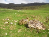
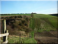
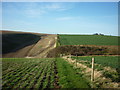
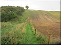
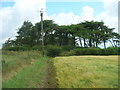
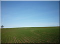
The above images may not be of the site on this page, they are loaded from Geograph.
Please Submit an Image of this site or go out and take one for us!
Click here to see more info for this site
Nearby sites
Key: Red: member's photo, Blue: 3rd party photo, Yellow: other image, Green: no photo - please go there and take one, Grey: site destroyed
Download sites to:
KML (Google Earth)
GPX (GPS waypoints)
CSV (Garmin/Navman)
CSV (Excel)
To unlock full downloads you need to sign up as a Contributory Member. Otherwise downloads are limited to 50 sites.
Turn off the page maps and other distractions
Nearby sites listing. In the following links * = Image available
1.0km W 266° Sharp Howes* Barrow Cemetery (TA049777)
1.2km NE 36° Spell Howe (Folkton) Cairn (TA06577878)
1.8km WSW 253° Elf Howe Round Barrow(s) (TA04227725)
3.4km WSW 242° Willerby Wold Long Barrow Long Barrow (TA029761)
4.4km NW 318° Star Carr* Ancient Village or Settlement (TA0282181013)
4.6km WSW 252° Willerby Wold House* Round Barrow(s) (TA015763)
5.1km SSW 197° Wold Newton* Round Barrow(s) (TA04527287)
5.3km SSW 193° Ba’l Hill* Round Barrow(s) (TA048726)
5.5km S 179° Willy Howe* Round Barrow(s) (TA06167235)
6.4km NNE 33° Gristhorpe Tumuli* Round Barrow(s) (TA093832)
6.5km ENE 68° Filey Roman Signal Station* Ancient Village or Settlement (TA1187080412)
6.7km ENE 62° Sailors' Well* Holy Well or Sacred Spring (TA117811)
6.8km NNW 336° Crossgates Stone (Seamer) Natural Stone / Erratic / Other Natural Feature (TA02948398)
7.3km SE 145° Rudston D Cursus Cursus (TA102719)
7.7km SSW 203° Paddock Hill* Henge (TA030707)
7.8km ENE 62° Carr Naze (Filey) Misc. Earthwork (TA1275581605)
7.9km ESE 110° Knox Well* Holy Well or Sacred Spring (TA134752)
8.1km SSE 154° Maidens Grave* Henge (TA09677063)
8.2km ENE 66° Spittals, Filey Brigg* Rock Outcrop (TA133813)
9.4km SE 134° Keld Spring* Holy Well or Sacred Spring (TA128714)
10.0km SSE 165° Rudston C Cursus Cursus (TA088682)
10.1km S 172° Rudstone Long Barrow Long Barrow (TA07586779)
10.3km NNW 344° Falsgrave Park Circle* Modern Stone Circle etc (TA028876)
10.4km SSE 156° Rudston A Cursus Cursus (TA103684)
10.4km NNW 327° East Ayton Long Barrow Long Barrow (TA000864)
View more nearby sites and additional images


 We would like to know more about this location. Please feel free to add a brief description and any relevant information in your own language.
 Wir möchten mehr über diese Stätte erfahren. Bitte zögern Sie nicht, eine kurze Beschreibung und relevante Informationen in Deutsch hinzuzufügen.
 Nous aimerions en savoir encore un peu sur les lieux. S'il vous plaît n'hesitez pas à ajouter une courte description et tous les renseignements pertinents dans votre propre langue.
 Quisieramos informarnos un poco más de las lugares. No dude en añadir una breve descripción y otros datos relevantes en su propio idioma.