


<< Our Photo Pages >> Dane's Graves - Barrow Cemetery in England in Yorkshire (East)
Submitted by SumDoood on Sunday, 09 April 2017 Page Views: 15174
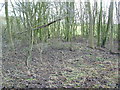
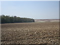
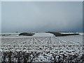
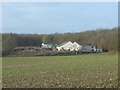
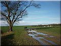
Neolithic and Bronze AgeSite Name: Dane's Graves Alternative Name: Danes' Graves, Danes GravesCountry: England County: Yorkshire (East) Type: Barrow Cemetery
Map Ref: TA01806330
Latitude: 54.055610N Longitude: 0.446382W
Condition:
| 5 | Perfect |
| 4 | Almost Perfect |
| 3 | Reasonable but with some damage |
| 2 | Ruined but still recognisable as an ancient site |
| 1 | Pretty much destroyed, possibly visible as crop marks |
| 0 | No data. |
| -1 | Completely destroyed |
| 5 | Superb |
| 4 | Good |
| 3 | Ordinary |
| 2 | Not Good |
| 1 | Awful |
| 0 | No data. |
| 5 | Can be driven to, probably with disabled access |
| 4 | Short walk on a footpath |
| 3 | Requiring a bit more of a walk |
| 2 | A long walk |
| 1 | In the middle of nowhere, a nightmare to find |
| 0 | No data. |
| 5 | co-ordinates taken by GPS or official recorded co-ordinates |
| 4 | co-ordinates scaled from a detailed map |
| 3 | co-ordinates scaled from a bad map |
| 2 | co-ordinates of the nearest village |
| 1 | co-ordinates of the nearest town |
| 0 | no data |
Internal Links:
External Links:
I have visited· I would like to visit
SumDoood visited on 6th Apr 2017 - their rating: Cond: 3 Amb: 4 Access: 3 I have never been anywhere like this and found it to be one of the most excitingly odd places I have visited.
SumDoood visited - their rating: Cond: 3 Amb: 4 Access: 3
Average ratings for this site from all visit loggers: Condition: 3 Ambience: 4 Access: 3
")
It's assumed to be a chieftain and his charioteer who was presumably killed so as to accompany the chieftain.
You may be viewing yesterday's version of this page. To see the most up to date information please register for a free account.
")
")
Do not use the above information on other web sites or publications without permission of the contributor.
Nearby Images from Geograph Britain and Ireland:
©2007(licence)
©2018(licence)
©2007(licence)
©2008(licence)
©2011(licence)
The above images may not be of the site on this page, they are loaded from Geograph.
Please Submit an Image of this site or go out and take one for us!
Click here to see more info for this site
Nearby sites
Key: Red: member's photo, Blue: 3rd party photo, Yellow: other image, Green: no photo - please go there and take one, Grey: site destroyed
Download sites to:
KML (Google Earth)
GPX (GPS waypoints)
CSV (Garmin/Navman)
CSV (Excel)
To unlock full downloads you need to sign up as a Contributory Member. Otherwise downloads are limited to 50 sites.
Turn off the page maps and other distractions
Nearby sites listing. In the following links * = Image available
3.0km E 82° Gallows Hill Barrow Round Barrow(s) (TA04776379)
4.5km ESE 118° Ruston Beacon (Ruston Parva) Cairn (TA05846128)
4.8km SSE 147° Southburn Archaeological Museum* Museum (TA0453959360)
5.1km SSE 156° Nafferton Slack (Driffield) Standing Stone (Menhir) (TA040587)
5.5km NE 45° Kilham Long Barrow Long Barrow (TA056673)
6.0km ESE 107° Fox Hill Tumulus* Round Barrow(s) (TA07606167)
6.4km WNW 299° Kemp Howe (Yorkshire) Long Barrow (SE96166628)
6.8km WNW 293° Willie Howe (Cowlam) Round Barrow(s) (SE95516586)
6.8km SW 217° Garton Slack 80 Round Barrow(s) (SE97815773)
6.9km SW 215° Garton Slack 81 Round Barrow(s) (SE97905755)
7.2km NW 311° Helperthorpe Long Barrow Long Barrow (SE963679)
7.2km ENE 61° Rudston B Cursus Cursus (TA081669)
7.3km NE 53° Rudstone Long Barrow Long Barrow (TA07586779)
7.5km N 10° Paddock Hill* Henge (TA030707)
7.8km ESE 103° St John's Well (Harpham)* Holy Well or Sacred Spring (TA095617)
8.0km ENE 74° Rudston Beacon Round Barrow* Round Barrow(s) (TA0945365617)
8.4km ENE 75° Rudston A Cursus* Cursus (TA099657)
8.4km ENE 62° Rudston Cursus Group Cursus (TA092674)
8.5km ENE 74° Rudston Cult Centre* Ancient Village or Settlement (TA099658)
8.5km NE 56° Rudston C Cursus Cursus (TA088682)
8.7km ENE 62° Rudston B Cursus Cursus (TA094675)
8.7km SSW 203° Mill Hill (Eastburn) Cairn (SE98545525)
9.1km ENE 62° Rudston D Cursus Cursus (TA097678)
9.1km ENE 62° Rudston Monolith* Standing Stone (Menhir) (TA0980367743)
9.5km ENE 71° Southside Mount* Round Barrow(s)
View more nearby sites and additional images


 We would like to know more about this location. Please feel free to add a brief description and any relevant information in your own language.
 Wir möchten mehr über diese Stätte erfahren. Bitte zögern Sie nicht, eine kurze Beschreibung und relevante Informationen in Deutsch hinzuzufügen.
 Nous aimerions en savoir encore un peu sur les lieux. S'il vous plaît n'hesitez pas à ajouter une courte description et tous les renseignements pertinents dans votre propre langue.
 Quisieramos informarnos un poco más de las lugares. No dude en añadir una breve descripción y otros datos relevantes en su propio idioma.