 with our Megalithic Portal iPhone app")


<< Text Pages >> Wykeham Forest Iron Age Square Barrow Cemetery - Misc. Earthwork in England in Yorkshire (East)
Submitted by Andy B on Thursday, 14 April 2011 Page Views: 6801
Iron Age and Later PrehistorySite Name: Wykeham Forest Iron Age Square Barrow CemeteryCountry: England
NOTE: This site is 2.8 km away from the location you searched for.
County: Yorkshire (East) Type: Misc. Earthwork
Map Ref: SE954894
Latitude: 54.291328N Longitude: 0.535855W
Condition:
| 5 | Perfect |
| 4 | Almost Perfect |
| 3 | Reasonable but with some damage |
| 2 | Ruined but still recognisable as an ancient site |
| 1 | Pretty much destroyed, possibly visible as crop marks |
| 0 | No data. |
| -1 | Completely destroyed |
| 5 | Superb |
| 4 | Good |
| 3 | Ordinary |
| 2 | Not Good |
| 1 | Awful |
| 0 | No data. |
| 5 | Can be driven to, probably with disabled access |
| 4 | Short walk on a footpath |
| 3 | Requiring a bit more of a walk |
| 2 | A long walk |
| 1 | In the middle of nowhere, a nightmare to find |
| 0 | No data. |
| 5 | co-ordinates taken by GPS or official recorded co-ordinates |
| 4 | co-ordinates scaled from a detailed map |
| 3 | co-ordinates scaled from a bad map |
| 2 | co-ordinates of the nearest village |
| 1 | co-ordinates of the nearest town |
| 0 | no data |
Be the first person to rate this site - see the 'Contribute!' box in the right hand menu.
Internal Links:
External Links:
Iron Age Square Barrow Cemetery in Yorkshire (East)
4 square barrows at this location.
Also barrows at SE 951891, SE 949889, SE 956888, SE 959885, SE 950883, and SE 950880
Source: AHDS
You may be viewing yesterday's version of this page. To see the most up to date information please register for a free account.
Do not use the above information on other web sites or publications without permission of the contributor.
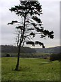
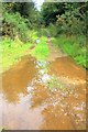
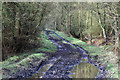
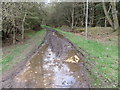
Nearby Images from Geograph Britain and Ireland:
©2005(licence)
©2012(licence)
©2015(licence)
©2018(licence)
©2015(licence)
The above images may not be of the site on this page, they are loaded from Geograph.
Please Submit an Image of this site or go out and take one for us!
Click here to see more info for this site
Nearby sites
Key: Red: member's photo, Blue: 3rd party photo, Yellow: other image, Green: no photo - please go there and take one, Grey: site destroyed
Download sites to:
KML (Google Earth)
GPX (GPS waypoints)
CSV (Garmin/Navman)
CSV (Excel)
To unlock full downloads you need to sign up as a Contributory Member. Otherwise downloads are limited to 50 sites.
Turn off the page maps and other distractions
Nearby sites listing. In the following links * = Image available
1.4km SSW 197° Loft Howe* Round Barrow(s) (SE95018804)
1.9km NE 54° Hackness Church* Ancient Cross (SE96919056)
2.2km NE 54° St Hilda's Holy Well* Holy Well or Sacred Spring (SE9714890729)
2.2km S 172° Fox Head Round Barrow* Round Barrow(s) (SE95748723)
2.2km S 171° California Belt Round Barrows Barrow Cemetery (SE95808719)
5.2km WNW 285° Three Howes (South Moor)* Round Barrow(s) (SE90329063)
5.4km WNW 288° Fox Howe* Round Barrow(s) (SE90249096)
5.5km SE 124° East Ayton Long Barrow Long Barrow (TA000864)
5.7km ESE 110° Seamer Beacon* Round Barrow(s) (TA008876)
5.9km WNW 285° Brown Howes* Round Barrow(s) (SE89709084)
6.1km WSW 237° Rob Howe Long Barrow Long Barrow (SE90308600)
6.2km WNW 289° Dargate Dykes* Ancient Village or Settlement (SE89519132)
7.0km WSW 243° Scamridge Long Barrow Long Barrow (SE892861)
7.5km NNW 327° High Greens Cairn Cemetery Cairn (SE91239564)
7.6km ESE 105° Falsgrave Park Circle* Modern Stone Circle etc (TA028876)
7.6km W 277° Adder Stone (Dalby Forest)* Natural Stone / Erratic / Other Natural Feature (SE8778090110)
7.9km NNE 23° Linglands Farm NW (Hardwood Dale) Cairn (SE9830296749)
7.9km NNE 21° Linglands Farm Cairnfields (Hardwood Dale) Cairn (SE9804796859)
8.1km NNE 22° Harwood Dale* Stone Circle (SE9824796976)
8.2km NE 38° Cloughton Moor Stone Circle (TA0036595947)
8.4km WNW 284° The Bridestones (Staindale)* Natural Stone / Erratic / Other Natural Feature (SE872912)
8.7km N 9° Three Howes (Hallow Rigg)* Barrow Cemetery (SE9659998032)
9.0km E 99° Rotunda Museum* Museum (TA0432588255)
9.1km WNW 297° Blakey Topping* Stone Circle (SE87199338)
9.2km NW 319° Low Woof Howe* Round Barrow(s) (SE89219618)
View more nearby sites and additional images


 We would like to know more about this location. Please feel free to add a brief description and any relevant information in your own language.
 Wir möchten mehr über diese Stätte erfahren. Bitte zögern Sie nicht, eine kurze Beschreibung und relevante Informationen in Deutsch hinzuzufügen.
 Nous aimerions en savoir encore un peu sur les lieux. S'il vous plaît n'hesitez pas à ajouter une courte description et tous les renseignements pertinents dans votre propre langue.
 Quisieramos informarnos un poco más de las lugares. No dude en añadir una breve descripción y otros datos relevantes en su propio idioma.