


<< Our Photo Pages >> Dragonby - Natural Stone / Erratic / Other Natural Feature in England in Lincolnshire
Submitted by Bladup on Monday, 23 November 2015 Page Views: 5369
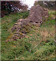
Natural PlacesSite Name: DragonbyCountry: England County: Lincolnshire Type: Natural Stone / Erratic / Other Natural Feature
Nearest Town: Scunthorpe
Map Ref: SE905142
Latitude: 53.616537N Longitude: 0.633383W
Condition:
| 5 | Perfect |
| 4 | Almost Perfect |
| 3 | Reasonable but with some damage |
| 2 | Ruined but still recognisable as an ancient site |
| 1 | Pretty much destroyed, possibly visible as crop marks |
| 0 | No data. |
| -1 | Completely destroyed |
| 5 | Superb |
| 4 | Good |
| 3 | Ordinary |
| 2 | Not Good |
| 1 | Awful |
| 0 | No data. |
| 5 | Can be driven to, probably with disabled access |
| 4 | Short walk on a footpath |
| 3 | Requiring a bit more of a walk |
| 2 | A long walk |
| 1 | In the middle of nowhere, a nightmare to find |
| 0 | No data. |
| 5 | co-ordinates taken by GPS or official recorded co-ordinates |
| 4 | co-ordinates scaled from a detailed map |
| 3 | co-ordinates scaled from a bad map |
| 2 | co-ordinates of the nearest village |
| 1 | co-ordinates of the nearest town |
| 0 | no data |
Internal Links:
External Links:
I have visited· I would like to visit
RantonUFO would like to visit
Bladup has visited here
")
I came to wake the Dragon up - nice outcrop
You may be viewing yesterday's version of this page. To see the most up to date information please register for a free account.
")
")
")
")
Do not use the above information on other web sites or publications without permission of the contributor.
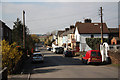
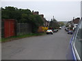
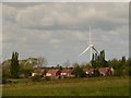
Nearby Images from Geograph Britain and Ireland:
©2011(licence)
©2006(licence)
©2009(licence)
©2009(licence)
©2005(licence)
The above images may not be of the site on this page, they are loaded from Geograph.
Please Submit an Image of this site or go out and take one for us!
Click here to see more info for this site
Nearby sites
Key: Red: member's photo, Blue: 3rd party photo, Yellow: other image, Green: no photo - please go there and take one, Grey: site destroyed
Download sites to:
KML (Google Earth)
GPX (GPS waypoints)
CSV (Garmin/Navman)
CSV (Excel)
To unlock full downloads you need to sign up as a Contributory Member. Otherwise downloads are limited to 50 sites.
Turn off the page maps and other distractions
Nearby sites listing. In the following links * = Image available
2.4km SSW 211° Crosby Stone Natural Stone / Erratic / Other Natural Feature (SE893121)
5.3km NE 48° Holy Well (Winterton) Holy Well or Sacred Spring (SE944178)
5.3km SE 139° Gokwell Priory (Broughton) Misc. Earthwork (SE94081028)
7.2km NNW 335° Kell Well (Walcot)* Holy Well or Sacred Spring (SE873207)
7.8km SE 137° Broughton Cross* Ancient Cross (SE960086)
7.8km NNW 342° Countess Close* Ancient Village or Settlement (SE879216)
8.0km NNW 343° Julian's Bower* Turf Maze (SE880218)
12.2km SW 230° West Butterwick Henge (SE813062)
12.6km ESE 122° St. Helen's Well (Wrawby) Holy Well or Sacred Spring (TA0137907720)
13.3km W 266° Crowle Stone* Early Christian Sculptured Stone (SE772130)
16.0km S 170° Ashwell* Holy Well or Sacred Spring (SK936985)
16.8km N 5° St Helen's Well (South Cave)* Holy Well or Sacred Spring (SE91693096)
17.0km SW 226° Holy Well (Lower Burnham)* Holy Well or Sacred Spring (SE78520205)
17.1km E 88° Howe Hill (Lincolnshire) Round Barrow(s) (TA07631510)
17.7km E 98° Yarborough Camp Hillfort (TA081120)
18.4km N 358° St. Helen's Well (North Cave)* Holy Well or Sacred Spring (SE894326)
18.9km SE 133° The Maiden-Well Holy Well or Sacred Spring (TA045015)
19.0km SE 133° Maiden Well (Maidenwell) Holy Well or Sacred Spring (TA047015)
20.2km ESE 115° Holy Wells (Barnetby le Wold) Holy Well or Sacred Spring (TA091061)
20.4km N 9° St Austin's Stone (High Hunsley)* Natural Stone / Erratic / Other Natural Feature (SE9336034443)
21.0km NW 313° Ringstone Wood (Howden) Stone Circle (SE748282)
21.0km WSW 252° Hatfield Moor* Ancient Trackway (SE7060407233)
22.4km NNE 17° Ling Howe Long Barrow Long Barrow (SE96503580)
23.2km NNE 15° Ella Hill* Round Barrow(s) (SE9606036730)
23.2km S 174° St. Helen's Well (Hemswell)* Holy Well or Sacred Spring (SK932911)
View more nearby sites and additional images


 We would like to know more about this location. Please feel free to add a brief description and any relevant information in your own language.
 Wir möchten mehr über diese Stätte erfahren. Bitte zögern Sie nicht, eine kurze Beschreibung und relevante Informationen in Deutsch hinzuzufügen.
 Nous aimerions en savoir encore un peu sur les lieux. S'il vous plaît n'hesitez pas à ajouter une courte description et tous les renseignements pertinents dans votre propre langue.
 Quisieramos informarnos un poco más de las lugares. No dude en añadir una breve descripción y otros datos relevantes en su propio idioma.