 with our Megalithic Portal iPhone app")

<< Our Photo Pages >> Fairy Stones - Natural Stone / Erratic / Other Natural Feature in England in Yorkshire (North)
Submitted by cavers35 on Monday, 18 March 2024 Page Views: 51
Natural PlacesSite Name: Fairy StonesCountry: England County: Yorkshire (North) Type: Natural Stone / Erratic / Other Natural Feature
Nearest Town: Norton on Derwent Nearest Village: Wharram le Street
Map Ref: SE8700363317
Latitude: 54.058469N Longitude: 0.672345W
Condition:
| 5 | Perfect |
| 4 | Almost Perfect |
| 3 | Reasonable but with some damage |
| 2 | Ruined but still recognisable as an ancient site |
| 1 | Pretty much destroyed, possibly visible as crop marks |
| 0 | No data. |
| -1 | Completely destroyed |
| 5 | Superb |
| 4 | Good |
| 3 | Ordinary |
| 2 | Not Good |
| 1 | Awful |
| 0 | No data. |
| 5 | Can be driven to, probably with disabled access |
| 4 | Short walk on a footpath |
| 3 | Requiring a bit more of a walk |
| 2 | A long walk |
| 1 | In the middle of nowhere, a nightmare to find |
| 0 | No data. |
| 5 | co-ordinates taken by GPS or official recorded co-ordinates |
| 4 | co-ordinates scaled from a detailed map |
| 3 | co-ordinates scaled from a bad map |
| 2 | co-ordinates of the nearest village |
| 1 | co-ordinates of the nearest town |
| 0 | no data |
Internal Links:
External Links:
")
At least 6 Barrows nearby including the famous Duggleby Howe
You may be viewing yesterday's version of this page. To see the most up to date information please register for a free account.
")
")
Do not use the above information on other web sites or publications without permission of the contributor.
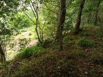
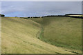
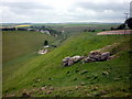
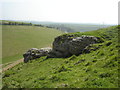
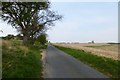
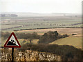
Nearby Images from Geograph Britain and Ireland:
©2005(licence)
©2011(licence)
©2008(licence)
©2014(licence)
©2006(licence)
The above images may not be of the site on this page, they are loaded from Geograph.
Please Submit an Image of this site or go out and take one for us!
Click here to see more info for this site
Nearby sites
Key: Red: member's photo, Blue: 3rd party photo, Yellow: other image, Green: no photo - please go there and take one, Grey: site destroyed
Download sites to:
KML (Google Earth)
GPX (GPS waypoints)
CSV (Garmin/Navman)
CSV (Excel)
To unlock full downloads you need to sign up as a Contributory Member. Otherwise downloads are limited to 50 sites.
Turn off the page maps and other distractions
Nearby sites listing. In the following links * = Image available
987m ESE 116° Towthorpe Plantation Barrow Cemetery Barrow Cemetery (SE879629)
1.1km ENE 69° High Street Barrow (Towthorpe) Cairn (SE88006373)
3.3km W 276° Wharram Percy Barrows Barrow Cemetery (SE837636)
3.3km SE 135° Fimber Cursus Cursus (SE894610)
3.7km NNE 15° Duggleby Cursus Cursus (SE879669)
3.7km NNE 17° Duggleby Howe* Round Barrow(s) (SE88046688)
4.3km NNE 32° Duggleby Cursus Cursus (SE892670)
4.4km ESE 123° Fimber Cursus* Cursus (SE907610)
6.0km SSE 167° Fridaythorpe Earthworks* Misc. Earthwork (SE88425753)
6.5km WSW 248° Hanging Grimstone Barrow Cemetery (SE810608)
6.9km WSW 257° Acklam Wold Cemetery* Barrow Cemetery (SE8027061693)
7.0km SW 235° Kirby Underdale Cursus Cursus (SE81355922)
7.9km SW 218° Callis Wold Barrow Cemetery* Barrow Cemetery (SE8217857003)
8.9km ENE 74° Willie Howe (Cowlam) Round Barrow(s) (SE95516586)
9.1km WNW 292° Hedon Howe Long Barrow (SE7843166510)
9.6km ENE 73° Kemp Howe (Yorkshire) Long Barrow (SE96166628)
10.0km WNW 300° Whitegrounds Barrow Cairn (SE78256824)
10.3km ENE 65° Helperthorpe Long Barrow Long Barrow (SE963679)
10.7km S 180° Dearsden Hill Hillfort (SE872526)
10.9km NNE 24° West Heslerton Wold Dyke Misc. Earthwork (SE913733)
11.3km NNE 12° Knapton Wold Dyke Misc. Earthwork (SE8908274415)
11.9km NNE 15° Staple Howe Ancient Village or Settlement (SE898749)
12.1km ESE 118° Garton Slack 80 Round Barrow(s) (SE97815773)
12.3km ESE 119° Garton Slack 81 Round Barrow(s) (SE97905755)
12.8km SSW 194° Newcote Round Barrow* Barrow Cemetery (SE84225085)
View more nearby sites and additional images


 We would like to know more about this location. Please feel free to add a brief description and any relevant information in your own language.
 Wir möchten mehr über diese Stätte erfahren. Bitte zögern Sie nicht, eine kurze Beschreibung und relevante Informationen in Deutsch hinzuzufügen.
 Nous aimerions en savoir encore un peu sur les lieux. S'il vous plaît n'hesitez pas à ajouter une courte description et tous les renseignements pertinents dans votre propre langue.
 Quisieramos informarnos un poco más de las lugares. No dude en añadir una breve descripción y otros datos relevantes en su propio idioma.