
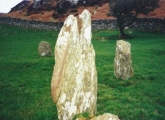

<< Our Photo Pages >> Stoughton Long Barrows - Long Barrow in England in West Sussex
Submitted by JimChampion on Sunday, 01 May 2005 Page Views: 8925
Neolithic and Bronze AgeSite Name: Stoughton Long BarrowsCountry: England County: West Sussex Type: Long Barrow
Nearest Town: Chichester Nearest Village: Stoughton
Map Ref: SU823121
Latitude: 50.902519N Longitude: 0.830967W
Condition:
| 5 | Perfect |
| 4 | Almost Perfect |
| 3 | Reasonable but with some damage |
| 2 | Ruined but still recognisable as an ancient site |
| 1 | Pretty much destroyed, possibly visible as crop marks |
| 0 | No data. |
| -1 | Completely destroyed |
| 5 | Superb |
| 4 | Good |
| 3 | Ordinary |
| 2 | Not Good |
| 1 | Awful |
| 0 | No data. |
| 5 | Can be driven to, probably with disabled access |
| 4 | Short walk on a footpath |
| 3 | Requiring a bit more of a walk |
| 2 | A long walk |
| 1 | In the middle of nowhere, a nightmare to find |
| 0 | No data. |
| 5 | co-ordinates taken by GPS or official recorded co-ordinates |
| 4 | co-ordinates scaled from a detailed map |
| 3 | co-ordinates scaled from a bad map |
| 2 | co-ordinates of the nearest village |
| 1 | co-ordinates of the nearest town |
| 0 | no data |
Internal Links:
External Links:
I have visited· I would like to visit
Spiderdrone visited on 19th Dec 2021 - their rating: Cond: 2 Amb: 4 Access: 3
MartynCon visited - their rating: Cond: 2 Amb: 3 Access: 2
Andy B have visited here
Average ratings for this site from all visit loggers: Condition: 2 Ambience: 3.5 Access: 2.5
")
You may be viewing yesterday's version of this page. To see the most up to date information please register for a free account.
")
")
")
Do not use the above information on other web sites or publications without permission of the contributor.
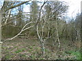
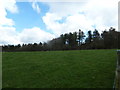
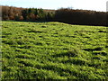
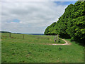
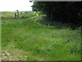
Nearby Images from Geograph Britain and Ireland:
©2013(licence)
©2013(licence)
©2012(licence)
©2010(licence)
©2008(licence)
The above images may not be of the site on this page, they are loaded from Geograph.
Please Submit an Image of this site or go out and take one for us!
Click here to see more info for this site
Nearby sites
Key: Red: member's photo, Blue: 3rd party photo, Yellow: other image, Green: no photo - please go there and take one, Grey: site destroyed
Download sites to:
KML (Google Earth)
GPX (GPS waypoints)
CSV (Garmin/Navman)
CSV (Excel)
To unlock full downloads you need to sign up as a Contributory Member. Otherwise downloads are limited to 50 sites.
Turn off the page maps and other distractions
Nearby sites listing. In the following links * = Image available
100m E 91° Stoughton Down Tumulus Round Barrow(s) (SU824121)
632m SSE 163° Bow Hill Cross Dykes and Earthwork Misc. Earthwork (SU825115)
859m NE 55° Goosehill Camp* Hillfort (SU830126)
1.0km SSW 198° Devil's Humps Barrows* Barrow Cemetery (SU820111)
1.1km SW 215° Bow Hill Cross Dykes* Misc. Earthwork (SU817112)
1.5km S 185° Kingley Vale Settlements Ancient Village or Settlement (SU822106)
1.8km SSW 200° Yew Tree Grove Cross Dyke Misc. Earthwork (SU817104)
2.1km SW 230° Adsdean Down Tumuli* Barrow Cemetery (SU80751075)
4.5km NW 325° Handle Down South Round Barrow(s) (SU7967815765)
4.8km NNW 328° Handle Down Central* Round Barrow(s) (SU79691619)
4.9km NW 315° Bevis Thumb* Long Barrow (SU7875415513)
5.0km NNE 30° West Dean Woods Barrow Round Barrow(s) (SU8473916465)
5.1km NNW 329° Handle Down North* Round Barrow(s) (SU7963616421)
5.1km E 100° St Roche's Gate Cross Dyke* Misc. Earthwork (SU874113)
5.2km N 3° Devil's Jumps* Barrow Cemetery (SU825173)
5.5km E 100° The Trundle* Hillfort (SU877112)
5.5km ESE 116° Lavant Down Earthworks Misc. Earthwork (SU873098)
5.8km NNE 31° Newfarm Plantation Cross Dyke Misc. Earthwork (SU8518117120)
5.8km NNE 25° Linch Down* Round Barrow(s) (SU8464517407)
5.8km NE 35° Bepton Down Platform barrow* Round Barrow(s) (SU8554516928)
5.8km NE 34° Bepton Down Bowl Barrow* Round Barrow(s) (SU8549716973)
5.8km NNE 27° Linchball Hill* Barrow Cemetery (SU84851735)
5.9km ESE 114° Lavant Down Flint Mines Ancient Mine, Quarry or other Industry (SU877098)
6.2km NE 41° Cocking Down* Round Barrow(s) (SU8629216825)
6.3km SSE 152° Brandy Hole Earthwork* Misc. Earthwork (SU854066)
View more nearby sites and additional images


 We would like to know more about this location. Please feel free to add a brief description and any relevant information in your own language.
 Wir möchten mehr über diese Stätte erfahren. Bitte zögern Sie nicht, eine kurze Beschreibung und relevante Informationen in Deutsch hinzuzufügen.
 Nous aimerions en savoir encore un peu sur les lieux. S'il vous plaît n'hesitez pas à ajouter une courte description et tous les renseignements pertinents dans votre propre langue.
 Quisieramos informarnos un poco más de las lugares. No dude en añadir una breve descripción y otros datos relevantes en su propio idioma.