


<< Our Photo Pages >> Acklam Wold Cemetery - Barrow Cemetery in England in Yorkshire (North)
Submitted by Andy B on Tuesday, 03 May 2016 Page Views: 12888
Neolithic and Bronze AgeSite Name: Acklam Wold CemeteryCountry: England
NOTE: This site is 0.8 km away from the location you searched for.
County: Yorkshire (North) Type: Barrow Cemetery
Nearest Village: Acklamn
Map Ref: SE8027061693 Landranger Map Number: 100
Latitude: 54.044968N Longitude: 0.775608W
Condition:
| 5 | Perfect |
| 4 | Almost Perfect |
| 3 | Reasonable but with some damage |
| 2 | Ruined but still recognisable as an ancient site |
| 1 | Pretty much destroyed, possibly visible as crop marks |
| 0 | No data. |
| -1 | Completely destroyed |
| 5 | Superb |
| 4 | Good |
| 3 | Ordinary |
| 2 | Not Good |
| 1 | Awful |
| 0 | No data. |
| 5 | Can be driven to, probably with disabled access |
| 4 | Short walk on a footpath |
| 3 | Requiring a bit more of a walk |
| 2 | A long walk |
| 1 | In the middle of nowhere, a nightmare to find |
| 0 | No data. |
| 5 | co-ordinates taken by GPS or official recorded co-ordinates |
| 4 | co-ordinates scaled from a detailed map |
| 3 | co-ordinates scaled from a bad map |
| 2 | co-ordinates of the nearest village |
| 1 | co-ordinates of the nearest town |
| 0 | no data |
Internal Links:
External Links:
I have visited· I would like to visit
Runemage has visited here
")
The jet buttons are probably the remains of the clothes in which the dead were buried. There are also linear earthworks that are considered to be British (Wright), ie of the Iron Age. Finds have included gold necklaces, amber beads and a rich ornament for a horse's head (Mee, Wright). It is not clear which of these are from the Bronze Age and which the Iron Age. Signs of strip lynchets suggest that this was marginal (arable) land a thousand years ago (Wright). A Roman road from South Newbold to Malton crosses Acklam Wold (Margary).
Source: Geograph
Monument No. 59725 is a bowl barrow no longer visible on the ground as an earthwork. Excavated by Mortimer in 1868, he uncovered a 6 feet deep grave-pit beneath the mound associated with a sequence of four burials. The remains of an adult male lay over the top of the grave fill; at a depth of 18 inches were the remains of a child inhumation; at a depth of 3 feet was an adult female inhumation with bone pin and flint knife; and near the bottom was a mature adult male with a flint dagger in one hand, accompanied by a Beaker, jet and amber buttons, a jet ring, a flint knife, a bone pin and a lump of iron pyrites. According to Mortimer, the mound was primarily of chalk and was surrounded by a ditch circa 50 feet in diameter (centre to centre), 2 feet deep, 5 feet wide at the bottom and 10 feet wide at the top.
Source: Pastscape
Note: Dying embers: fire-lighting technology and mortuary practice in early Bronze Age Britain. See the comment on our page for more.
You may be viewing yesterday's version of this page. To see the most up to date information please register for a free account.
")
Do not use the above information on other web sites or publications without permission of the contributor.
Runemage has found this location on Google Street View:
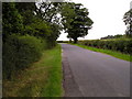
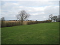
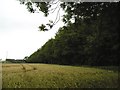
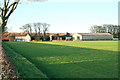
Nearby Images from Geograph Britain and Ireland:
©2010(licence)
©2012(licence)
©2010(licence)
©2006(licence)
©2014(licence)
The above images may not be of the site on this page, they are loaded from Geograph.
Please Submit an Image of this site or go out and take one for us!
Click here to see more info for this site
Nearby sites
Key: Red: member's photo, Blue: 3rd party photo, Yellow: other image, Green: no photo - please go there and take one, Grey: site destroyed
Download sites to:
KML (Google Earth)
GPX (GPS waypoints)
CSV (Garmin/Navman)
CSV (Excel)
To unlock full downloads you need to sign up as a Contributory Member. Otherwise downloads are limited to 50 sites.
Turn off the page maps and other distractions
Nearby sites listing. In the following links * = Image available
1.2km SE 142° Hanging Grimstone Barrow Cemetery (SE810608)
2.7km SSE 157° Kirby Underdale Cursus Cursus (SE81355922)
3.9km ENE 62° Wharram Percy Barrows Barrow Cemetery (SE837636)
5.1km SSE 159° Callis Wold Barrow Cemetery* Barrow Cemetery (SE8217857003)
5.2km NNW 340° Hedon Howe Long Barrow (SE7843166510)
6.8km NNW 344° Whitegrounds Barrow Cairn (SE78256824)
6.9km ENE 77° Fairy Stones* Natural Stone / Erratic / Other Natural Feature (SE8700363317)
7.7km E 82° Towthorpe Plantation Barrow Cemetery Barrow Cemetery (SE879629)
8.0km ENE 76° High Street Barrow (Towthorpe) Cairn (SE88006373)
9.1km ESE 118° Fridaythorpe Earthworks* Misc. Earthwork (SE88425753)
9.1km E 95° Fimber Cursus Cursus (SE894610)
9.2km ENE 57° Duggleby Cursus Cursus (SE879669)
9.3km ENE 57° Duggleby Howe* Round Barrow(s) (SE88046688)
10.4km ENE 60° Duggleby Cursus Cursus (SE892670)
10.4km E 95° Fimber Cursus* Cursus (SE907610)
11.2km NNW 328° Holy Well, Hildenley* Holy Well or Sacred Spring (SE741711)
11.3km NW 312° St Ann's Well (Castle Howard)* Holy Well or Sacred Spring (SE71786918)
11.4km SE 144° Dearsden Hill Hillfort (SE872526)
11.5km SSE 161° Newcote Round Barrow* Barrow Cemetery (SE84225085)
11.6km SW 225° Catton Cursus (SE721534)
12.3km SW 226° Catton Cursus (SE716530)
12.5km SSE 165° Kilnwick Percy Hill - Barrow* Barrow Cemetery (SE8365149674)
14.6km SSE 163° St James Church (Nunburnholme)* Ancient Cross (SE84774779)
15.3km WSW 242° Holtby Timber Circle (SE668543)
15.5km NE 36° Knapton Wold Dyke Misc. Earthwork (SE8908274415)
View more nearby sites and additional images


 We would like to know more about this location. Please feel free to add a brief description and any relevant information in your own language.
 Wir möchten mehr über diese Stätte erfahren. Bitte zögern Sie nicht, eine kurze Beschreibung und relevante Informationen in Deutsch hinzuzufügen.
 Nous aimerions en savoir encore un peu sur les lieux. S'il vous plaît n'hesitez pas à ajouter une courte description et tous les renseignements pertinents dans votre propre langue.
 Quisieramos informarnos un poco más de las lugares. No dude en añadir una breve descripción y otros datos relevantes en su propio idioma.