Featured: Hare and Tabor T Shirts for discerning antiquarians

Hare and Tabor T Shirts for discerning antiquarians

Random Image

Serpent’s Gold by Sam Osman

Serpent’s Gold by Sam Osman

Who's Online

There are currently, 319 guests and 1 members online.

You are a guest. To join in, please register for free by clicking here

Sponsors

<< Our Photo Pages >> Middle Rigg round barrows and pit alignment - Barrow Cemetery in England in Yorkshire (North)

Submitted by Andy B on Monday, 25 December 2017  Page Views: 1363

Neolithic and Bronze AgeSite Name: Middle Rigg round barrows and pit alignment
Country: England County: Yorkshire (North) Type: Barrow Cemetery

Map Ref: NZ739106
Latitude: 54.485372N  Longitude: 0.860818W
Condition:
5Perfect
4Almost Perfect
3Reasonable but with some damage
2Ruined but still recognisable as an ancient site
1Pretty much destroyed, possibly visible as crop marks
0No data.
-1Completely destroyed
no data Ambience:
5Superb
4Good
3Ordinary
2Not Good
1Awful
0No data.
no data Access:
5Can be driven to, probably with disabled access
4Short walk on a footpath
3Requiring a bit more of a walk
2A long walk
1In the middle of nowhere, a nightmare to find
0No data.
no data Accuracy:
5co-ordinates taken by GPS or official recorded co-ordinates
4co-ordinates scaled from a detailed map
3co-ordinates scaled from a bad map
2co-ordinates of the nearest village
1co-ordinates of the nearest town
0no data
5
Be the first person to rate this site - see the 'Contribute!' box in the right hand menu.

Internal Links:
External Links:

Middle Rigg round barrows and pit alignment
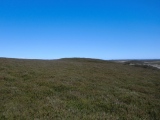
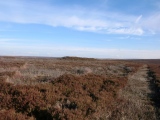
Middle Rigg round barrows and pit alignment submitted by johndhunter : The central barrow viewed looking northerly, June 2018 (Vote or comment on this photo)
Barrow Cemetery in Yorkshire (North). The monument includes the buried and earthwork remains of four round barrows and a pit alignment on Middle Rigg, Easington High Moor.

The pit alignment was first noted by Young in 1817 who interpreted the remains as an ancient British pit village. Canon Atkinson investigated one of the pits in 1848 and found it to have a stone floor 1.2m-1.5m below the level of the surrounding ground surface. In 1864 Atkinson returned to part excavate one of the four round barrows. Elgee reinterpreted the pit alignments as an unfinished cross dyke in 1930 and in 1993 the area was surveyed by the Royal Commission on the Historic Monuments of England who identified it as the best surviving example of a particular form of pit alignment, a segmented embanked pit alignment.

Three of the four round barrows form a roughly north west to south east line on the part of Middle Rigg known as Three Howes Rigg. All three barrows show signs of antiquarian excavation, but each has a significant proportion of the original volume of the mound surviving undisturbed. The north western barrow is just over 20m in diameter and stands 1.5m high. The middle barrow is centred 45m to the ESE and is 17m in diameter and 2m high. The third barrow is centred a further 50m to the south east, is also about 17m in diameter and stands to 1.2m in height. The middle barrow has a north-south trench cut through its centre. This is thought to have been dug in 1864 by Atkinson, who found two cremation burials. The first was about 6m from the centre of the mound and was associated with a small cup, fragments of other pieces of pottery including those from a large Bronze Age urn and four worked flints, one being an arrow head. Within 0.5m of the mound's centre there was a second small cup with more cremated bone, worked flint and a 32mm long lump of haematite.

The pit alignment on Middle Rigg runs approximately parallel to the line of three barrows, about 120m to the north east. It is in two main sections, slightly offset from each other, with the 23m gap between the two sections lying opposite the central barrow. Each section of the pit alignment is further subdivided into segments, with each segment typically having between two and four pairs of pits flanked to the NNE and SSW by a pair of banks. Each segment is divided from the next by a slight change in direction, or a small break in the flanking banks. The two lines of paired pits are typically centred 10m apart and are up to 3m in diameter with the banks 12m to 18m apart and up to 1m high. The western section of the pit alignment is 138m long and includes 34 pits arranged in four shorter segments. The eastern section is 115m long and has 30 pits divided between five segments.

The fourth round barrow is centered 60m to the south east of the south eastern end of the pit alignment, with the line of the pit alignment forming a tangent with the northern side of the barrow. This barrow is more complex in earthwork form than the other three in the group. It is a 13m diameter squat mound placed centrally on a circular platform which has an outer lip 0.1m to 0.2m high. The base of the platform is 22m in diameter, with the lip 0.5m above the surrounding ground surface. The whole barrow is sited on slightly sloping ground so that it is 1m high when measured on the north western side and 1.6m high on the south eastern side.

The four round barrows associated with the pit alignment on Middle Rigg have no discernible ditches around them, but excavation of other barrows has shown that even where no encircling depression is discernible on the modern ground surface, ditches immediately around the outside of barrows frequently survive as infilled features, containing additional archaeological deposits.

Source: Historic England
You may be viewing yesterday's version of this page. To see the most up to date information please register for a free account.

Middle Rigg round barrows and pit alignment
Middle Rigg round barrows and pit alignment submitted by johndhunter : Hannah Coling Memorial Stone at NZ 73779 10371 – Just over 300 yards to the south west of the barrows on Three Howes Rigg is a memorial stone to Hannah Coling. The inscription reads: H Coling, Perished Here, January 27, 1848. She was 29 years old and perished in a snow storm, her body was not found for 3 days. This photo taken January 2012 (Vote or comment on this photo)

Middle Rigg round barrows and pit alignment
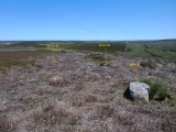
Middle Rigg round barrows and pit alignment submitted by johndhunter : Elgees Stone Triangle – Is this Elgees Stone Triangle on Easington High Moor? Photo taken June 2018 looking towards Danby Beacon. See comments section on the site web page (Middle Rigg Round Barrows and Pit alignment) for more information on this triangle. (Vote or comment on this photo)

Middle Rigg round barrows and pit alignment
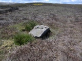
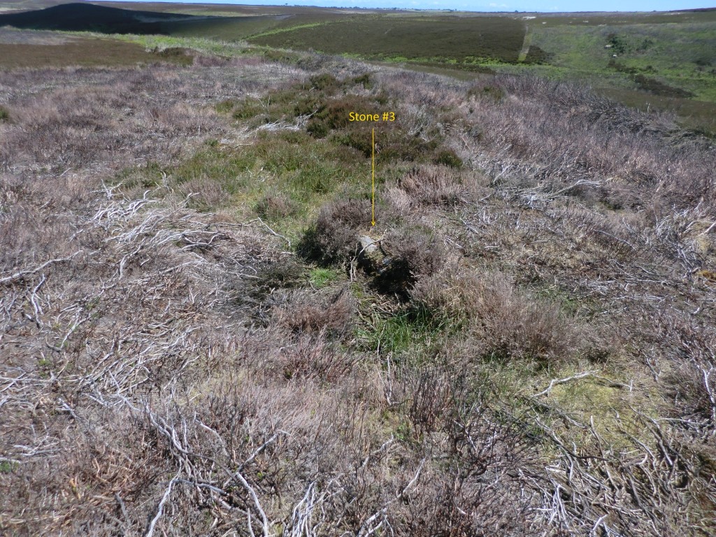
Middle Rigg round barrows and pit alignment submitted by johndhunter : Elgees Stone Triangle? - Stone #3 , This view was taken in June 2018 after I had with my limited means available scraped some of the vegetation off the surface. With what can now be seen and further poking around with a stick I get the feeling that this stone is going to be of a similar shape to stone #1 (Vote or comment on this photo)

Middle Rigg round barrows and pit alignment
Middle Rigg round barrows and pit alignment submitted by johndhunter : Elgees Stone Triangle? - In this view taken in June 2018 we are looking at stone #3 in a north easterly direction. It is just barely visible and indicated by the arrow. However poking around with a walking stick indicated that it was at least 5 feet long. See comments section on the site web page (Middle Rigg Round Barrows and Pit alignment) for more information on this triangle. (Vote or comment on this photo)

Middle Rigg round barrows and pit alignment
Middle Rigg round barrows and pit alignment submitted by johndhunter : Elgees Stone Triangle? - In this view taken in June 2018 we are looking at stones #2 and #3 in a north easterly direction. See comments section on the site web page (Middle Rigg Round Barrows and Pit alignment) for more information on this triangle. (Vote or comment on this photo)

Middle Rigg round barrows and pit alignment
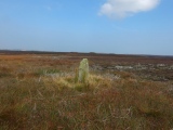
Middle Rigg round barrows and pit alignment submitted by johndhunter : Elgees Stone Triangle? - In this view taken June 2018 we are looking at stone #2 in the foreground , stone #1 towards the centre and the round barrow at NZ 74148 10663 behind that. See comments section on the site web page (Middle Rigg Round Barrows and Pit alignment) for more information on this triangle.

Middle Rigg round barrows and pit alignment
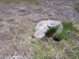
Middle Rigg round barrows and pit alignment submitted by johndhunter : Elgees Stone Triangle? - Stone #2. As can be seen from this view taken June 2018 most of it is buried but poking around with a walking stick indicates that it is over 5 feet long. See comments section on the site web page (Middle Rigg Round Barrows and Pit alignment) for more information on this triangle.

Middle Rigg round barrows and pit alignment
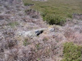
Middle Rigg round barrows and pit alignment submitted by johndhunter : Elgees Stone Triangle? - Stone #1 at NZ 74172 10677. As can be seen in this view of the stone taken in June 2018 , its full length is not totally exposed. See comments section on the site web page (Middle Rigg Round Barrows and Pit alignment) for more information on this triangle.

Middle Rigg round barrows and pit alignment
Middle Rigg round barrows and pit alignment submitted by johndhunter : Elgees Stone Triangle? - Stone #1 at NZ 74172 10677 viewed looking south easterly to the round barrow at NZ 74148 10663. See comments section on the site web page (Middle Rigg Round Barrows and Pit alignment) for more information on this triangle.

Middle Rigg round barrows and pit alignment
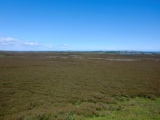
Middle Rigg round barrows and pit alignment submitted by johndhunter : Elgees Stone Triangle – Is this Elgees Stone Triangle on Easington High Moor? Photo taken June 2018 looking north easterly across Bella Dale Slack. See comments section on the site web page (Middle Rigg Round Barrows and Pit alignment) for more information on this triangle

Middle Rigg round barrows and pit alignment
Middle Rigg round barrows and pit alignment submitted by johndhunter : The fourth barrow at NZ 74148 10663 on Three Howes / Middle Rigg lies about 200 feet to the south east end of the pit alignment and almost in line with it. Google Earth gives a good view of this. This is a view of the barrow looking westerly taken June 2018.

Middle Rigg round barrows and pit alignment
Middle Rigg round barrows and pit alignment submitted by johndhunter : The fourth barrow at NZ 74148 10663 on Three Howes / Middle Rigg lies about 200 feet to the south east end of the pit alignment and almost in line with it. Google Earth gives a good view of this. This is a view of the barrow looking north easterly taken June 2018

Middle Rigg round barrows and pit alignment
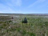
Middle Rigg round barrows and pit alignment submitted by johndhunter : Hannah Coling Memorial Stone at NZ 73779 10371 – Another view taken June 2018 looking south easterly towards Brown Howe Rigg. The stone at this time of year is sitting amongst a sea of cotton grass

Middle Rigg round barrows and pit alignment
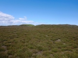
Middle Rigg round barrows and pit alignment submitted by johndhunter : In this view taken September 2014 from the Hannah Coling Memorial Stone at NZ 73779 10371 the three round barrows on Three Howes Rigg can be seen on the skyline in the centre of the image. From left to right, western, centre and eastern barrows

Middle Rigg round barrows and pit alignment
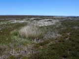
Middle Rigg round barrows and pit alignment submitted by johndhunter : It is difficult to get a decent photo of the pit alignment with it being low lying and is best viewed on Google Earth to see how it is actually laid out. This view was taken in June 2018 from the top of the central round barrow on Three Howes Rigg looking towards Scaling Dam. The pit alignment is indicated by the patches of white cotton grass running left to right across the centre of the image. ...

Middle Rigg round barrows and pit alignment
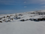
Middle Rigg round barrows and pit alignment submitted by johndhunter : It is difficult to get a decent photo of the pit alignment with it being low lying and is best viewed on Google Earth to see how it is actually laid out. However because of the embankments etc. the location of the pit alignment stands out in the snow. Photo taken March 2013

Middle Rigg round barrows and pit alignment
Middle Rigg round barrows and pit alignment submitted by johndhunter : It is difficult to get a decent photo of the pit alignment with it being low lying and is best viewed on Google Earth to see how it is actually laid out. This view is of a section of the alignment showing some of the pits in June 2018 taken from NZ 73839 10801 looking east. The cotton grass indicating where the pits are

Middle Rigg round barrows and pit alignment
Middle Rigg round barrows and pit alignment submitted by johndhunter : It is difficult to get a decent photo of the pit alignment with it being low lying and is best viewed on Google Earth to see how it is actually laid out. This view is of a section of the alignment showing some of the pits in September 2014 .The tufts of marsh type grass some of which are indicated by the red arrows denote the centre of the pits

Middle Rigg round barrows and pit alignment
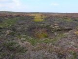
Middle Rigg round barrows and pit alignment submitted by johndhunter : It is difficult to get a decent photo of the pit alignment with it being low lying and is best viewed on Google Earth to see how it is actually laid out. This view is of a section of the alignment showing some of the pits in September 2014 after the heather had been burned off. The tufts of marsh type grass denote the centre of the pits

Middle Rigg round barrows and pit alignment
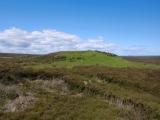
Middle Rigg round barrows and pit alignment submitted by johndhunter : Western, central and eastern barrows viewed looking westerly from the southern side, June 2018

Middle Rigg round barrows and pit alignment
Middle Rigg round barrows and pit alignment submitted by johndhunter : Eastern Barrow viewed looking northerly, February 2017

Middle Rigg round barrows and pit alignment
Middle Rigg round barrows and pit alignment submitted by johndhunter : Eastern barrow viewed looking northerly, June 2018

Middle Rigg round barrows and pit alignment
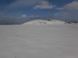
Middle Rigg round barrows and pit alignment submitted by johndhunter : The central barrow viewed looking southerly. March 2013

Middle Rigg round barrows and pit alignment
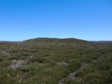
Middle Rigg round barrows and pit alignment submitted by johndhunter : The central barrow viewed looking westerly, June 2018

Middle Rigg round barrows and pit alignment
Middle Rigg round barrows and pit alignment submitted by johndhunter : The central barrow viewed looking northerly, March 2013

These are just the first 25 photos of Middle Rigg round barrows and pit alignment. If you log in with a free user account you will be able to see our entire collection.

Do not use the above information on other web sites or publications without permission of the contributor.
Click here to see more info for this site

Nearby sites

Click here to view sites on an interactive OS map

Key: Red: member's photo, Blue: 3rd party photo, Yellow: other image, Green: no photo - please go there and take one, Grey: site destroyed

Download sites to:
KML (Google Earth)
GPX (GPS waypoints)
CSV (Garmin/Navman)
CSV (Excel)

To unlock full downloads you need to sign up as a Contributory Member. Otherwise downloads are limited to 50 sites.


Turn off the page maps and other distractions

Nearby sites listing. In the following links * = Image available
 339m S 176° Bella Dale Slack MS1* Marker Stone (NZ7392810262)
 389m NE 46° Long Stone (Easington High Moor)* Standing Stone (Menhir) (NZ7417710874)
 446m NNW 336° Franklan Dyke Stone* Marker Stone (NZ7371511006)
 541m E 80° Black Dike Moor Segmented Pit Alignment* Misc. Earthwork (NZ7443210707)
 579m NW 318° Little Dinnod* Marker Stone (NZ7350411024)
 848m ENE 70° Long Stone (Black Dike Moor)* Marker Stone (NZ7469210909)
 998m WSW 246° Nean Howe* Round Barrow(s) (NZ7299010184)
 1.2km WNW 304° Great Dinnod* Marker Stone (NZ7291511232)
 1.2km ENE 66° Good Goose Thorne (East)* Marker Stone (NZ7497011089)
 1.3km SSE 152° Brown Rigg (Lealholm Moor)* Round Barrow(s) (NZ7451709505)
 1.3km SSE 157° Stump Cross (Lealholm Moor)* Ancient Cross (NZ7441109439)
 1.3km ENE 59° Nan Stone.* Marker Stone (NZ7498411279)
 1.4km SSW 194° Danby Beacon* Round Barrow(s) (NZ73600927)
 1.4km NW 316° Viscount Downe BS2* Marker Stone (NZ7288411618)
 1.5km NW 318° Beckwith Stone* Marker Stone (NZ7287611705)
 1.5km NW 320° Waupley Moor South HC1* Ancient Village or Settlement (NZ7290111755)
 1.5km NW 306° Old Beckwith Stone* Marker Stone (NZ7264311470)
 1.6km NW 322° Black Howe (Waupley Moor)* Round Barrow(s) (NZ7289011853)
 1.7km NW 317° Waupley Moor South MS1* Marker Stone (NZ7273011793)
 1.8km NW 315° Water Dittins Marker Stone* Marker Stone (NZ7258311880)
 1.9km NW 314° Viscount Downe BS1* Marker Stone (NZ7252911879)
 1.9km ESE 105° Temple Beeld (Lealholm Moor)* Stone Row / Alignment (NZ7572810141)
 1.9km SW 233° Castleton Pits RB1* Round Barrow(s) (NZ7240009450)
 2.0km W 279° Elm Ledge Guide Stone* Marker Stone (NZ7191810876)
 2.0km SE 132° Rawland Howe* Round Barrow(s) (NZ7542809261)
View more nearby sites and additional images

<< Devil's Arrows

Crocoriga Nuraghe >>

Please add your thoughts on this site

Prehistoric Rock Art in the Northern Dales

Prehistoric Rock Art in the Northern Dales

Sponsors

Auto-Translation (Google)

Translate from English into:

"Middle Rigg round barrows and pit alignment" | Login/Create an Account | 3 News and Comments
  
Go back to top of page    Comments are owned by the poster. We aren't responsible for their content.
Re: Middle Rigg round barrows and pit alignment by johndhunter on Sunday, 15 July 2018
(User Info | Send a Message)
Stone Triangles – Frank Elgee in his 1930 book “Early Man in North East Yorkshire” on page 106 states and I quote from the book “Another fallen triangle occurs on Easington High Moor. It lies immediately east of the large barrow between the words Ridge and Inclosures on Fig 51. The stones form a right angled triangle, one side of which is 30 yards long, the other two about 24 yards. The stones are from 5 -7 feet long with broad bases” The barrow he is talking about is the one 200ft to the south east of the pit alignment at NZ 74148 10663 and looking at Fig 51 in his book it puts the triangle just to the north as well as east of the barrow. I did a search all round the barrow paying specific attention to the location described by Elgee where I found three recumbent stones, however they are feet apart not yards and appear to form an obtuse triangle with the larger angle being about 120 degrees rather than 90 degrees. Note - measurements that I took were all rough and ready just to give myself an idea of what the situation was. However the stones do all appear to be at least 5 feet in length, so may be this is Elgees triangle? I found no other exposed stones of any size around the barrow. In the images uploaded to this web page I have designated the stone nearest to the barrow as #1, this is at NZ 74172 10677 and is the stone with most of its surface exposed. The stone I have designated #2 in the uploaded images is about 25 feet from stone #1 with what appears to be about 25% of its surface exposed and poking around with a walking stick indicates that it is over 5 foot in length. The stone designated #3 is about 10 feet from #2 and 18 feet from #1 and was barely visible covered by vegetation, with just a very small section exposed. Again poking around with a walking stick indicates that it is at least 5 feet in length. With the limited means that I had available I scraped some of the vegetation off the top of the stone and it gives me the impression that it will be of a similar shape to stone #1
[ Reply to This ]

Re: Middle Rigg round barrows and pit alignment by Andy B on Monday, 25 December 2017
(User Info | Send a Message)
Gavin writes: Just north of the pits and barrows is a large standing stone known as the Long Stone. The stone about 2 meters tall. I’ve never been sure whether this stone is prehistoric or not. It’s sides have been squared and it has a semi-circular carved area on its south face. The sheer size of the stone and the un-squared deeply weathered top indicate that it is quite ancient and not a typical estate boundary stone, as to its origins, who knows?

https://teessidepsychogeography.wordpress.com/2017/01/05/ingleby-bank-top/
[ Reply to This ]
    Re: Middle Rigg round barrows and pit alignment by johndhunter on Wednesday, 11 July 2018
    (User Info | Send a Message)
    Frank Elgee in his 1930 book “Early Man in North East Yorkshire” page 106 says this is certainly a prehistoric standing stone. For images of this stone see Site # 50263 - Long Stone (Easington High Moor)
    [ Reply to This ]

Your Name: Anonymous [ Register Now ]
Subject:


Add your comment or contribution to this page. Spam or offensive posts are deleted immediately, don't even bother

<<< What is five plus one as a number? (Please type the answer to this question in the little box on the left)
You can also embed videos and other things. For Youtube please copy and paste the 'embed code'.
For Google Street View please include Street View in the text.
Create a web link like this: <a href="https://www.megalithic.co.uk">This is a link</a>  

Allowed HTML is:
<p> <b> <i> <a> <img> <em> <br> <strong> <blockquote> <tt> <li> <ol> <ul> <object> <param> <embed> <iframe>

We would like to know more about this location. Please feel free to add a brief description and any relevant information in your own language.
Wir möchten mehr über diese Stätte erfahren. Bitte zögern Sie nicht, eine kurze Beschreibung und relevante Informationen in Deutsch hinzuzufügen.
Nous aimerions en savoir encore un peu sur les lieux. S'il vous plaît n'hesitez pas à ajouter une courte description et tous les renseignements pertinents dans votre propre langue.
Quisieramos informarnos un poco más de las lugares. No dude en añadir una breve descripción y otros datos relevantes en su propio idioma.