


<< Our Photo Pages >> Gerrick Moor RB1 - Round Barrow(s) in England in Yorkshire (North)
Submitted by johndhunter on Friday, 25 March 2022 Page Views: 273
Neolithic and Bronze AgeSite Name: Gerrick Moor RB1Country: England County: Yorkshire (North) Type: Round Barrow(s)
Nearest Town: Loftus Nearest Village: Danby
Map Ref: NZ7052011834
Latitude: 54.496940N Longitude: 0.912685W
Condition:
| 5 | Perfect |
| 4 | Almost Perfect |
| 3 | Reasonable but with some damage |
| 2 | Ruined but still recognisable as an ancient site |
| 1 | Pretty much destroyed, possibly visible as crop marks |
| 0 | No data. |
| -1 | Completely destroyed |
| 5 | Superb |
| 4 | Good |
| 3 | Ordinary |
| 2 | Not Good |
| 1 | Awful |
| 0 | No data. |
| 5 | Can be driven to, probably with disabled access |
| 4 | Short walk on a footpath |
| 3 | Requiring a bit more of a walk |
| 2 | A long walk |
| 1 | In the middle of nowhere, a nightmare to find |
| 0 | No data. |
| 5 | co-ordinates taken by GPS or official recorded co-ordinates |
| 4 | co-ordinates scaled from a detailed map |
| 3 | co-ordinates scaled from a bad map |
| 2 | co-ordinates of the nearest village |
| 1 | co-ordinates of the nearest town |
| 0 | no data |
Internal Links:
External Links:
")
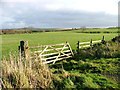
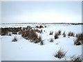
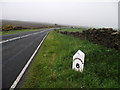
A bronze age round barrow sited below and about 100m to the north east of HERD HOWE. It sits on a stretch of fairly level ground about 80m to the east of what is probably an Iron Age ENCLOSURE and though not in a particularly prominent position it still has quite extensive views over the relatively flat land to the north.
Its location is usually heavily overgrown and the barrow tends to blend in with the background, consequently its position may not be obvious when looking for it from a distance, however as you approach, it begins to stand out clearly for what it is. The barrow is Historic England LIST ENTRY 1018803 which tells us that 17m in diameter and stands up to 1.1m in height. Also that it is undisturbed and has not been excavated.
Further information can also be found at HERR MONUMENT 1211505
You may be viewing yesterday's version of this page. To see the most up to date information please register for a free account.
")
")
")
Do not use the above information on other web sites or publications without permission of the contributor.
Nearby Images from Geograph Britain and Ireland:
©2005(licence)
©2010(licence)
©2011(licence)
©2005(licence)
©2010(licence)
The above images may not be of the site on this page, they are loaded from Geograph.
Please Submit an Image of this site or go out and take one for us!
Click here to see more info for this site
Nearby sites
Key: Red: member's photo, Blue: 3rd party photo, Yellow: other image, Green: no photo - please go there and take one, Grey: site destroyed
Download sites to:
KML (Google Earth)
GPX (GPS waypoints)
CSV (Garmin/Navman)
CSV (Excel)
To unlock full downloads you need to sign up as a Contributory Member. Otherwise downloads are limited to 50 sites.
Turn off the page maps and other distractions
Nearby sites listing. In the following links * = Image available
85m WNW 285° Gerrick Moor Enclosure E1* Ancient Village or Settlement (NZ7043711855)
99m SW 229° Herd Howe (Gerrick Moor)* Round Barrow(s) (NZ7044611768)
196m NW 313° Gerrick Moor Hut Circles* Ancient Village or Settlement (NZ7037411965)
288m S 171° Robin Hoods Butts 2* Round Barrow(s) (NZ70571155)
523m ESE 114° Gerrick Moor Standing Stone SS1* Standing Stone (Menhir) (NZ7100111625)
642m SE 129° Robin Hoods Butts 3* Round Barrow(s) (NZ7102411434)
813m ESE 123° Robin Hoods Butts 1* Round Barrow(s) (NZ71211140)
979m ESE 117° Robin Hood Butts Howe* Round Barrow(s) (NZ71401140)
1.2km E 90° Harlow Bush* Marker Stone (NZ7171811857)
1.2km S 190° Siss Cross* Marker Stone (NZ7032510614)
1.4km SE 134° Elm Ledge LB1* Long Barrow (NZ7151110900)
1.4km SE 141° Elm Ledge RB1* Round Barrow(s) (NZ7144710745)
1.7km SE 125° Elm Ledge Guide Stone* Marker Stone (NZ7191810876)
1.7km WNW 298° Freebrough Hill* Natural Stone / Erratic / Other Natural Feature (NZ68971263)
1.9km SW 234° Haw Rigg (Danby Low Moor)* Round Barrow(s) (NZ6901910721)
1.9km W 273° Moorsholm Moor Cup Marked Rock* Rock Art (NZ6861911919)
2.0km E 90° Viscount Downe BS1* Marker Stone (NZ7252911879)
2.1km E 90° Water Dittins Marker Stone* Marker Stone (NZ7258311880)
2.1km WSW 248° Job Cross (Middle Heads)* Ancient Cross (NZ6855210987)
2.1km E 101° Old Beckwith Stone* Marker Stone (NZ7264311470)
2.2km E 92° Waupley Moor South MS1* Marker Stone (NZ7273011793)
2.4km E 94° Beckwith Stone* Marker Stone (NZ7287611705)
2.4km E 90° Black Howe (Waupley Moor)* Round Barrow(s) (NZ7289011853)
2.4km E 96° Viscount Downe BS2* Marker Stone (NZ7288411618)
2.4km E 93° Waupley Moor South HC1* Ancient Village or Settlement (NZ7290111755)
View more nearby sites and additional images


 We would like to know more about this location. Please feel free to add a brief description and any relevant information in your own language.
 Wir möchten mehr über diese Stätte erfahren. Bitte zögern Sie nicht, eine kurze Beschreibung und relevante Informationen in Deutsch hinzuzufügen.
 Nous aimerions en savoir encore un peu sur les lieux. S'il vous plaît n'hesitez pas à ajouter une courte description et tous les renseignements pertinents dans votre propre langue.
 Quisieramos informarnos un poco más de las lugares. No dude en añadir una breve descripción y otros datos relevantes en su propio idioma.