<< Our Photo Pages >> Percy Cross Rigg Settlement - Ancient Village or Settlement in England in Yorkshire (North)
Submitted by johndhunter on Saturday, 08 August 2020 Page Views: 3570
Iron Age and Later PrehistorySite Name: Percy Cross Rigg SettlementCountry: England County: Yorkshire (North) Type: Ancient Village or Settlement
Nearest Village: Hutton
Map Ref: NZ6099911551
Latitude: 54.495629N Longitude: 1.059724W
Condition:
| 5 | Perfect |
| 4 | Almost Perfect |
| 3 | Reasonable but with some damage |
| 2 | Ruined but still recognisable as an ancient site |
| 1 | Pretty much destroyed, possibly visible as crop marks |
| 0 | No data. |
| -1 | Completely destroyed |
| 5 | Superb |
| 4 | Good |
| 3 | Ordinary |
| 2 | Not Good |
| 1 | Awful |
| 0 | No data. |
| 5 | Can be driven to, probably with disabled access |
| 4 | Short walk on a footpath |
| 3 | Requiring a bit more of a walk |
| 2 | A long walk |
| 1 | In the middle of nowhere, a nightmare to find |
| 0 | No data. |
| 5 | co-ordinates taken by GPS or official recorded co-ordinates |
| 4 | co-ordinates scaled from a detailed map |
| 3 | co-ordinates scaled from a bad map |
| 2 | co-ordinates of the nearest village |
| 1 | co-ordinates of the nearest town |
| 0 | no data |
Internal Links:
External Links:
I have visited· I would like to visit
elad13 would like to visit
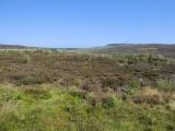
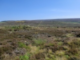
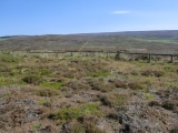
Charisma_Eowyn visited on 1st Jan 2021 - their rating: Cond: 2 Amb: 3 Access: 2 Went with my 8 year old for her topic homework. 5 circles clearly visible and what can be distinguished as a path. One mound has up to 3 stones high of the original wall left.
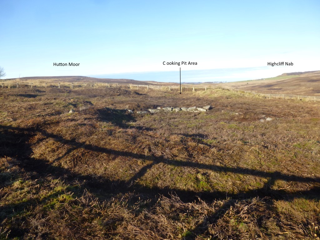
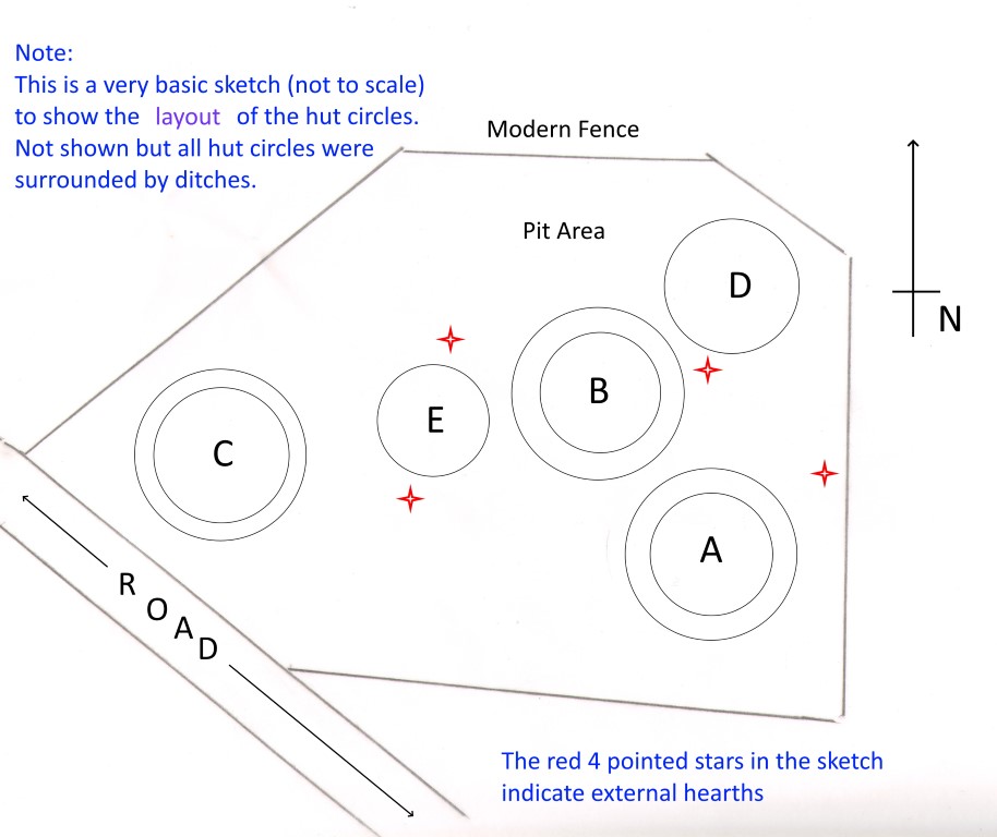
The hut circles were first noticed by local farmer Fred Proud of nearby Sleddale Farm in 1962 and subsequently excavated by local amateur archaeologist Roland Close between 1962 and 1968 who determined that there were at least two phases of building on the site and probably three. Referring to the uploaded sketch map showing the layout of the huts, then huts D & E were built first, followed by hut B whose drainage ditches cut into hut E and then drains across hut D implying that they had fallen into disuse. The final phase was the building of huts A & C. The cooking pit area was from one of the earlier phases and had been covered with earth from later ditch digging.
When originally built the huts were built of stone with stone floors. No post holes were found, however it is probable that posts with bracing were mounted on the stone floor to support the roof. The basic dimensions and features of the huts are as follows:
Hut A – Internal diameter 20 ft. with walls 4 ft. thick, giving an external diameter of 28ft. The floor of the hut had been levelled with a fair amount of paving still existing. It has a central hearth which appears to be unused. It is surrounded by a ditch except for the gap at the doorway which faces north east.
Hut B – Internal diameter 20 ft, external diameter 29 ft. Very little of the stone paving survives, however there was a heavily burnt central hearth. Surrounded by a ditch with a gap to the east indicating that's where the doorway would have been. The ditch cut into the circle of hut E and drained across hut D.
Hut C – Internal diameter 22 ft., with walls 2 ft thick, giving an external diameter of 28ft. Of all the huts this one was in the best condition with a fully levelled paved floor. It had a central earth which showed little use with only one stone being burnt. It was surrounded by a ditch with a gap at the south east for the door also the paving extended from inside to outside the hut at this point.
Hut D – None of the wall foundations have survived but the ditch around it does, thus a likely outside diameter would have been 22 ft. It has a heavily burnt central hearth and some fragments of paving survive.
Hut E – The smallest of the huts, with an external diameter of 18 ft. and a well burnt central hearth with a few paving stones still remaining. The drainage ditch from hut B cuts into it this hut and it looks like a later track ran across it with wheel ruts being visible.
The huts are from the later iron age and would have been occupied by one of those clans whose confederation made up what the Romans called the Brigantes, this blog HERE names them as the Gabrantovices. The main finds at this site when excavated by R. Close were nine saddle querns, the base of a rotary quern, a door pivot, pieces of poorly fired pottery sherds and a pot boiler (a heated stone used for heating water).
The source for most of the above information is from a paper by R.S. Close entitled “Excavation of Iron Age Circles at Percy Rigg, Kildale” published in the 1972 Yorkshire Archaeological Journal volume 44 pages 23 – 31.
As of August 2020 Historic England has no List Entry for these huts, though Pastscape does at Monument 28639. Also all the hut circles can be clearly seen when viewed with satellite imagery such as Google Earth. At the location itself, to the casual observer only Huts A & C really stand out because of whats left of their surviving walls.
You may be viewing yesterday's version of this page. To see the most up to date information please register for a free account.





Do not use the above information on other web sites or publications without permission of the contributor.
Click here to see more info for this site
Nearby sites
Key: Red: member's photo, Blue: 3rd party photo, Yellow: other image, Green: no photo - please go there and take one, Grey: site destroyed
Download sites to:
KML (Google Earth)
GPX (GPS waypoints)
CSV (Garmin/Navman)
CSV (Excel)
To unlock full downloads you need to sign up as a Contributory Member. Otherwise downloads are limited to 50 sites.
Turn off the page maps and other distractions
Nearby sites listing. In the following links * = Image available
439m NW 313° Percy Cross and Bowl Barrow* Ancient Cross (NZ6067411848)
701m NNE 11° Codhill Slack* Ring Cairn (NZ6112812241)
836m ESE 116° Percy Rigg* Standing Stone (Menhir) (NZ61761120)
1.0km WNW 292° Great Ayton Moor Cairns 2* Cairn (NZ6003611926)
1.1km W 260° Great Ayton Moor HC1* Ancient Village or Settlement (NZ5987711340)
1.2km NNE 19° Codhill Heights* Round Barrow(s) (NZ6136812677)
1.3km W 259° Great Ayton Moor HC2* Ancient Village or Settlement (NZ5973611291)
1.5km NW 307° Newton Moor RC1* Round Cairn (NZ5979412448)
1.6km NW 306° Newton Moor RC2* Round Cairn (NZ5971312441)
1.6km W 269° Great Ayton Moor Chambered Cairn* Cairn (NZ5939811514)
1.7km NW 305° Newton Moor RC3* Round Cairn (NZ5962812494)
1.7km NW 306° Newton Moor RC4* Round Cairn (NZ5962612519)
1.7km SW 222° Coate Moor* Round Barrow(s) (NZ59841025)
1.8km W 260° Great Ayton Moor HC3* Ancient Village or Settlement (NZ5927311231)
1.9km NW 308° Newton Moor RC5* Round Cairn (NZ5951412666)
1.9km NW 309° Newton Moor RC6 & RC7* Round Cairn (NZ5948612730)
2.1km ENE 58° Pretty Hut Howe* Round Barrow(s) (NZ6278412680)
2.3km ENE 69° Gisborough Moor RB1* Round Barrow(s) (NZ6318012415)
2.4km NW 306° Pinchinthorpe Moor tumuli* Cairn (NZ5900612945)
2.6km ENE 73° Gisborough Moor RB2* Round Barrow(s) (NZ6345012348)
2.7km NW 317° Hanging Stone (Hutton Lowcross Woods)* Rock Outcrop (NZ5914713460)
2.7km E 98° Whiteley Crag RB1* Round Barrow(s) (NZ6366311232)
2.7km ENE 70° Gisborough Moor RB3* Round Barrow(s) (NZ6354112492)
2.8km E 95° Commondale Moor North SS1* Standing Stone (Menhir) (NZ6384311338)
2.9km E 98° Whiteley Crag RB2* Round Barrow(s) (NZ6384111194)
View more nearby sites and additional images




 We would like to know more about this location. Please feel free to add a brief description and any relevant information in your own language.
 Wir möchten mehr über diese Stätte erfahren. Bitte zögern Sie nicht, eine kurze Beschreibung und relevante Informationen in Deutsch hinzuzufügen.
 Nous aimerions en savoir encore un peu sur les lieux. S'il vous plaît n'hesitez pas à ajouter une courte description et tous les renseignements pertinents dans votre propre langue.
 Quisieramos informarnos un poco más de las lugares. No dude en añadir una breve descripción y otros datos relevantes en su propio idioma.