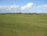
<< Our Photo Pages >> Dyke Hills - Hillfort in England in Oxfordshire
Submitted by vicky on Saturday, 09 August 2003 Page Views: 21044
Iron Age and Later PrehistorySite Name: Dyke HillsCountry: England County: Oxfordshire Type: Hillfort
Nearest Town: Dorchester-on-Thames
Map Ref: SU57389358 Landranger Map Number: 164
Latitude: 51.638107N Longitude: 1.172257W
Condition:
| 5 | Perfect |
| 4 | Almost Perfect |
| 3 | Reasonable but with some damage |
| 2 | Ruined but still recognisable as an ancient site |
| 1 | Pretty much destroyed, possibly visible as crop marks |
| 0 | No data. |
| -1 | Completely destroyed |
| 5 | Superb |
| 4 | Good |
| 3 | Ordinary |
| 2 | Not Good |
| 1 | Awful |
| 0 | No data. |
| 5 | Can be driven to, probably with disabled access |
| 4 | Short walk on a footpath |
| 3 | Requiring a bit more of a walk |
| 2 | A long walk |
| 1 | In the middle of nowhere, a nightmare to find |
| 0 | No data. |
| 5 | co-ordinates taken by GPS or official recorded co-ordinates |
| 4 | co-ordinates scaled from a detailed map |
| 3 | co-ordinates scaled from a bad map |
| 2 | co-ordinates of the nearest village |
| 1 | co-ordinates of the nearest town |
| 0 | no data |
Internal Links:
External Links:
I have visited· I would like to visit
JohnLindsay visited on 7th Apr 2012 - their rating: Cond: 3 Amb: 4 Access: 4 The bus X39 or X40 from Reading Station, or from Oxford, stop called the Dorchester layby, on the main road which lies over the Dorchester Cursus. I think the bus stops and foot bridge at the endpoint of the cursus, and it lies, or lay, under the road. There is a short walk into the village, then the abbey, and Watling Lane, which takes to a view of Wittenham Clumps and suddently the Dyke Hills comes into view. The footpath continues and the site is open and walkable, with a footpath to the Thames, the lock, and the Clumps. So this is really quite a combination. There is a good local museum though most of the stuff has gone to the Ashmolean. The museum has a good local booklet with bibliography which is more than enough for a walk and a read.
SolarMegalith visited on 3rd Mar 2012 - their rating: Cond: 3 Amb: 4 Access: 4
Bird_nerd29 visited - their rating: Cond: 4 Amb: 4 Access: 4 A great site, although you can only access half of it. There's a large WWII pillbox at the bottom of the site, which is accessible. You can get to the open part of the hills via a number of footpaths.
Andy B have visited here
Average ratings for this site from all visit loggers: Condition: 3.33 Ambience: 4 Access: 4

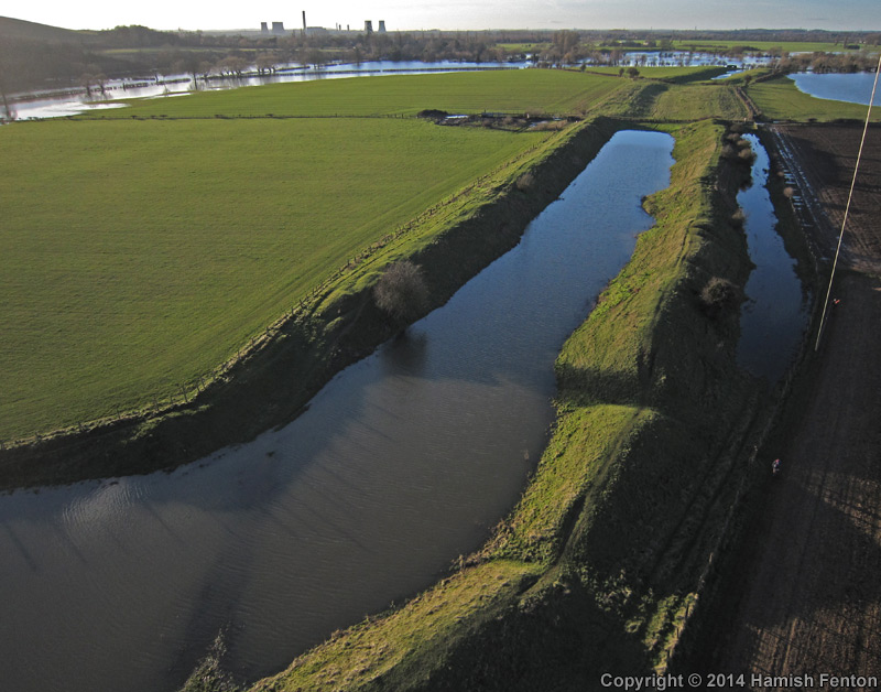
Dyke Hills is recorded as Pastscape Monument No. 238029 which has a page of notes on this settlement, an extract of which reads: "The earthwork remains of an Iron Age settlement of possibly defensive function is well preserved despite extensive damage in the 19th century. It consists of a two banks and ditch connecting the Rivers Thames and Thame and has also been interpreted as an oppidum. Gullies, pits and hutcircles were reportedly visible as cropmarks within the interior of the enclosure although these have not been seen since. It is thought that the site had a long occupation history with multiple phases, although it is not clear to when the phases date. Five barrows, thought to be of Bronze Age date, are also present at the east end of the site."
The Northern Antiquarian (TNA) also feature a page on this site - see their entry for Dyke Hills, Dorchester, Oxfordshire, which includes directions for finding the site together with a brief archaeology & history, a plan of the site and drawings from the 1870s.
You may be viewing yesterday's version of this page. To see the most up to date information please register for a free account.




Do not use the above information on other web sites or publications without permission of the contributor.
Click here to see more info for this site
Nearby sites
Key: Red: member's photo, Blue: 3rd party photo, Yellow: other image, Green: no photo - please go there and take one, Grey: site destroyed
Download sites to:
KML (Google Earth)
GPX (GPS waypoints)
CSV (Garmin/Navman)
CSV (Excel)
To unlock full downloads you need to sign up as a Contributory Member. Otherwise downloads are limited to 50 sites.
Turn off the page maps and other distractions
Nearby sites listing. In the following links * = Image available
1.2km SSW 201° Sinodun Camp* Hillfort (SU5694592434)
1.4km NNE 31° Dorchester Cursus Cursus (SU581948)
1.6km ENE 64° Dorchester; Overy Cursus (SU588943)
1.6km NNE 14° Woodhenge (Dorchester) Henge (SU57759513)
1.7km S 173° Brightwell Barrow* Round Barrow(s) (SU576919)
1.8km N 355° Dorchester Big Rings* Henge (SU57209537)
1.9km N 1° Dorchester Cursus Cursus (SU57389546)
1.9km E 81° Dorchester; Overy Cursus (SU593939)
2.2km NNW 348° Dorchester-on-Thames 4 Timber Circle (SU569957)
2.2km NNW 348° Dorchester-on-Thames 5 Timber Circle (SU569957)
2.3km NNW 348° Dorchester-on-Thames 6 Timber Circle (SU569958)
2.4km NNW 348° Dorchester Cursus* Cursus (SU56859595)
2.5km NNE 32° Dorchester-on-Thames 3 Timber Circle (SU587957)
2.5km ESE 109° Shillingford Cursus Cursus (SU598928)
2.9km ESE 110° Warborough Cursus Cursus (SU60119260)
3.0km ESE 112° Shillingford Cursus Cursus (SU602925)
3.3km NNE 17° Mount Farm (Oxfordshire) Timber Circle (SU583968)
4.4km NE 38° Drayton St. Leonard Cursus Cursus (SU601971)
4.6km NE 38° Drayton St. Leonard Cursus Cursus (SU602972)
5.6km ESE 118° Benson Cursus Cursus (SU624910)
5.7km S 181° Cholsey Hill Camp* Hillfort (SU5735387927)
5.7km NNE 26° Stadhampton Cursus Cursus (SU59799875)
5.8km ESE 108° Benson Cursus Cursus (SU629919)
6.1km NNE 25° Stadhampton Cursus Cursus (SU59909910)
7.3km WSW 249° Great Western Park* Ancient Village or Settlement (SU50629091)
View more nearby sites and additional images




 We would like to know more about this location. Please feel free to add a brief description and any relevant information in your own language.
 Wir möchten mehr über diese Stätte erfahren. Bitte zögern Sie nicht, eine kurze Beschreibung und relevante Informationen in Deutsch hinzuzufügen.
 Nous aimerions en savoir encore un peu sur les lieux. S'il vous plaît n'hesitez pas à ajouter une courte description et tous les renseignements pertinents dans votre propre langue.
 Quisieramos informarnos un poco más de las lugares. No dude en añadir una breve descripción y otros datos relevantes en su propio idioma.