


<< Our Photo Pages >> Dorchester Big Rings - Henge in England in Oxfordshire
Submitted by coldrum on Tuesday, 30 June 2009 Page Views: 13633
Neolithic and Bronze AgeSite Name: Dorchester Big RingsCountry: England County: Oxfordshire Type: Henge
Nearest Town: Abingdon Nearest Village: Dorchester
Map Ref: SU57209537
Latitude: 51.654218N Longitude: 1.174566W
Condition:
| 5 | Perfect |
| 4 | Almost Perfect |
| 3 | Reasonable but with some damage |
| 2 | Ruined but still recognisable as an ancient site |
| 1 | Pretty much destroyed, possibly visible as crop marks |
| 0 | No data. |
| -1 | Completely destroyed |
| 5 | Superb |
| 4 | Good |
| 3 | Ordinary |
| 2 | Not Good |
| 1 | Awful |
| 0 | No data. |
| 5 | Can be driven to, probably with disabled access |
| 4 | Short walk on a footpath |
| 3 | Requiring a bit more of a walk |
| 2 | A long walk |
| 1 | In the middle of nowhere, a nightmare to find |
| 0 | No data. |
| 5 | co-ordinates taken by GPS or official recorded co-ordinates |
| 4 | co-ordinates scaled from a detailed map |
| 3 | co-ordinates scaled from a bad map |
| 2 | co-ordinates of the nearest village |
| 1 | co-ordinates of the nearest town |
| 0 | no data |
Internal Links:
External Links:
")
Most of the area has been destroyed by quarrying.
More information from Pastscape:
http://www.pastscape.org.uk/hob.aspx?hob_id=237825
You may be viewing yesterday's version of this page. To see the most up to date information please register for a free account.
")
")
")
Do not use the above information on other web sites or publications without permission of the contributor.
Nearby Images from Geograph Britain and Ireland:
©2012(licence)
©2012(licence)
©2012(licence)
©2009(licence)
©2015(licence)
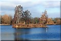
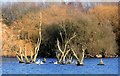
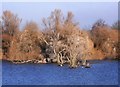
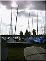
The above images may not be of the site on this page, they are loaded from Geograph.
Please Submit an Image of this site or go out and take one for us!
Click here to see more info for this site
Nearby sites
Key: Red: member's photo, Blue: 3rd party photo, Yellow: other image, Green: no photo - please go there and take one, Grey: site destroyed
Download sites to:
KML (Google Earth)
GPX (GPS waypoints)
CSV (Garmin/Navman)
CSV (Excel)
To unlock full downloads you need to sign up as a Contributory Member. Otherwise downloads are limited to 50 sites.
Turn off the page maps and other distractions
Nearby sites listing. In the following links * = Image available
201m ENE 64° Dorchester Cursus Cursus (SU57389546)
445m NW 318° Dorchester-on-Thames 4 Timber Circle (SU569957)
445m NW 318° Dorchester-on-Thames 5 Timber Circle (SU569957)
524m NW 326° Dorchester-on-Thames 6 Timber Circle (SU569958)
599m ESE 114° Woodhenge (Dorchester) Henge (SU57759513)
677m NNW 330° Dorchester Cursus* Cursus (SU56859595)
1.1km ESE 123° Dorchester Cursus Cursus (SU581948)
1.5km ENE 78° Dorchester-on-Thames 3 Timber Circle (SU587957)
1.8km S 175° Dyke Hills* Hillfort (SU57389358)
1.8km NE 38° Mount Farm (Oxfordshire) Timber Circle (SU583968)
1.9km SE 124° Dorchester; Overy Cursus (SU588943)
2.6km SE 126° Dorchester; Overy Cursus (SU593939)
2.9km S 186° Sinodun Camp* Hillfort (SU5694592434)
3.4km ENE 60° Drayton St. Leonard Cursus Cursus (SU601971)
3.5km S 174° Brightwell Barrow* Round Barrow(s) (SU576919)
3.5km ENE 59° Drayton St. Leonard Cursus Cursus (SU602972)
3.7km SE 135° Shillingford Cursus Cursus (SU598928)
4.0km SE 134° Warborough Cursus Cursus (SU60119260)
4.1km SE 134° Shillingford Cursus Cursus (SU602925)
4.3km NE 38° Stadhampton Cursus Cursus (SU59799875)
4.6km NE 36° Stadhampton Cursus Cursus (SU59909910)
6.1km WNW 299° Barrow Hills Radley I Timber Circle (SU518983)
6.7km ESE 122° Benson Cursus Cursus (SU629919)
6.8km SE 131° Benson Cursus Cursus (SU624910)
7.4km S 179° Cholsey Hill Camp* Hillfort (SU5735387927)
View more nearby sites and additional images


 We would like to know more about this location. Please feel free to add a brief description and any relevant information in your own language.
 Wir möchten mehr über diese Stätte erfahren. Bitte zögern Sie nicht, eine kurze Beschreibung und relevante Informationen in Deutsch hinzuzufügen.
 Nous aimerions en savoir encore un peu sur les lieux. S'il vous plaît n'hesitez pas à ajouter une courte description et tous les renseignements pertinents dans votre propre langue.
 Quisieramos informarnos un poco más de las lugares. No dude en añadir una breve descripción y otros datos relevantes en su propio idioma.