


<< Our Photo Pages >> Ramsbury Corner - Hillfort in England in Berkshire
Submitted by SolarMegalith on Tuesday, 10 July 2012 Page Views: 5085
Iron Age and Later PrehistorySite Name: Ramsbury CornerCountry: England County: Berkshire Type: Hillfort
Nearest Town: Newbury Nearest Village: Cold Ash
Map Ref: SU525696
Latitude: 51.422987N Longitude: 1.246333W
Condition:
| 5 | Perfect |
| 4 | Almost Perfect |
| 3 | Reasonable but with some damage |
| 2 | Ruined but still recognisable as an ancient site |
| 1 | Pretty much destroyed, possibly visible as crop marks |
| 0 | No data. |
| -1 | Completely destroyed |
| 5 | Superb |
| 4 | Good |
| 3 | Ordinary |
| 2 | Not Good |
| 1 | Awful |
| 0 | No data. |
| 5 | Can be driven to, probably with disabled access |
| 4 | Short walk on a footpath |
| 3 | Requiring a bit more of a walk |
| 2 | A long walk |
| 1 | In the middle of nowhere, a nightmare to find |
| 0 | No data. |
| 5 | co-ordinates taken by GPS or official recorded co-ordinates |
| 4 | co-ordinates scaled from a detailed map |
| 3 | co-ordinates scaled from a bad map |
| 2 | co-ordinates of the nearest village |
| 1 | co-ordinates of the nearest town |
| 0 | no data |
Internal Links:
External Links:
")
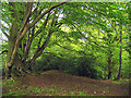
Earthworks of this small Iron Age hillfort are located NE of Cold Ash. The ramparts enclose an area of 8 acres.
You may be viewing yesterday's version of this page. To see the most up to date information please register for a free account.
")
")
Do not use the above information on other web sites or publications without permission of the contributor.
Andy B has found this location on Google Street View:
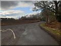
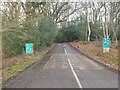
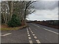
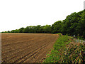
Nearby Images from Geograph Britain and Ireland:
©2023(licence)
©2023(licence)
©2023(licence)
©2005(licence)
©2005(licence)
The above images may not be of the site on this page, they are loaded from Geograph.
Please Submit an Image of this site or go out and take one for us!
Click here to see more info for this site
Nearby sites
Key: Red: member's photo, Blue: 3rd party photo, Yellow: other image, Green: no photo - please go there and take one, Grey: site destroyed
Download sites to:
KML (Google Earth)
GPX (GPS waypoints)
CSV (Garmin/Navman)
CSV (Excel)
To unlock full downloads you need to sign up as a Contributory Member. Otherwise downloads are limited to 50 sites.
Turn off the page maps and other distractions
Nearby sites listing. In the following links * = Image available
1.5km S 188° Dunston Park Ancient Village or Settlement (SU523681)
3.0km NNW 335° Grimsbury Castle* Hillfort (SU512723)
4.4km NE 35° St. Frideswide's Well* Holy Well or Sacred Spring (SU54997326)
5.8km WSW 245° West Berkshire Museum Museum (SU472671)
6.4km NNW 331° Oareborough Hill* Hillfort (SU49407515)
6.4km WNW 298° Bussock Camp* Hillfort (SU468726)
7.3km WSW 257° The Ladywell* Holy Well or Sacred Spring (SU454679)
8.2km ENE 69° St. Andrew's Well* Holy Well or Sacred Spring (SU602726)
8.3km N 357° Perborough Castle* Hillfort (SU520779)
8.5km WSW 237° Wash Common* Barrow Cemetery (SU45446484)
8.7km SE 144° Borson Barrows* Barrow Cemetery (SU57756265)
8.9km WNW 289° Borough Hill (Boxford)* Hillfort (SU4401372417)
9.1km NNE 14° Grim's Ditch (Berkshire) Ancient Village or Settlement (SU546785)
9.3km E 91° Ufton Nervet Cursus Cursus (SU618695)
9.5km E 94° Ufton Nervet Cursus Cursus (SU620691)
9.7km NW 306° Leckhampstead Bowl Barrow Round Barrow(s) (SU44507518)
10.1km E 87° Englefield Cursus (SU626703)
10.2km E 82° Englefield Cursus (SU626712)
10.7km WSW 256° Hampstead Marshall Mottes Artificial Mound (SU42156685)
10.7km WNW 300° Hangman's Stone - Leckhampstead* Marker Stone (SU431748)
10.9km ESE 109° Raven Hill* Promontory Fort / Cliff Castle (SU62876615)
11.4km ESE 106° Ufton Nervet Bell Barrow* Round Barrow(s) (SU6356266625)
11.6km SE 126° Aldermaston Enclosure* Misc. Earthwork (SU6197062917)
12.1km ESE 123° The Frith (Hampshire)* Hillfort (SU62686308)
12.6km E 89° Burghfield Cursus Cursus (SU65137000)
View more nearby sites and additional images


 We would like to know more about this location. Please feel free to add a brief description and any relevant information in your own language.
 Wir möchten mehr über diese Stätte erfahren. Bitte zögern Sie nicht, eine kurze Beschreibung und relevante Informationen in Deutsch hinzuzufügen.
 Nous aimerions en savoir encore un peu sur les lieux. S'il vous plaît n'hesitez pas à ajouter une courte description et tous les renseignements pertinents dans votre propre langue.
 Quisieramos informarnos un poco más de las lugares. No dude en añadir una breve descripción y otros datos relevantes en su propio idioma.