

<< Text Pages >> Drayton North Cursus - Cursus in England in Oxfordshire
Submitted by EssexMan on Wednesday, 07 April 2010 Page Views: 3908
Neolithic and Bronze AgeSite Name: Drayton North CursusCountry: England
NOTE: This site is 1.7 km away from the location you searched for.
County: Oxfordshire Type: Cursus
Nearest Town: Abingdon Nearest Village: Drayton North
Map Ref: SU492950 Landranger Map Number: 164
Latitude: 51.651647N Longitude: 1.290248W
Condition:
| 5 | Perfect |
| 4 | Almost Perfect |
| 3 | Reasonable but with some damage |
| 2 | Ruined but still recognisable as an ancient site |
| 1 | Pretty much destroyed, possibly visible as crop marks |
| 0 | No data. |
| -1 | Completely destroyed |
| 5 | Superb |
| 4 | Good |
| 3 | Ordinary |
| 2 | Not Good |
| 1 | Awful |
| 0 | No data. |
| 5 | Can be driven to, probably with disabled access |
| 4 | Short walk on a footpath |
| 3 | Requiring a bit more of a walk |
| 2 | A long walk |
| 1 | In the middle of nowhere, a nightmare to find |
| 0 | No data. |
| 5 | co-ordinates taken by GPS or official recorded co-ordinates |
| 4 | co-ordinates scaled from a detailed map |
| 3 | co-ordinates scaled from a bad map |
| 2 | co-ordinates of the nearest village |
| 1 | co-ordinates of the nearest town |
| 0 | no data |
Internal Links:
External Links:
Minor Cursus in Oxfordshire
Status: Certain
For more information see Pastscape Monument No. 892010 (NMR No. SU 49 SE 83)
Extent: 650mx75m
Terminal type: Unknown
Date: 3610-3380 cal BC 95% confidence
Note: This location marks one terminal (end) of a cursus monument. The location of the other terminal can be found in the Nearby Site list below.
Update August 2017: This site is also described on The Northern Antiquarian - see their page for Drayton Cursus, Abingdon, Oxfordshire which includes Paul Devereux's Drayton Cursus alignment drawing and a brief archaeology & history.
You may be viewing yesterday's version of this page. To see the most up to date information please register for a free account.
Do not use the above information on other web sites or publications without permission of the contributor.
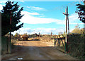
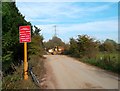
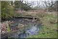
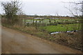
Nearby Images from Geograph Britain and Ireland:
©2011(licence)
©2011(licence)
©2013(licence)
©2013(licence)
©2010(licence)
The above images may not be of the site on this page, they are loaded from Geograph.
Please Submit an Image of this site or go out and take one for us!
Click here to see more info for this site
Nearby sites
Key: Red: member's photo, Blue: 3rd party photo, Yellow: other image, Green: no photo - please go there and take one, Grey: site destroyed
Download sites to:
KML (Google Earth)
GPX (GPS waypoints)
CSV (Garmin/Navman)
CSV (Excel)
To unlock full downloads you need to sign up as a Contributory Member. Otherwise downloads are limited to 50 sites.
Turn off the page maps and other distractions
Nearby sites listing. In the following links * = Image available
922m SSW 193° Drayton North Cursus Cursus (SU490941)
948m SSW 199° Drayton South Cursus Cursus (SU489941)
1.5km N 8° Abingdon Cursus Cursus (SU494965)
1.6km SSW 202° Drayton South Cursus Cursus (SU486935)
4.2km NE 39° Barrow Hills Radley I Timber Circle (SU518983)
4.3km SSE 161° Great Western Park* Ancient Village or Settlement (SU50629091)
5.2km WNW 284° Iron Age and Roman Complex at Frilford Ancient Village or Settlement (SU441962)
7.7km E 83° Dorchester Cursus* Cursus (SU56859595)
7.7km E 85° Dorchester-on-Thames 5 Timber Circle (SU569957)
7.7km E 85° Dorchester-on-Thames 4 Timber Circle (SU569957)
7.7km E 85° Dorchester-on-Thames 6 Timber Circle (SU569958)
8.0km E 88° Dorchester Big Rings* Henge (SU57209537)
8.1km ESE 109° Sinodun Camp* Hillfort (SU5694592434)
8.2km E 87° Dorchester Cursus Cursus (SU57389546)
8.3km E 100° Dyke Hills* Hillfort (SU57389358)
8.5km E 90° Woodhenge (Dorchester) Henge (SU57759513)
8.6km NW 320° Badger's Well* Holy Well or Sacred Spring (SP4360201485)
8.9km E 92° Dorchester Cursus Cursus (SU581948)
8.9km ESE 111° Brightwell Barrow* Round Barrow(s) (SU576919)
9.3km E 79° Mount Farm (Oxfordshire) Timber Circle (SU583968)
9.5km E 86° Dorchester-on-Thames 3 Timber Circle (SU587957)
9.6km E 95° Dorchester; Overy Cursus (SU588943)
10.1km E 97° Dorchester; Overy Cursus (SU593939)
10.4km SSE 149° Blewburton Hill* Hillfort (SU547862)
10.6km SSW 200° Skutchamer Knob Round Barrow(s) (SU4565585038)
View more nearby sites and additional images


 We would like to know more about this location. Please feel free to add a brief description and any relevant information in your own language.
 Wir möchten mehr über diese Stätte erfahren. Bitte zögern Sie nicht, eine kurze Beschreibung und relevante Informationen in Deutsch hinzuzufügen.
 Nous aimerions en savoir encore un peu sur les lieux. S'il vous plaît n'hesitez pas à ajouter une courte description et tous les renseignements pertinents dans votre propre langue.
 Quisieramos informarnos un poco más de las lugares. No dude en añadir una breve descripción y otros datos relevantes en su propio idioma.