


<< Text Pages >> Eynsham Timber Circle - Timber Circle in England in Oxfordshire
Submitted by vicky on Sunday, 22 December 2002 Page Views: 6328
Neolithic and Bronze AgeSite Name: Eynsham Timber CircleCountry: England
NOTE: This site is 0.9 km away from the location you searched for.
County: Oxfordshire Type: Timber Circle
Map Ref: SP425086 Landranger Map Number: 164
Latitude: 51.774464N Longitude: 1.385431W
Condition:
| 5 | Perfect |
| 4 | Almost Perfect |
| 3 | Reasonable but with some damage |
| 2 | Ruined but still recognisable as an ancient site |
| 1 | Pretty much destroyed, possibly visible as crop marks |
| 0 | No data. |
| -1 | Completely destroyed |
| 5 | Superb |
| 4 | Good |
| 3 | Ordinary |
| 2 | Not Good |
| 1 | Awful |
| 0 | No data. |
| 5 | Can be driven to, probably with disabled access |
| 4 | Short walk on a footpath |
| 3 | Requiring a bit more of a walk |
| 2 | A long walk |
| 1 | In the middle of nowhere, a nightmare to find |
| 0 | No data. |
| 5 | co-ordinates taken by GPS or official recorded co-ordinates |
| 4 | co-ordinates scaled from a detailed map |
| 3 | co-ordinates scaled from a bad map |
| 2 | co-ordinates of the nearest village |
| 1 | co-ordinates of the nearest town |
| 0 | no data |
Internal Links:
External Links:
Timber Circle in Oxfordshire
Have you visited this site? Please add a comment below.
You may be viewing yesterday's version of this page. To see the most up to date information please register for a free account.
Do not use the above information on other web sites or publications without permission of the contributor.
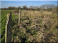
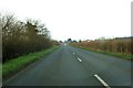
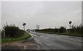
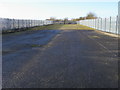
Nearby Images from Geograph Britain and Ireland:
©2006(licence)
©2014(licence)
©2019(licence)
©2009(licence)
©2014(licence)
The above images may not be of the site on this page, they are loaded from Geograph.
Please Submit an Image of this site or go out and take one for us!
Click here to see more info for this site
Nearby sites
Key: Red: member's photo, Blue: 3rd party photo, Yellow: other image, Green: no photo - please go there and take one, Grey: site destroyed
Download sites to:
KML (Google Earth)
GPX (GPS waypoints)
CSV (Garmin/Navman)
CSV (Excel)
To unlock full downloads you need to sign up as a Contributory Member. Otherwise downloads are limited to 50 sites.
Turn off the page maps and other distractions
Nearby sites listing. In the following links * = Image available
541m S 169° Deadman's Burial 2 Henge (SP42610807)
667m SSW 193° Deadman's Burial 1 Misc. Earthwork (SP42350795)
3.1km SSW 197° Stanton Harcourt Church Cross* Ancient Cross (SP4164305666)
3.8km SSW 214° Gravelly Guy Timber Circle (SP404054)
4.1km SSW 200° Devils Quoits* Stone Circle (SP41120476)
4.2km NW 312° Eynsham Park Camp Hillfort (SP393114)
4.5km SSE 159° Physic Well (Cumnor)* Holy Well or Sacred Spring (SP4412604375)
5.6km NE 53° Yarnton* Ancient Village or Settlement (SP4712)
5.7km SW 228° Standlake 20 Timber Circle (SP383047)
6.1km E 96° St Margaret's Well (Binsey)* Holy Well or Sacred Spring (SP486080)
7.2km S 172° Badger's Well* Holy Well or Sacred Spring (SP4360201485)
7.4km NNW 338° North Leigh Roman Villa* Ancient Village or Settlement (SP39661547)
7.5km SSW 197° Northmoor Linear Ditches* Barrow Cemetery (SP40390142)
7.9km N 9° Fair Rosamund's Well* Holy Well or Sacred Spring (SP43651646)
8.0km NW 321° The Lady's Well (Oxfordshire)* Holy Well or Sacred Spring (SP374148)
8.1km E 100° Walton Well* Holy Well or Sacred Spring (SP5047907312)
8.6km E 100° Radcliffe Infirmary prehistoric monumental landscape Round Barrow(s) (SP5103607101)
8.8km ESE 104° Ashmolean Museum of Art and Archaeology* Museum (SP511065)
8.8km E 101° Kendrew Quadrangle* Henge (SP51200695)
9.1km ESE 106° Museum of Oxford* Museum (SP513061)
9.1km E 101° Pitt Rivers Museum* Museum (SP51510695)
9.2km WNW 288° Churchill Plain Chambered Tomb (SP33711129)
9.7km N 2° Blenheim Great Park Ancient Village or Settlement (SP427183)
11.1km N 359° Glympton Farm Ancient Village or Settlement (SP423197)
11.4km ESE 106° St Bartholomew's Well Holy Well or Sacred Spring (SP5349805476)
View more nearby sites and additional images


 We would like to know more about this location. Please feel free to add a brief description and any relevant information in your own language.
 Wir möchten mehr über diese Stätte erfahren. Bitte zögern Sie nicht, eine kurze Beschreibung und relevante Informationen in Deutsch hinzuzufügen.
 Nous aimerions en savoir encore un peu sur les lieux. S'il vous plaît n'hesitez pas à ajouter une courte description et tous les renseignements pertinents dans votre propre langue.
 Quisieramos informarnos un poco más de las lugares. No dude en añadir una breve descripción y otros datos relevantes en su propio idioma.