 with our Megalithic Portal iPhone app")

<< Text Pages >> Cana Henge - Henge in England in Yorkshire (North)
Submitted by vicky on Sunday, 21 July 2002 Page Views: 12298
Neolithic and Bronze AgeSite Name: Cana Henge Alternative Name: Cana BarnCountry: England County: Yorkshire (North) Type: Henge
Map Ref: SE36087185 Landranger Map Number: 99
Latitude: 54.141225N Longitude: 1.449215W
Condition:
| 5 | Perfect |
| 4 | Almost Perfect |
| 3 | Reasonable but with some damage |
| 2 | Ruined but still recognisable as an ancient site |
| 1 | Pretty much destroyed, possibly visible as crop marks |
| 0 | No data. |
| -1 | Completely destroyed |
| 5 | Superb |
| 4 | Good |
| 3 | Ordinary |
| 2 | Not Good |
| 1 | Awful |
| 0 | No data. |
| 5 | Can be driven to, probably with disabled access |
| 4 | Short walk on a footpath |
| 3 | Requiring a bit more of a walk |
| 2 | A long walk |
| 1 | In the middle of nowhere, a nightmare to find |
| 0 | No data. |
| 5 | co-ordinates taken by GPS or official recorded co-ordinates |
| 4 | co-ordinates scaled from a detailed map |
| 3 | co-ordinates scaled from a bad map |
| 2 | co-ordinates of the nearest village |
| 1 | co-ordinates of the nearest town |
| 0 | no data |
Internal Links:
External Links:
Henge in North Yorshire
Pastscape monument no. 53684
You may be viewing yesterday's version of this page. To see the most up to date information please register for a free account.
Do not use the above information on other web sites or publications without permission of the contributor.
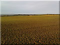
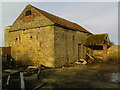
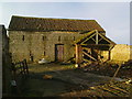
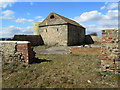
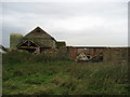
Nearby Images from Geograph Britain and Ireland:
©2009(licence)
©2009(licence)
©2009(licence)
©2013(licence)
©2006(licence)
The above images may not be of the site on this page, they are loaded from Geograph.
Please Submit an Image of this site or go out and take one for us!
Click here to see more info for this site
Nearby sites
Key: Red: member's photo, Blue: 3rd party photo, Yellow: other image, Green: no photo - please go there and take one, Grey: site destroyed
Download sites to:
KML (Google Earth)
GPX (GPS waypoints)
CSV (Garmin/Navman)
CSV (Excel)
To unlock full downloads you need to sign up as a Contributory Member. Otherwise downloads are limited to 50 sites.
Turn off the page maps and other distractions
Nearby sites listing. In the following links * = Image available
800m NNW 340° Copt Hewick Cursus Cursus (SE358726)
1.9km NNW 334° Hutton Moor Henge (SE35267353)
2.0km WSW 256° St Swithin's Well (Copt Hewick)* Holy Well or Sacred Spring (SE3413271336)
4.6km SE 136° All Saints (Kirby Hill)* Ancient Cross (SE39326859)
4.7km W 261° Ripon Cathedral* Ancient Cross (SE31457112)
4.8km NW 309° Nunwick Henge Henge (SE3229274837)
5.0km SSE 151° Langthorpe Earthwork Misc. Earthwork (SE38526751)
5.3km W 261° St Wilfrid's Holy Well* Holy Well or Sacred Spring (SE30857102)
5.7km ENE 57° Maiden's Bower (Asenby)* Turf Maze (SE409750)
6.0km SSE 151° Devil's Arrows* Stone Row / Alignment (SE39076659)
6.4km NNW 327° St Mary (Wath)* Ancient Cross (SE32517715)
7.9km WNW 298° Castle Dikes Hillfort (SE291755)
8.2km S 190° St Mungo's Well (Copgrove)* Holy Well or Sacred Spring (SE34706378)
8.8km S 190° Devil's Stone (Copgrove)* Sculptured Stone (SE346632)
8.9km NNW 346° Quernhow (Ainderby Quernhow) Cairn (SE33818045)
9.1km WSW 247° Robin Hood's Well ( Yorkshire)* Holy Well or Sacred Spring (SE2767868295)
9.2km S 179° All Saints (Staveley) Ancient Cross (SE36266266)
9.3km N 349° Sinderby Henge (SE34288100)
10.0km NW 315° Thornborough S* Henge (SE28947884)
10.5km NW 318° Thornborough Cursus Cursus (SE289796)
10.5km NNW 336° Lady Well (Kirklington)* Holy Well or Sacred Spring (SE31628142)
10.7km SE 143° Duel Cross Hill (Grafton) Cairn (SE426634)
10.7km NW 313° Thornborough Cursus Cursus (SE282791)
10.7km NW 316° Thornborough Central* Henge (SE28517945)
11.4km WNW 298° Ings Well (Mickley)* Holy Well or Sacred Spring (SE2593377125)
View more nearby sites and additional images


 We would like to know more about this location. Please feel free to add a brief description and any relevant information in your own language.
 Wir möchten mehr über diese Stätte erfahren. Bitte zögern Sie nicht, eine kurze Beschreibung und relevante Informationen in Deutsch hinzuzufügen.
 Nous aimerions en savoir encore un peu sur les lieux. S'il vous plaît n'hesitez pas à ajouter une courte description et tous les renseignements pertinents dans votre propre langue.
 Quisieramos informarnos un poco más de las lugares. No dude en añadir una breve descripción y otros datos relevantes en su propio idioma.