


<< Our Photo Pages >> Pudding Barrow - Round Barrow(s) in England in Hampshire
Submitted by JimChampion on Sunday, 09 January 2005 Page Views: 10962
Neolithic and Bronze AgeSite Name: Pudding BarrowCountry: England
NOTE: This site is 2.1 km away from the location you searched for.
County: Hampshire Type: Round Barrow(s)
Nearest Village: Brockenhurst
Map Ref: SU336018
Latitude: 50.814779N Longitude: 1.524437W
Condition:
| 5 | Perfect |
| 4 | Almost Perfect |
| 3 | Reasonable but with some damage |
| 2 | Ruined but still recognisable as an ancient site |
| 1 | Pretty much destroyed, possibly visible as crop marks |
| 0 | No data. |
| -1 | Completely destroyed |
| 5 | Superb |
| 4 | Good |
| 3 | Ordinary |
| 2 | Not Good |
| 1 | Awful |
| 0 | No data. |
| 5 | Can be driven to, probably with disabled access |
| 4 | Short walk on a footpath |
| 3 | Requiring a bit more of a walk |
| 2 | A long walk |
| 1 | In the middle of nowhere, a nightmare to find |
| 0 | No data. |
| 5 | co-ordinates taken by GPS or official recorded co-ordinates |
| 4 | co-ordinates scaled from a detailed map |
| 3 | co-ordinates scaled from a bad map |
| 2 | co-ordinates of the nearest village |
| 1 | co-ordinates of the nearest town |
| 0 | no data |
Internal Links:
External Links:
I have visited· I would like to visit
SolarMegalith would like to visit
JimChampion has visited here
")
There is no stile or gate to this fence, so presumably the barrow should be admired from a distance. Sadly the information board at the site has been stripped of its information (Jan 2005) so I have drawn from other sources.
There are many similar barrows in this part of the New Forest, but this one is unique in that it has a given name (an obvious reference to its "pudding" shape?). Hampshire treasures states that the barrow is "disturbed on east side", but at least it escaped the fate of many other local tumuli that were lost when the Beaulieu Heath area was used as an airfield during the Second World War.
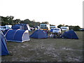
Access The barrow is on Forrestry Commission land, in the corner of a campsite (only open for camping during the summer). However, access by foot/bike is possible all year round. Nearest car park is off the B3055 at Stockley (SU345017); then take the concrete track west along the southern edge of Stockley Inclosure.
You may be viewing yesterday's version of this page. To see the most up to date information please register for a free account.")
")
Do not use the above information on other web sites or publications without permission of the contributor.
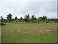
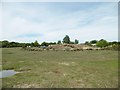
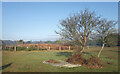
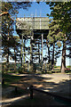
Nearby Images from Geograph Britain and Ireland:
©2011(licence)
©2015(licence)
©2022(licence)
©2022(licence)
©2007(licence)
The above images may not be of the site on this page, they are loaded from Geograph.
Please Submit an Image of this site or go out and take one for us!
Click here to see more info for this site
Nearby sites
Key: Red: member's photo, Blue: 3rd party photo, Yellow: other image, Green: no photo - please go there and take one, Grey: site destroyed
Download sites to:
KML (Google Earth)
GPX (GPS waypoints)
CSV (Garmin/Navman)
CSV (Excel)
To unlock full downloads you need to sign up as a Contributory Member. Otherwise downloads are limited to 50 sites.
Turn off the page maps and other distractions
Nearby sites listing. In the following links * = Image available
1.8km SSE 168° Beaulieu Heath (West)* Round Barrow(s) (SU3400)
2.5km SSE 168° Laurences Barrow* Round Barrow(s) (SZ34139937)
4.3km WSW 246° Setley Plain disc barrows* Round Barrow(s) (SU29620002)
4.8km NE 55° Culverley Farm Bowl Barrow Round Barrow(s) (SU37530461)
5.3km SW 231° Shirley Holms* Round Barrow(s) (SZ295985)
5.3km NNE 26° Yew Tree Heath* Round Barrow(s) (SU3589506556)
5.4km SSW 203° Buckland Rings* Ancient Village or Settlement (SZ315968)
5.8km WNW 289° Ober Heath* Round Barrow(s) (SU281037)
6.1km WSW 251° Longslade View tumulus* Round Barrow(s) (SZ278998)
6.4km N 0° Matley Heath* Round Barrow(s) (SU336082)
6.5km NE 49° Dibden Bottom* Barrow Cemetery (SU385061)
6.7km N 0° Ashurst Lodge Earthworks* Misc. Earthwork (SU336085)
7.0km NNE 23° Longdown (New Forest) tumuli* Round Barrow(s) (SU363083)
7.3km NNW 331° New Forest Museum* Museum (SU30020813)
7.4km NE 47° The Dibden-Lynch Bottom Ring Henge
7.5km E 81° Beaulieu Heath (East)* Round Barrow(s) (SU4103)
7.5km NE 43° Ipley Cross* Round Barrow(s) (SU38670735)
7.6km NE 52° Darcy Island* Round Barrow(s) (SU39520654)
8.2km W 280° Ferny Knap tumuli* Round Barrow(s) (SU255032)
8.8km ESE 111° Exbury Promontory Fort / Cliff Castle (SZ419987)
10.1km W 275° Clay Hill tumuli* Round Barrow(s) (SU235027)
11.8km NNW 331° Malwood Castle Hillfort (SU278121)
12.2km SSE 166° Bouldnor Underwater Settlement and Wooden Structure* Ancient Trackway (SZ367900)
12.3km E 91° Poppy Pond* Round Barrow(s) (SU45920174)
12.5km WNW 283° Collins Grave Round Barrow(s) (SU21350461)
View more nearby sites and additional images


 We would like to know more about this location. Please feel free to add a brief description and any relevant information in your own language.
 Wir möchten mehr über diese Stätte erfahren. Bitte zögern Sie nicht, eine kurze Beschreibung und relevante Informationen in Deutsch hinzuzufügen.
 Nous aimerions en savoir encore un peu sur les lieux. S'il vous plaît n'hesitez pas à ajouter une courte description et tous les renseignements pertinents dans votre propre langue.
 Quisieramos informarnos un poco más de las lugares. No dude en añadir una breve descripción y otros datos relevantes en su propio idioma.