


<< Our Photo Pages >> Sincombe Farm Bowl Barrow - Round Barrow(s) in England in Oxfordshire
Submitted by twentytrees on Wednesday, 12 April 2006 Page Views: 6035
Neolithic and Bronze AgeSite Name: Sincombe Farm Bowl BarrowCountry: England
NOTE: This site is 1.2 km away from the location you searched for.
County: Oxfordshire Type: Round Barrow(s)
Nearest Town: Swindon Nearest Village: Lambourn
Map Ref: SU34368521
Latitude: 51.564725N Longitude: 1.505695W
Condition:
| 5 | Perfect |
| 4 | Almost Perfect |
| 3 | Reasonable but with some damage |
| 2 | Ruined but still recognisable as an ancient site |
| 1 | Pretty much destroyed, possibly visible as crop marks |
| 0 | No data. |
| -1 | Completely destroyed |
| 5 | Superb |
| 4 | Good |
| 3 | Ordinary |
| 2 | Not Good |
| 1 | Awful |
| 0 | No data. |
| 5 | Can be driven to, probably with disabled access |
| 4 | Short walk on a footpath |
| 3 | Requiring a bit more of a walk |
| 2 | A long walk |
| 1 | In the middle of nowhere, a nightmare to find |
| 0 | No data. |
| 5 | co-ordinates taken by GPS or official recorded co-ordinates |
| 4 | co-ordinates scaled from a detailed map |
| 3 | co-ordinates scaled from a bad map |
| 2 | co-ordinates of the nearest village |
| 1 | co-ordinates of the nearest town |
| 0 | no data |
Internal Links:
External Links:
")
Bronze Age bowl barrow on the edge of the chalk escarpment near the Ridgeway path. The barrow remains visible being 1m high and 23m in diameter. Visible from the road about 50m away. Previously surrounded by a ditch. See this PDF.
You may be viewing yesterday's version of this page. To see the most up to date information please register for a free account.
")
Do not use the above information on other web sites or publications without permission of the contributor.
coldrum has found this location on Google Street View:
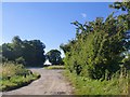
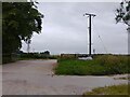
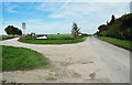
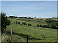
Nearby Images from Geograph Britain and Ireland:

©2023(licence)
©2016(licence)
©2023(licence)
©2016(licence)
©2005(licence)
The above images may not be of the site on this page, they are loaded from Geograph.
Please Submit an Image of this site or go out and take one for us!
Click here to see more info for this site
Nearby sites
Key: Red: member's photo, Blue: 3rd party photo, Yellow: other image, Green: no photo - please go there and take one, Grey: site destroyed
Download sites to:
KML (Google Earth)
GPX (GPS waypoints)
CSV (Garmin/Navman)
CSV (Excel)
To unlock full downloads you need to sign up as a Contributory Member. Otherwise downloads are limited to 50 sites.
Turn off the page maps and other distractions
Nearby sites listing. In the following links * = Image available
2.7km NW 314° The Blowing Stone* Holed Stone (SU324871)
2.7km SW 228° Lambourn Long Barrow* Long Barrow (SU32328338)
2.8km SSW 213° Lambourn Seven Barrows* Barrow Cemetery (SU32898288)
3.1km WNW 291° Rams Hill* Causewayed Enclosure (SU314863)
3.5km NW 324° Fawler Modern Stone Circle* Modern Stone Circle etc (SU323880)
4.2km W 265° Idlebush Barrow* Ancient Village or Settlement (SU302848)
4.2km E 100° Segsbury Camp* Hillfort (SU385845)
4.5km WNW 289° Uffington White Horse* Hill Figure or Geoglyph (SU30128662)
4.5km WNW 287° Uffington Castle Neolithic long barrow* Long Barrow (SU30008652)
4.6km WNW 292° Dragon Hill* Natural Stone / Erratic / Other Natural Feature (SU30078687)
4.6km WNW 285° Uffington Castle* Hillfort (SU299864)
4.6km SSW 211° Hangman's Stone - Upper Lambourn* Standing Stone (Menhir) (SU320812)
4.9km WSW 243° Knighton Bushes* Ancient Village or Settlement (SU300830)
5.7km SSW 214° St Luke's Church Barrow Round Barrow(s) (SU31228042)
5.8km WNW 285° Hardwell Camp* Hillfort (SU2876686671)
6.0km SW 232° Park Farm Barrow Round Barrow(s) (SU29638143)
6.1km ENE 65° King Alfred's Well* Holy Well or Sacred Spring (SU399878)
6.1km W 273° Odstone Barrow Round Barrow(s) (SU28248545)
6.3km W 272° Wayland's Smithy* Long Barrow (SU28098539)
6.5km SSW 196° Lambourn Market Cross* Ancient Cross (SU326789)
6.7km E 100° Pewit Farm Round Barrow(s) (SU40968412)
6.9km WSW 258° Hailey Wood Barrows Round Barrow(s) (SU27638378)
7.0km SW 230° Fognam Clump Barrow* Round Barrow(s) (SU29008072)
7.1km W 265° Ashbury Folly Barrows Round Barrow(s) (SU27238454)
7.3km WSW 246° Alfred's Castle* Hillfort (SU27738223)
View more nearby sites and additional images


 We would like to know more about this location. Please feel free to add a brief description and any relevant information in your own language.
 Wir möchten mehr über diese Stätte erfahren. Bitte zögern Sie nicht, eine kurze Beschreibung und relevante Informationen in Deutsch hinzuzufügen.
 Nous aimerions en savoir encore un peu sur les lieux. S'il vous plaît n'hesitez pas à ajouter une courte description et tous les renseignements pertinents dans votre propre langue.
 Quisieramos informarnos un poco más de las lugares. No dude en añadir una breve descripción y otros datos relevantes en su propio idioma.