


<< Our Photo Pages >> Farley Moor Stone - Standing Stone (Menhir) in England in Derbyshire
Submitted by stu on Friday, 18 October 2013 Page Views: 5205
Neolithic and Bronze AgeSite Name: Farley Moor StoneCountry: England County: Derbyshire Type: Standing Stone (Menhir)
Map Ref: SK29966300
Latitude: 53.163285N Longitude: 1.553346W
Condition:
| 5 | Perfect |
| 4 | Almost Perfect |
| 3 | Reasonable but with some damage |
| 2 | Ruined but still recognisable as an ancient site |
| 1 | Pretty much destroyed, possibly visible as crop marks |
| 0 | No data. |
| -1 | Completely destroyed |
| 5 | Superb |
| 4 | Good |
| 3 | Ordinary |
| 2 | Not Good |
| 1 | Awful |
| 0 | No data. |
| 5 | Can be driven to, probably with disabled access |
| 4 | Short walk on a footpath |
| 3 | Requiring a bit more of a walk |
| 2 | A long walk |
| 1 | In the middle of nowhere, a nightmare to find |
| 0 | No data. |
| 5 | co-ordinates taken by GPS or official recorded co-ordinates |
| 4 | co-ordinates scaled from a detailed map |
| 3 | co-ordinates scaled from a bad map |
| 2 | co-ordinates of the nearest village |
| 1 | co-ordinates of the nearest town |
| 0 | no data |
Be the first person to rate this site - see the 'Contribute!' box in the right hand menu.
Internal Links:
External Links:
I have visited· I would like to visit
Neil1911 visited on 1st Jan 2012 - their rating: Cond: 5 Amb: 4 Access: 4 Surrounded by Forrestry Commission pines but evidently receives some attention as either an educational or meeting site.
")
Standing stone on Farley Moor, now in forestry.
Marked on 1st edition of the O.S 1:2500 as stone.
John Barnatt and Frank Robinson visited the stone in 2003
and thought it to be prehistoric due to its location and weathering,
although only excavation would prove this.
If it is prehistoric it would be the 3rd largest standing stone
on the eastern gritstone moors.
You may be viewing yesterday's version of this page. To see the most up to date information please register for a free account.
")
")
")
Do not use the above information on other web sites or publications without permission of the contributor.
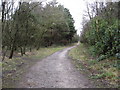
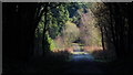
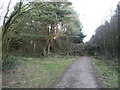
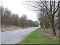
Nearby Images from Geograph Britain and Ireland:
©2008(licence)
©2019(licence)

©2007(licence)
©2007(licence)
©2006(licence)
The above images may not be of the site on this page, they are loaded from Geograph.
Please Submit an Image of this site or go out and take one for us!
Click here to see more info for this site
Nearby sites
Key: Red: member's photo, Blue: 3rd party photo, Yellow: other image, Green: no photo - please go there and take one, Grey: site destroyed
Download sites to:
KML (Google Earth)
GPX (GPS waypoints)
CSV (Garmin/Navman)
CSV (Excel)
To unlock full downloads you need to sign up as a Contributory Member. Otherwise downloads are limited to 50 sites.
Turn off the page maps and other distractions
Nearby sites listing. In the following links * = Image available
1.3km NE 47° Seven Brideron Stone Circle (SK309639)
1.6km ESE 119° Cuckoo Stone (Derbyshire)* Natural Stone / Erratic / Other Natural Feature (SK314622)
3.1km NNW 332° Woodbrook Quarry Stone Circle (SK28496573)
3.3km W 270° St Helen’s Church (Darley Dale)* Carving (SK26676298)
3.8km NW 323° Fallinge Edge* Ring Cairn (SK277660)
4.3km NNW 333° Beeley Triple Cairn* Ring Cairn (SK2800366824)
4.7km W 274° Cat Stone* Rock Outcrop (SK253633)
4.8km W 274° Stanton Moor Cairn T57* Cairn (SK25136331)
4.8km E 87° Ashover School* Rock Art (SK348633)
4.8km W 269° Gorse Stone* Rock Outcrop (SK251629)
4.9km NNW 343° Beeley Moor South* Ring Cairn (SK285677)
4.9km NNW 343° Beeley Moor North Ring Cairn (SK285677)
5.1km W 276° Nine Ladies* Stone Circle (SK24916349)
5.1km W 278° Stanton Moor 1* Stone Circle (SK249637)
5.1km W 276° The King (Stanton Moor)* Standing Stone (Menhir) (SK24876347)
5.1km W 272° Stanton Moor Cairn T55* Round Cairn (SK24826313)
5.1km S 188° Peat Well* Holy Well or Sacred Spring (SK293579)
5.2km W 273° Stanton Moor 3* Stone Circle (SK24806326)
5.2km W 274° Stanton Moor Cairn T24* Cairn (SK24806333)
5.2km W 269° Stanton Moor 4* Ring Cairn (SK24716290)
5.3km W 268° Stanton Moor Cairn (TBC)* Cairn (SK2467562791)
5.3km W 270° Stanton Moor Cairn T25* Cairn (SK24656297)
5.3km W 279° Stanton Moor Cairn T2* Round Cairn (SK247638)
5.6km NNE 14° Longside Moor* Cairn (SK313684)
5.6km W 268° Cork Stone* Natural Stone / Erratic / Other Natural Feature (SK2434662788)
View more nearby sites and additional images


 We would like to know more about this location. Please feel free to add a brief description and any relevant information in your own language.
 Wir möchten mehr über diese Stätte erfahren. Bitte zögern Sie nicht, eine kurze Beschreibung und relevante Informationen in Deutsch hinzuzufügen.
 Nous aimerions en savoir encore un peu sur les lieux. S'il vous plaît n'hesitez pas à ajouter une courte description et tous les renseignements pertinents dans votre propre langue.
 Quisieramos informarnos un poco más de las lugares. No dude en añadir una breve descripción y otros datos relevantes en su propio idioma.