


<< Our Photo Pages >> Lyneham Camp - Hillfort in England in Oxfordshire
Submitted by ral on Tuesday, 03 December 2002 Page Views: 10547
Iron Age and Later PrehistorySite Name: Lyneham CampCountry: England County: Oxfordshire Type: Hillfort
Map Ref: SP299214 Landranger Map Number: 164
Latitude: 51.890358N Longitude: 1.56694W
Condition:
| 5 | Perfect |
| 4 | Almost Perfect |
| 3 | Reasonable but with some damage |
| 2 | Ruined but still recognisable as an ancient site |
| 1 | Pretty much destroyed, possibly visible as crop marks |
| 0 | No data. |
| -1 | Completely destroyed |
| 5 | Superb |
| 4 | Good |
| 3 | Ordinary |
| 2 | Not Good |
| 1 | Awful |
| 0 | No data. |
| 5 | Can be driven to, probably with disabled access |
| 4 | Short walk on a footpath |
| 3 | Requiring a bit more of a walk |
| 2 | A long walk |
| 1 | In the middle of nowhere, a nightmare to find |
| 0 | No data. |
| 5 | co-ordinates taken by GPS or official recorded co-ordinates |
| 4 | co-ordinates scaled from a detailed map |
| 3 | co-ordinates scaled from a bad map |
| 2 | co-ordinates of the nearest village |
| 1 | co-ordinates of the nearest town |
| 0 | no data |
Internal Links:
External Links:
I have visited· I would like to visit
h_fenton has visited here
")
Have you visited this site? Please add a comment below.
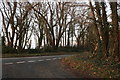
Note: The hillfort is visible from the A361.
You may be viewing yesterday's version of this page. To see the most up to date information please register for a free account.
")
Do not use the above information on other web sites or publications without permission of the contributor.
Nearby Images from Geograph Britain and Ireland:
©2011(licence)
![SP2921 : Country junction [2] by Michael Dibb](https://s3.geograph.org.uk/geophotos/02/73/72/2737291_df11e5a2_120x120.jpg)
©2011(licence)
©2011(licence)
![SP2921 : Country junction [1] by Michael Dibb](https://s2.geograph.org.uk/geophotos/02/73/72/2737286_79698b91_120x120.jpg)
©2011(licence)
©2020(licence)
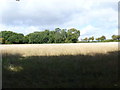
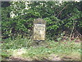
The above images may not be of the site on this page, they are loaded from Geograph.
Please Submit an Image of this site or go out and take one for us!
Click here to see more info for this site
Nearby sites
Key: Red: member's photo, Blue: 3rd party photo, Yellow: other image, Green: no photo - please go there and take one, Grey: site destroyed
Download sites to:
KML (Google Earth)
GPX (GPS waypoints)
CSV (Garmin/Navman)
CSV (Excel)
To unlock full downloads you need to sign up as a Contributory Member. Otherwise downloads are limited to 50 sites.
Turn off the page maps and other distractions
Nearby sites listing. In the following links * = Image available
362m SSW 205° Lyneham Long Barrow* Long Barrow (SP29752107)
1.8km NNW 331° Old Vicarage* Standing Stone (Menhir) (SP290230)
2.3km NE 47° Knollbury Enclosure* Ancient Village or Settlement (SP316230)
3.1km NNW 331° Churchill* Stone Circle (SP284241)
3.2km SSE 153° Smallstones Farm Long Barrow (SP31411852)
3.8km S 180° Ascott under Wychwood* Chambered Tomb (SP299176)
4.0km S 183° Coldwell Bridge Long Barrow 2* Long Barrow (SP29751745)
4.3km N 353° Churchill Standing Stone* Standing Stone (Menhir) (SP29372568)
4.3km SSE 154° High Lodge Tumuli Round Barrow(s) (SP318175)
4.5km ENE 62° Hawk Stone* Standing Stone (Menhir) (SP33922354)
5.6km SE 145° Churchill Copse* Long Barrow (SP33161685)
5.7km NNE 11° Serpent's Well (Chipping Norton) Holy Well or Sacred Spring (SP310270)
5.7km SSE 149° Slatepits Copse* Chambered Tomb (SP329165)
5.7km NNE 13° New Street Stone* Holed Stone (SP312270)
6.0km ESE 116° Cornbury Park Round Barrow(s) (SP35311878)
6.1km E 84° Thor Stone* Standing Stone (Menhir) (SP35932208)
6.1km E 86° Thorsbrook Spring* Holy Well or Sacred Spring (SP360219)
6.6km SSW 207° Shipton Barrow* Barrow Cemetery (SP269155)
6.6km ESE 112° Sturt Henge* Modern Stone Circle etc (SP36111899)
6.8km N 350° Salford Cross Cup Marks (Salford) Ancient Cross (SP2864428058)
7.3km WSW 255° Idbury Camp* Hillfort (SP22871954)
7.5km NNE 22° Druids Barrow Round Barrow(s) (SP32612835)
7.5km S 185° Ladihame* Long Barrow (SP293139)
7.8km NNW 335° Burnt Hill barrow* Long Barrow (SP26602850)
7.9km NNW 330° Chastleton Camp* Hillfort (SP259282)
View more nearby sites and additional images


 We would like to know more about this location. Please feel free to add a brief description and any relevant information in your own language.
 Wir möchten mehr über diese Stätte erfahren. Bitte zögern Sie nicht, eine kurze Beschreibung und relevante Informationen in Deutsch hinzuzufügen.
 Nous aimerions en savoir encore un peu sur les lieux. S'il vous plaît n'hesitez pas à ajouter une courte description et tous les renseignements pertinents dans votre propre langue.
 Quisieramos informarnos un poco más de las lugares. No dude en añadir una breve descripción y otros datos relevantes en su propio idioma.