


<< Our Photo Pages >> Gibbet Moor South - Ancient Village or Settlement in England in Derbyshire
Submitted by Vicky on Wednesday, 18 September 2002 Page Views: 7942
Multi-periodSite Name: Gibbet Moor SouthCountry: England
NOTE: This site is 0.6 km away from the location you searched for.
County: Derbyshire Type: Ancient Village or Settlement
Nearest Town: Bakewell Nearest Village: Beeley
Map Ref: SK282709 Landranger Map Number: 119
Latitude: 53.234391N Longitude: 1.578975W
Condition:
| 5 | Perfect |
| 4 | Almost Perfect |
| 3 | Reasonable but with some damage |
| 2 | Ruined but still recognisable as an ancient site |
| 1 | Pretty much destroyed, possibly visible as crop marks |
| 0 | No data. |
| -1 | Completely destroyed |
| 5 | Superb |
| 4 | Good |
| 3 | Ordinary |
| 2 | Not Good |
| 1 | Awful |
| 0 | No data. |
| 5 | Can be driven to, probably with disabled access |
| 4 | Short walk on a footpath |
| 3 | Requiring a bit more of a walk |
| 2 | A long walk |
| 1 | In the middle of nowhere, a nightmare to find |
| 0 | No data. |
| 5 | co-ordinates taken by GPS or official recorded co-ordinates |
| 4 | co-ordinates scaled from a detailed map |
| 3 | co-ordinates scaled from a bad map |
| 2 | co-ordinates of the nearest village |
| 1 | co-ordinates of the nearest town |
| 0 | no data |
Internal Links:
External Links:
")
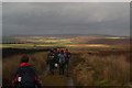
This site is almost impossible to locate on the featureless Gibbet Moor and definitely requires the help of a GPS. Discovered in 1983 it is composed of a rough bank and several fallen stones which may once have been standing. Only one stone still stands, leaning in the bank. Four slabs towards the south may be a ruined entrance. Some have suggested the site may have been a stone circle, but it was planned by the RCHM-E and was reported to be a domestic site. (Barnatt 1990)
You may be viewing yesterday's version of this page. To see the most up to date information please register for a free account.
")
Do not use the above information on other web sites or publications without permission of the contributor.
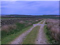
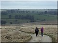
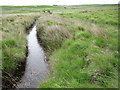
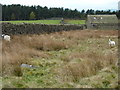
Nearby Images from Geograph Britain and Ireland:
©2006(licence)
©2014(licence)
©2010(licence)
©2012(licence)
©2010(licence)
The above images may not be of the site on this page, they are loaded from Geograph.
Please Submit an Image of this site or go out and take one for us!
Click here to see more info for this site
Nearby sites
Key: Red: member's photo, Blue: 3rd party photo, Yellow: other image, Green: no photo - please go there and take one, Grey: site destroyed
Download sites to:
KML (Google Earth)
GPX (GPS waypoints)
CSV (Garmin/Navman)
CSV (Excel)
To unlock full downloads you need to sign up as a Contributory Member. Otherwise downloads are limited to 50 sites.
![]()
Turn off the page maps and other distractions
Nearby sites listing. In the following links * = Image available
282m SW 225° Gibbet Moor 3 Cairn (SK280707)
282m SW 225° Gibbet Moor 2 Cairn (SK280707)
360m WSW 237° Gibbet Moor 1 Cairn (SK279707)
608m S 190° Gibbet Moor North* Stone Circle (SK281703)
1.5km N 0° Birchen Edge 2 Ring Cairn (SK282724)
1.5km WNW 294° Dobb Edge Cup and Ring* Rock Art (SK268715)
1.7km N 0° Birchen Edge Stone* Natural Stone / Erratic / Other Natural Feature (SK28207256)
1.7km NNW 332° Gardoms Edge Ringcairn* Ring Cairn (SK274724)
1.8km SSE 162° Hob Hurst's House* Round Barrow(s) (SK28746923)
2.0km S 189° Beeley Warren 2 Ring Cairn (SK279689)
2.1km NNW 331° Three Men of Gardoms* Round Barrow(s) (SK2716172774)
2.2km ESE 117° Rodknoll Cairn (SK302699)
2.2km S 191° Beeley Warren 1 Ring Cairn (SK278687)
2.3km NNW 337° Gardoms Edge 1* Rock Art (SK2728573037)
2.4km S 184° Park Gate* Stone Circle (SK2804868513)
2.4km S 191° Beeley Moor Bronze Age Enclosure* Misc. Earthwork (SK27756850)
2.5km NNW 344° Gardoms Edge 02 (Baslow) Rock Art (SK27527328)
2.5km NNW 347° Gardoms Edge 2 (Baslow)* Rock Art (SK2761773339)
2.5km NNW 338° Gardoms Edge Stone* Standing Stone (Menhir) (SK2725273225)
2.5km NNW 336° Gardoms Edge Enclosure* Causewayed Enclosure (SK2716473201)
2.5km NNW 342° Gardoms Edge Cairns* Barrow Cemetery (SK27407330)
2.5km SSE 155° Harland Edge* Ring Cairn (SK293686)
2.6km N 7° Birchen Edge 1* Ring Cairn (SK285735)
3.1km NW 309° Lady Well Wall* Holy Well or Sacred Spring (SK258728)
3.2km S 175° Beeley Moor South* Ring Cairn (SK285677)
View more nearby sites and additional images


 We would like to know more about this location. Please feel free to add a brief description and any relevant information in your own language.
 Wir möchten mehr über diese Stätte erfahren. Bitte zögern Sie nicht, eine kurze Beschreibung und relevante Informationen in Deutsch hinzuzufügen.
 Nous aimerions en savoir encore un peu sur les lieux. S'il vous plaît n'hesitez pas à ajouter une courte description et tous les renseignements pertinents dans votre propre langue.
 Quisieramos informarnos un poco más de las lugares. No dude en añadir una breve descripción y otros datos relevantes en su propio idioma.