


<< Our Photo Pages >> Dobb Edge Cup and Ring - Rock Art in England in Derbyshire
Submitted by masoc on Monday, 18 November 2013 Page Views: 5091
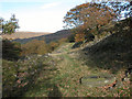
Rock ArtSite Name: Dobb Edge Cup and RingCountry: England County: Derbyshire Type: Rock Art
Map Ref: SK268715
Latitude: 53.239856N Longitude: 1.599898W
Condition:
| 5 | Perfect |
| 4 | Almost Perfect |
| 3 | Reasonable but with some damage |
| 2 | Ruined but still recognisable as an ancient site |
| 1 | Pretty much destroyed, possibly visible as crop marks |
| 0 | No data. |
| -1 | Completely destroyed |
| 5 | Superb |
| 4 | Good |
| 3 | Ordinary |
| 2 | Not Good |
| 1 | Awful |
| 0 | No data. |
| 5 | Can be driven to, probably with disabled access |
| 4 | Short walk on a footpath |
| 3 | Requiring a bit more of a walk |
| 2 | A long walk |
| 1 | In the middle of nowhere, a nightmare to find |
| 0 | No data. |
| 5 | co-ordinates taken by GPS or official recorded co-ordinates |
| 4 | co-ordinates scaled from a detailed map |
| 3 | co-ordinates scaled from a bad map |
| 2 | co-ordinates of the nearest village |
| 1 | co-ordinates of the nearest town |
| 0 | no data |
Internal Links:
External Links:
")
From the Derbyshire HER (No. 15864):
..."A good example of prehistoric rock art that was exposed in 2012 on a low earth-fast boulder due to footfall erosion on a concession path on the Chatsworth Estate. It is of a design type common in areas further to the north, such as Northumberland and south-west Scotland, but there has been nothing quite like it found before in the Peak District National Park. (1)
Sources and Further Reading
[1] SDR20358 - Personal Observation: Barnatt, J. Personal observation or communication. Email sent 29/05/2013, with photographs and drawing."...
You may be viewing yesterday's version of this page. To see the most up to date information please register for a free account.
Do not use the above information on other web sites or publications without permission of the contributor.
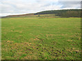
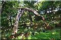
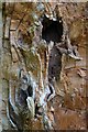
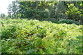
Nearby Images from Geograph Britain and Ireland:
©2013(licence)
©2012(licence)
©2012(licence)
©2013(licence)
©2006(licence)
The above images may not be of the site on this page, they are loaded from Geograph.
Please Submit an Image of this site or go out and take one for us!
Click here to see more info for this site
Nearby sites
Key: Red: member's photo, Blue: 3rd party photo, Yellow: other image, Green: no photo - please go there and take one, Grey: site destroyed
Download sites to:
KML (Google Earth)
GPX (GPS waypoints)
CSV (Garmin/Navman)
CSV (Excel)
To unlock full downloads you need to sign up as a Contributory Member. Otherwise downloads are limited to 50 sites.
Turn off the page maps and other distractions
Nearby sites listing. In the following links * = Image available
1.1km NE 34° Gardoms Edge Ringcairn* Ring Cairn (SK274724)
1.3km NNE 16° Three Men of Gardoms* Round Barrow(s) (SK2716172774)
1.4km SE 126° Gibbet Moor 1 Cairn (SK279707)
1.4km SE 124° Gibbet Moor 2 Cairn (SK280707)
1.4km SE 124° Gibbet Moor 3 Cairn (SK280707)
1.5km ESE 114° Gibbet Moor South* Ancient Village or Settlement (SK282709)
1.6km NNE 18° Gardoms Edge 1* Rock Art (SK2728573037)
1.6km NW 323° Lady Well Wall* Holy Well or Sacred Spring (SK258728)
1.7km ENE 58° Birchen Edge 2 Ring Cairn (SK282724)
1.7km NNE 12° Gardoms Edge Enclosure* Causewayed Enclosure (SK2716473201)
1.8km NE 53° Birchen Edge Stone* Natural Stone / Erratic / Other Natural Feature (SK28207256)
1.8km SE 133° Gibbet Moor North* Stone Circle (SK281703)
1.8km NNE 15° Gardoms Edge Stone* Standing Stone (Menhir) (SK2725273225)
1.9km NNE 19° Gardoms Edge Cairns* Barrow Cemetery (SK27407330)
1.9km NNE 22° Gardoms Edge 02 (Baslow) Rock Art (SK27527328)
2.0km NNE 24° Gardoms Edge 2 (Baslow)* Rock Art (SK2761773339)
2.6km NE 41° Birchen Edge 1* Ring Cairn (SK285735)
2.8km SSE 157° Beeley Warren 2 Ring Cairn (SK279689)
3.0km SSE 161° Beeley Warren 1 Ring Cairn (SK278687)
3.0km SE 140° Hob Hurst's House* Round Barrow(s) (SK28746923)
3.1km SSE 163° Beeley Moor Bronze Age Enclosure* Misc. Earthwork (SK27756850)
3.2km SSE 158° Park Gate* Stone Circle (SK2804868513)
3.5km N 7° Swine Sty* Ancient Village or Settlement (SK272750)
3.7km N 3° Barbrook 5* Ring Cairn (SK270752)
3.7km ESE 116° Rodknoll Cairn (SK302699)
View more nearby sites and additional images


 We would like to know more about this location. Please feel free to add a brief description and any relevant information in your own language.
 Wir möchten mehr über diese Stätte erfahren. Bitte zögern Sie nicht, eine kurze Beschreibung und relevante Informationen in Deutsch hinzuzufügen.
 Nous aimerions en savoir encore un peu sur les lieux. S'il vous plaît n'hesitez pas à ajouter une courte description et tous les renseignements pertinents dans votre propre langue.
 Quisieramos informarnos un poco más de las lugares. No dude en añadir una breve descripción y otros datos relevantes en su propio idioma.