 with our Megalithic Portal iPhone app")


<< Text Pages >> Ashbury Folly Barrows - Round Barrow(s) in England in Oxfordshire
Submitted by coldrum on Saturday, 02 January 2010 Page Views: 6346
Neolithic and Bronze AgeSite Name: Ashbury Folly BarrowsCountry: England
NOTE: This site is 1.4 km away from the location you searched for.
County: Oxfordshire Type: Round Barrow(s)
Map Ref: SU27238454
Latitude: 51.559089N Longitude: 1.608606W
Condition:
| 5 | Perfect |
| 4 | Almost Perfect |
| 3 | Reasonable but with some damage |
| 2 | Ruined but still recognisable as an ancient site |
| 1 | Pretty much destroyed, possibly visible as crop marks |
| 0 | No data. |
| -1 | Completely destroyed |
| 5 | Superb |
| 4 | Good |
| 3 | Ordinary |
| 2 | Not Good |
| 1 | Awful |
| 0 | No data. |
| 5 | Can be driven to, probably with disabled access |
| 4 | Short walk on a footpath |
| 3 | Requiring a bit more of a walk |
| 2 | A long walk |
| 1 | In the middle of nowhere, a nightmare to find |
| 0 | No data. |
| 5 | co-ordinates taken by GPS or official recorded co-ordinates |
| 4 | co-ordinates scaled from a detailed map |
| 3 | co-ordinates scaled from a bad map |
| 2 | co-ordinates of the nearest village |
| 1 | co-ordinates of the nearest town |
| 0 | no data |
Be the first person to rate this site - see the 'Contribute!' box in the right hand menu.
Internal Links:
External Links:
Round Barrow(s) in Oxfordshire
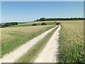
From Pastscape: "The cropmark remains of three probable Bronze Age round barrows were mapped from aerial photographs."
You may be viewing yesterday's version of this page. To see the most up to date information please register for a free account.
Do not use the above information on other web sites or publications without permission of the contributor.
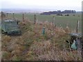
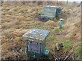
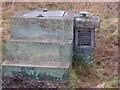
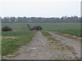
Nearby Images from Geograph Britain and Ireland:
©2009(licence)
©2009(licence)
©2009(licence)
©2010(licence)
©2012(licence)
The above images may not be of the site on this page, they are loaded from Geograph.
Please Submit an Image of this site or go out and take one for us!
Click here to see more info for this site
Nearby sites
Key: Red: member's photo, Blue: 3rd party photo, Yellow: other image, Green: no photo - please go there and take one, Grey: site destroyed
Download sites to:
KML (Google Earth)
GPX (GPS waypoints)
CSV (Garmin/Navman)
CSV (Excel)
To unlock full downloads you need to sign up as a Contributory Member. Otherwise downloads are limited to 50 sites.
Turn off the page maps and other distractions
Nearby sites listing. In the following links * = Image available
858m SSE 153° Hailey Wood Barrows Round Barrow(s) (SU27638378)
1.2km NE 46° Wayland's Smithy* Long Barrow (SU28098539)
1.4km NE 48° Odstone Barrow Round Barrow(s) (SU28248545)
1.5km SW 215° Idstone Hill Barrow Round Barrow(s) (SU26348327)
2.4km SSE 168° Alfred's Castle* Hillfort (SU27738223)
2.6km NE 36° Hardwell Camp* Hillfort (SU2876686671)
2.8km WSW 251° William's Well Holy Well or Sacred Spring (SU246836)
3.0km S 179° Swinley Copse Barrows Round Barrow(s) (SU27318159)
3.0km E 85° Idlebush Barrow* Ancient Village or Settlement (SU302848)
3.1km S 171° Ashdown Barrow Round Barrow(s) (SU27748153)
3.2km ESE 119° Knighton Bushes* Ancient Village or Settlement (SU300830)
3.2km NE 55° Uffington Castle* Hillfort (SU299864)
3.4km NE 55° Uffington Castle Neolithic long barrow* Long Barrow (SU30008652)
3.4km S 180° Bishopstone Barrow Round Barrow(s) (SU27268111)
3.5km S 176° Three Barrows (Oxfordshire) Round Barrow(s) (SU27508102)
3.6km NE 54° Uffington White Horse* Hill Figure or Geoglyph (SU30128662)
3.7km NE 51° Dragon Hill* Natural Stone / Erratic / Other Natural Feature (SU30078687)
3.9km SE 143° Park Farm Barrow Round Barrow(s) (SU29638143)
4.0km SSE 160° Botley Barrow Round Barrow(s) (SU28618076)
4.1km SW 232° Strip Lynchets, Bishopstone* Misc. Earthwork (SU2482)
4.2km SSE 156° Fognam Clump Barrow* Round Barrow(s) (SU29008072)
4.5km ENE 67° Rams Hill* Causewayed Enclosure (SU314863)
5.2km ESE 103° Lambourn Long Barrow* Long Barrow (SU32328338)
5.7km SE 136° St Luke's Church Barrow Round Barrow(s) (SU31228042)
5.8km ENE 64° The Blowing Stone* Holed Stone (SU324871)
View more nearby sites and additional images


 We would like to know more about this location. Please feel free to add a brief description and any relevant information in your own language.
 Wir möchten mehr über diese Stätte erfahren. Bitte zögern Sie nicht, eine kurze Beschreibung und relevante Informationen in Deutsch hinzuzufügen.
 Nous aimerions en savoir encore un peu sur les lieux. S'il vous plaît n'hesitez pas à ajouter une courte description et tous les renseignements pertinents dans votre propre langue.
 Quisieramos informarnos un poco más de las lugares. No dude en añadir una breve descripción y otros datos relevantes en su propio idioma.