 with our Megalithic Portal iPhone app")


<< Text Pages >> Hathersage Moor - Ring Cairn in England in Derbyshire
Submitted by Vicky on Wednesday, 18 September 2002 Page Views: 11554
Neolithic and Bronze AgeSite Name: Hathersage MoorCountry: England County: Derbyshire Type: Ring Cairn
Nearest Town: Hathersage
Map Ref: SK257809 Landranger Map Number: 110
Latitude: 53.324402N Longitude: 1.615623W
Condition:
| 5 | Perfect |
| 4 | Almost Perfect |
| 3 | Reasonable but with some damage |
| 2 | Ruined but still recognisable as an ancient site |
| 1 | Pretty much destroyed, possibly visible as crop marks |
| 0 | No data. |
| -1 | Completely destroyed |
| 5 | Superb |
| 4 | Good |
| 3 | Ordinary |
| 2 | Not Good |
| 1 | Awful |
| 0 | No data. |
| 5 | Can be driven to, probably with disabled access |
| 4 | Short walk on a footpath |
| 3 | Requiring a bit more of a walk |
| 2 | A long walk |
| 1 | In the middle of nowhere, a nightmare to find |
| 0 | No data. |
| 5 | co-ordinates taken by GPS or official recorded co-ordinates |
| 4 | co-ordinates scaled from a detailed map |
| 3 | co-ordinates scaled from a bad map |
| 2 | co-ordinates of the nearest village |
| 1 | co-ordinates of the nearest town |
| 0 | no data |
Internal Links:
External Links:
Ring Cairn in Derbyshire
According to John Barnatt (1990) this is a possible ringcairn with a stone bank approximately 7.5m by 5.5m wide internally. One stone lies at the inner edge which could have been a standing stone but is more likely to have fallen from the bank. A possible entrance lies to the south.
You may be viewing yesterday's version of this page. To see the most up to date information please register for a free account.
Do not use the above information on other web sites or publications without permission of the contributor.
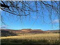
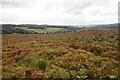
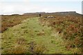
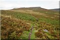
Nearby Images from Geograph Britain and Ireland:
©2022(licence)

©2014(licence)
©2023(licence)
©2023(licence)
©2023(licence)
The above images may not be of the site on this page, they are loaded from Geograph.
Please Submit an Image of this site or go out and take one for us!
Click here to see more info for this site
Nearby sites
Key: Red: member's photo, Blue: 3rd party photo, Yellow: other image, Green: no photo - please go there and take one, Grey: site destroyed
Download sites to:
KML (Google Earth)
GPX (GPS waypoints)
CSV (Garmin/Navman)
CSV (Excel)
To unlock full downloads you need to sign up as a Contributory Member. Otherwise downloads are limited to 50 sites.
![]()
Turn off the page maps and other distractions
Nearby sites listing. In the following links * = Image available
316m SSE 162° Toads Mouth (Hathersage)* Natural Stone / Erratic / Other Natural Feature (SK258806)
565m NW 315° Winyards Nick* Round Barrow(s) (SK253813)
670m NNE 27° Carl Wark* Hillfort (SK260815)
1.2km SSW 200° Lawrence Field* Stone Circle (SK253798)
1.6km E 90° Fingerem Stone* Cairn (SK273809)
1.7km SSE 149° Little John's Well (Hathersage)* Holy Well or Sacred Spring (SK266794)
1.8km E 94° Ciceley Low II* Ring Cairn (SK2752080782)
1.8km E 94° Ciceley Low I* Ring Cairn (SK2752080782)
2.9km WNW 282° Healing Spring* Holy Well or Sacred Spring (SK229815)
2.9km ENE 65° God's Spring* Holy Well or Sacred Spring (SK283821)
2.9km ENE 59° Harrys Stone* Ancient Temple (SK282824)
3.0km NNW 335° Robin Hood's Cave* Cave or Rock Shelter (SK244836)
3.1km SW 233° Eyam Moor II* Stone Circle (SK232790)
3.2km ESE 109° Strawberry Lea* Ring Cairn (SK287799)
3.3km SW 230° Eyam Moor III* Stone Circle (SK232788)
3.4km NW 318° Trinity Well (Hathersage)* Holy Well or Sacred Spring (SK234834)
3.4km SSE 160° The Hurkling Stone* Marker Stone (SK269777)
3.4km E 82° Giant's Chair (Yorkshire)* Standing Stone (Menhir) (SK291814)
3.5km SSE 161° White Edge Cairn* Cairn (SK26847762)
3.6km NW 321° North Lees Romano British Village* Ancient Village or Settlement (SK2343083673)
3.6km ESE 122° Brown Edge* Stone Circle (SK288790)
3.7km WSW 239° Wet Withens* Stone Circle (SK22557900)
3.7km WSW 239° Eyam Moor Barrow* Long Barrow (SK22547900)
4.2km S 190° Stoke Flat* Stone Circle (SK24967679)
4.3km NW 321° Sheepwash Bank Cairn (SK230842)
View more nearby sites and additional images


 We would like to know more about this location. Please feel free to add a brief description and any relevant information in your own language.
 Wir möchten mehr über diese Stätte erfahren. Bitte zögern Sie nicht, eine kurze Beschreibung und relevante Informationen in Deutsch hinzuzufügen.
 Nous aimerions en savoir encore un peu sur les lieux. S'il vous plaît n'hesitez pas à ajouter une courte description et tous les renseignements pertinents dans votre propre langue.
 Quisieramos informarnos un poco más de las lugares. No dude en añadir una breve descripción y otros datos relevantes en su propio idioma.