


<< Text Pages >> Adlestrop Hill (round) - Round Barrow(s) in England in Oxfordshire
Submitted by vicky on Saturday, 06 December 2003 Page Views: 6818
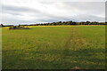
Neolithic and Bronze AgeSite Name: Adlestrop Hill (round)Country: England County: Oxfordshire Type: Round Barrow(s)
Nearest Town: Chipping Norton Nearest Village: Chastleton
Map Ref: SP253282 Landranger Map Number: 163
Latitude: 51.951721N Longitude: 1.633282W
Condition:
| 5 | Perfect |
| 4 | Almost Perfect |
| 3 | Reasonable but with some damage |
| 2 | Ruined but still recognisable as an ancient site |
| 1 | Pretty much destroyed, possibly visible as crop marks |
| 0 | No data. |
| -1 | Completely destroyed |
| 5 | Superb |
| 4 | Good |
| 3 | Ordinary |
| 2 | Not Good |
| 1 | Awful |
| 0 | No data. |
| 5 | Can be driven to, probably with disabled access |
| 4 | Short walk on a footpath |
| 3 | Requiring a bit more of a walk |
| 2 | A long walk |
| 1 | In the middle of nowhere, a nightmare to find |
| 0 | No data. |
| 5 | co-ordinates taken by GPS or official recorded co-ordinates |
| 4 | co-ordinates scaled from a detailed map |
| 3 | co-ordinates scaled from a bad map |
| 2 | co-ordinates of the nearest village |
| 1 | co-ordinates of the nearest town |
| 0 | no data |
Internal Links:
External Links:
Round Barrow in Oxfordshire
Have you visited this site? Please add a comment below.
You may be viewing yesterday's version of this page. To see the most up to date information please register for a free account.
 (PID:213031)")
Do not use the above information on other web sites or publications without permission of the contributor.
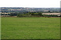
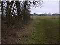
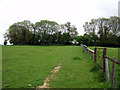
Nearby Images from Geograph Britain and Ireland:
©2021(licence)
©2013(licence)
©2017(licence)
©2005(licence)
©2021(licence)
The above images may not be of the site on this page, they are loaded from Geograph.
Please Submit an Image of this site or go out and take one for us!
Click here to see more info for this site
Nearby sites
Key: Red: member's photo, Blue: 3rd party photo, Yellow: other image, Green: no photo - please go there and take one, Grey: site destroyed
Download sites to:
KML (Google Earth)
GPX (GPS waypoints)
CSV (Garmin/Navman)
CSV (Excel)
To unlock full downloads you need to sign up as a Contributory Member. Otherwise downloads are limited to 50 sites.
Turn off the page maps and other distractions
Nearby sites listing. In the following links * = Image available
92m NE 41° Adlestrop Hill* Long Barrow (SP25362827)
399m E 90° Barrow Hill (Oxfordshire) Standing Stone (Menhir) (SP257282)
538m NNE 22° Goose Stones* Standing Stone (Menhir) (SP255287)
598m E 90° Chastleton Camp* Hillfort (SP259282)
1.3km ENE 77° Burnt Hill barrow* Long Barrow (SP26602850)
1.4km ENE 72° Burnt Hill Dolmen* Burial Chamber or Dolmen (SP26672865)
3.3km E 93° Salford Cross Cup Marks (Salford) Ancient Cross (SP2864428058)
4.8km ESE 122° Churchill Standing Stone* Standing Stone (Menhir) (SP29372568)
4.9km ENE 57° Gough's Barrow (Long Compton) Cairn (SP29463090)
5.0km ENE 58° Rollright Stones* Stone Circle (SP29583087)
5.1km ENE 58° King Stone at the Rollrights* Standing Stone (Menhir) (SP29623095)
5.1km ENE 58° King Stone Round Cairn* Cairn (SP2961430968)
5.1km SE 143° Churchill* Stone Circle (SP284241)
5.3km ENE 61° Whispering Knights* Portal Tomb (SP29933084)
5.8km ESE 102° Serpent's Well (Chipping Norton) Holy Well or Sacred Spring (SP310270)
6.0km ESE 102° New Street Stone* Holed Stone (SP312270)
6.3km WSW 249° Stow Camp* Hillfort (SP19442595)
6.3km W 259° Broadwell Chambered Tomb (SP191270)
6.4km WSW 250° St Edwards (Stow Well) Well* Holy Well or Sacred Spring (SP1931126039)
6.4km SE 145° Old Vicarage* Standing Stone (Menhir) (SP290230)
6.8km NW 315° Batsford Camp* Ancient Village or Settlement (SP2038932974)
7.1km SW 225° Icomb Camp* Hillfort (SP20352315)
7.2km WSW 239° St Edwards well* Holy Well or Sacred Spring (SP191245)
7.3km E 89° Druids Barrow Round Barrow(s) (SP32612835)
7.9km W 275° Ganborough* Chambered Tomb (SP174289)
View more nearby sites and additional images


 We would like to know more about this location. Please feel free to add a brief description and any relevant information in your own language.
 Wir möchten mehr über diese Stätte erfahren. Bitte zögern Sie nicht, eine kurze Beschreibung und relevante Informationen in Deutsch hinzuzufügen.
 Nous aimerions en savoir encore un peu sur les lieux. S'il vous plaît n'hesitez pas à ajouter une courte description et tous les renseignements pertinents dans votre propre langue.
 Quisieramos informarnos un poco más de las lugares. No dude en añadir una breve descripción y otros datos relevantes en su propio idioma.