Featured: Current Archaeology Book of the Year 2019!

Current Archaeology Book of the Year 2019!

Random Image


Wasdale (Orkney)

Megalithomania by John Michell, Only £4.99 + P&P

Megalithomania by John Michell, Only £4.99 + P&P

Who's Online

There are currently, 272 guests and 3 members online.

You are a guest. To join in, please register for free by clicking here

Sponsors

<< Our Photo Pages >> Lawrence Field - Stone Circle in England in Derbyshire

Submitted by Vicky on Wednesday, 18 September 2002  Page Views: 29674

Neolithic and Bronze AgeSite Name: Lawrence Field
Country: England County: Derbyshire Type: Stone Circle
Nearest Town: Hathersage
Map Ref: SK253798  Landranger Map Number: 119
Latitude: 53.314534N  Longitude: 1.621715W
Condition:
5Perfect
4Almost Perfect
3Reasonable but with some damage
2Ruined but still recognisable as an ancient site
1Pretty much destroyed, possibly visible as crop marks
0No data.
-1Completely destroyed
2 Ambience:
5Superb
4Good
3Ordinary
2Not Good
1Awful
0No data.
1 Access:
5Can be driven to, probably with disabled access
4Short walk on a footpath
3Requiring a bit more of a walk
2A long walk
1In the middle of nowhere, a nightmare to find
0No data.
4 Accuracy:
5co-ordinates taken by GPS or official recorded co-ordinates
4co-ordinates scaled from a detailed map
3co-ordinates scaled from a bad map
2co-ordinates of the nearest village
1co-ordinates of the nearest town
0no data
4

Internal Links:
External Links:

I have visited· I would like to visit

elad13 would like to visit

BolshieBoris visited on 1st Jan 1983 - their rating: Cond: 2 Amb: 3 Access: 4

nicoladidsbury have visited here
Lawrence Field
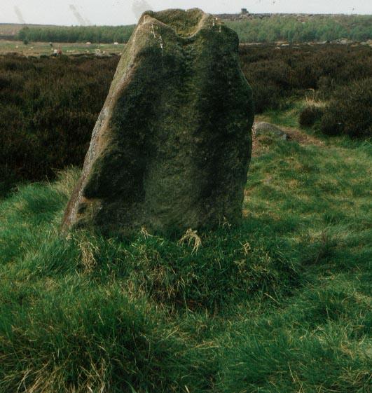
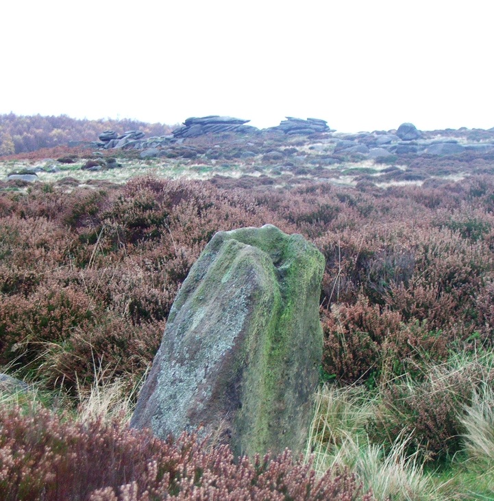
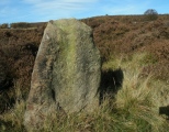
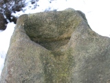
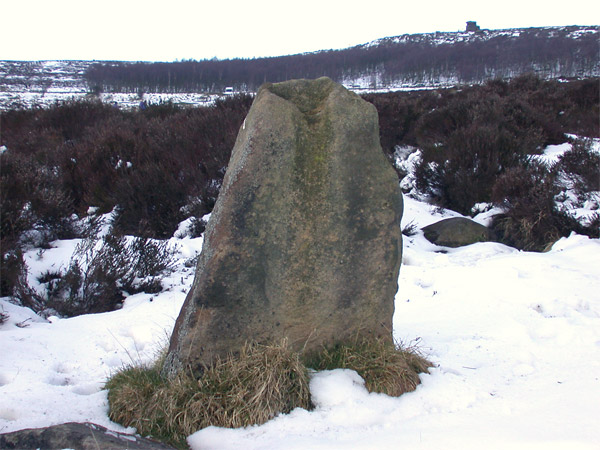
Lawrence Field submitted by nicoladidsbury : Standing Stone at Lawrence Field The stone has a strange groove in the top. This view looks over to the Tor know as Mother Cap (Vote or comment on this photo)
This site is marked on the OS map as a stone circle, but only a single standing stone now survives. There are a number of other boulders in the area, but John Barnatt believes that these are just 'fortuitous'.
You may be viewing yesterday's version of this page. To see the most up to date information please register for a free account.
Lawrence Field
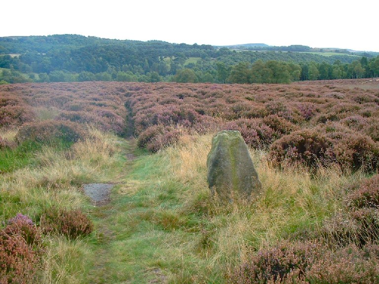
Lawrence Field submitted by bec-zog : Is this really the sole surviving stone form the Lawrence Field Circle SK253797 ? (Vote or comment on this photo)

Lawrence Field
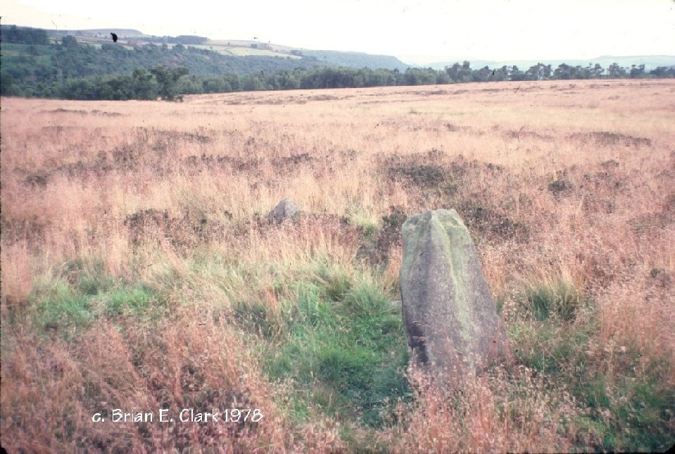
Lawrence Field submitted by bec-zog : "Enigmatic site" 1978 (1 comment - Vote or comment on this photo)

Lawrence Field
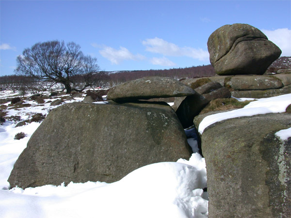
Lawrence Field submitted by nicoladidsbury : Stones near to Lawrence field standing stone. The tree in the background is a silver birch, the biggest silver birch I have ever seen. It must be incredibly old. (Vote or comment on this photo)

Lawrence Field
Lawrence Field submitted by PaulM : The lonesome standing stone in Lawrence Field (Derbyshire) (1 comment - Vote or comment on this photo)

Lawrence Field
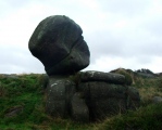
Lawrence Field submitted by postman : Standing stone and possible circle tone with giant balanced egg rock in the distance. (Vote or comment on this photo)

Lawrence Field
Lawrence Field submitted by nicoladidsbury : This stone is close by the standing stone of Lawrence Field. It is really big, and must have been put there by giants. Ok, I'm being silly, I know its a product of erosion, but to the people who lived here and erected the standing stone, the most compelling rationalisation must have been the giants at work. (1 comment)

Lawrence Field
Lawrence Field submitted by bec-zog : Circular Stone setting located in 1978 (4 comments)

Lawrence Field
Lawrence Field submitted by Bladup : Lawrence Field, you can see mother cap in the distance to the North.

Lawrence Field
Lawrence Field submitted by postman : Giant balanced egg rock

Lawrence Field
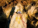
Lawrence Field submitted by royston7 : the standing stone at lawrencefield. note the shape of the groove - allow for weathering - and how the near and far side of the groove are shaped to "cup" the suns left and lower limb.

Lawrence Field
Lawrence Field submitted by royston7 : View number 2 of 2 showing the "sighting groove" at lawrencefield.

Lawrence Field
Lawrence Field submitted by royston7 : View number 1 of 2 showing the orientation of the "sighting groove"at lawrencefield. (1 comment)

Lawrence Field
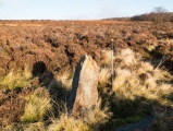
Lawrence Field submitted by royston7 : The standing stone at lawrencefield showing the view through the "sighting groove" towards the horizon in the north-east.

Lawrence Field
Lawrence Field submitted by nicoladidsbury : Close up of standing stone at Lawrence Field.

Do not use the above information on other web sites or publications without permission of the contributor.
Click here to see more info for this site

Nearby sites

Click here to view sites on an interactive OS map

Key: Red: member's photo, Blue: 3rd party photo, Yellow: other image, Green: no photo - please go there and take one, Grey: site destroyed

Download sites to:
KML (Google Earth)
GPX (GPS waypoints)
CSV (Garmin/Navman)
CSV (Excel)

To unlock full downloads you need to sign up as a Contributory Member. Otherwise downloads are limited to 50 sites.

Alastair's Derbyshire Stone Circle Pages by Alastair McIvor


Turn off the page maps and other distractions

Nearby sites listing. In the following links * = Image available
 942m NNE 32° Toads Mouth (Hathersage)* Natural Stone / Erratic / Other Natural Feature (SK258806)
 1.2km NNE 20° Hathersage Moor Ring Cairn (SK257809)
 1.4km ESE 107° Little John's Well (Hathersage)* Holy Well or Sacred Spring (SK266794)
 1.5km N 0° Winyards Nick* Round Barrow(s) (SK253813)
 1.8km NNE 23° Carl Wark* Hillfort (SK260815)
 2.2km WSW 249° Eyam Moor II* Stone Circle (SK232790)
 2.3km ENE 61° Fingerem Stone* Cairn (SK273809)
 2.3km WSW 245° Eyam Moor III* Stone Circle (SK232788)
 2.4km ENE 66° Ciceley Low II* Ring Cairn (SK2752080782)
 2.4km ENE 66° Ciceley Low I* Ring Cairn (SK2752080782)
 2.6km SE 143° The Hurkling Stone* Marker Stone (SK269777)
 2.7km SE 145° White Edge Cairn* Cairn (SK26847762)
 2.9km WSW 254° Wet Withens* Stone Circle (SK22557900)
 2.9km WSW 254° Eyam Moor Barrow* Long Barrow (SK22547900)
 2.9km NW 306° Healing Spring* Holy Well or Sacred Spring (SK229815)
 3.0km S 187° Stoke Flat* Stone Circle (SK24967679)
 3.4km E 89° Strawberry Lea* Ring Cairn (SK287799)
 3.6km ESE 103° Brown Edge* Stone Circle (SK288790)
 3.8km NE 53° God's Spring* Holy Well or Sacred Spring (SK283821)
 3.8km W 275° Highlow Bank* Standing Stone (Menhir) (SK215801)
 3.9km NE 48° Harrys Stone* Ancient Temple (SK282824)
 3.9km NNW 347° Robin Hood's Cave* Cave or Rock Shelter (SK244836)
 3.9km SE 130° Barbrook 3* Stone Circle (SK28337728)
 3.9km WSW 254° Stanage* Cairn (SK215787)
 4.0km SW 222° Top Of Riley Stone Circle (SK226768)
View more nearby sites and additional images

<< Hob Hurst's House

Offerton Moor >>

Please add your thoughts on this site

Footprints in Stone

Footprints in Stone

Archived Web links for Lawrence Field

Alastair's Derbyshire Stone Circle Pages by Alastair McIvor

Sponsors

Auto-Translation (Google)

Translate from English into:

"Lawrence Field" | Login/Create an Account | 7 News and Comments
  
Go back to top of page    Comments are owned by the poster. We aren't responsible for their content.
Re: Lawrence Field by Andy B on Thursday, 09 April 2015
(User Info | Send a Message)
Don Russell writes: I’ve always thought that my navigation is pretty good with a map and compass; however, I have sighted (Silva Type 54) and paced from various points and I don’t get the same ‘Stone’ as in your photos (I have been to that stone). The end of the stone wall on the west side is obviously different to the map but all other datum points fall-in correct.

The stones that I keep getting to are in a circle and quite large (one was missing but on inspecting the ground it was there but overgrown). How certain are you that the stone in the photo is the correct stone? It could be that the position on the map may be slightly out but OS are normally pretty good.

I've been to this site now a few times as I live relatively close by and still end up at the same position using a different set of fixed start points. There is a small dry re-entrant depicted on the map. The stone circle that I keep going to is to the west of that re-entrant (as it is on the map) whereas the single stone in the photos is on the east side of the re-entrant. There is also a drain on the map that is pretty much in the right position relative to my stone circle but well out of position the the stone in the photos.

[ Reply to This ]

Re: Lawrence Field by royston7 on Sunday, 16 December 2012
(User Info | Send a Message)
With regard to the lone standing stone at lawrencefield. Whether or not this was part of a circle is debatable as there are so many eratics in this area. I have noted however that, in common with many other derbyshire standing stones, the top of the stone is grooved (no other stones in the immediate vicinity are grooved - indeed most are simply weather worn and rounded), moreover upon examination - and allowing for weathering - it would appear that the groove has been man made (almost akin to the sights on a rifle) If one is to kneel down and align the "sighting groove" with the horizon then it would capture the sun at midsummer sunrise - very handy for early hunter gatherers/farmers! I will upload photos to demonstrate. Royston 7
[ Reply to This ]

Re: Lawrence Field Circle near Hathersage by AngieLake on Tuesday, 31 August 2010
(User Info | Send a Message)
'Surprise View' was the name of the roomy car park opposite this area where I parked briefly on Sunday evening (29th Aug. 2010), too late to go exploring the moors as sun was setting, and not properly shod - [to boot?]
Maybe it's just as well, as I'd have been looking for a proper circle after seeing it on the OS map!
Thank goodness for Meg.P.
[ Reply to This ]

Grindleford Audio Trail by Andy B on Saturday, 13 February 2010
(User Info | Send a Message)
Follow the ghost of a river as your tour takes you back millions of years to see how the geology of this area (and the Peak District) was laid down to give us the landscape we see today. The audio trail was produced in conjunction with Grindleford Youth Club.

http://www.moorsforthefuture.org.uk/mftf/audio_trails/grindleford.htm
[ Reply to This ]

Re: Lawrence Field by Anonymous on Sunday, 20 March 2005
"One stone doesn't make a circle" as endorsed by Burl. Doubt has also been expressed about the authenticity of Carl Wark.
[ Reply to This ]

Re: Lawrence Field by Anonymous on Saturday, 24 January 2004
In the late 70's, local historian, Tom Tomlinson took me and a group of other primary teachers around Lawrence Field, an iron age village. The circle of stones formed the perimeter wall of the village and 4 or 5 circular huts' foundations could be seen clearly, along with a larger, rectangular hut belonging to the chieftain. Tom explained that
Carl Wark, the hill fort, was their home in times of attack, and Mother Cap was the signpost pointing them to it. Higger Tor was the burial ground for the residents of Lawrence Field. Hope this is of use to you. Pam Cartwright.
[ Reply to This ]

Re: Lawrence Field by Vicky on Friday, 16 November 2001
(User Info | Send a Message)
OS Maps record this as a stone circle, but all that is visible is a single standing stone. John Barnatt believes that all stones considered to be in the circle are just fortuitous.
[ Reply to This ]

Your Name: Anonymous [ Register Now ]
Subject:


Add your comment or contribution to this page. Spam or offensive posts are deleted immediately, don't even bother

<<< What is five plus one as a number? (Please type the answer to this question in the little box on the left)
You can also embed videos and other things. For Youtube please copy and paste the 'embed code'.
For Google Street View please include Street View in the text.
Create a web link like this: <a href="https://www.megalithic.co.uk">This is a link</a>  

Allowed HTML is:
<p> <b> <i> <a> <img> <em> <br> <strong> <blockquote> <tt> <li> <ol> <ul> <object> <param> <embed> <iframe>

We would like to know more about this location. Please feel free to add a brief description and any relevant information in your own language.
Wir möchten mehr über diese Stätte erfahren. Bitte zögern Sie nicht, eine kurze Beschreibung und relevante Informationen in Deutsch hinzuzufügen.
Nous aimerions en savoir encore un peu sur les lieux. S'il vous plaît n'hesitez pas à ajouter une courte description et tous les renseignements pertinents dans votre propre langue.
Quisieramos informarnos un poco más de las lugares. No dude en añadir una breve descripción y otros datos relevantes en su propio idioma.