


<< Text Pages >> Martin's Clump Flint Mine - Ancient Mine, Quarry or other Industry in England in Hampshire
Submitted by SolarMegalith on Tuesday, 07 February 2012 Page Views: 5694
Multi-periodSite Name: Martin''s Clump Flint MineCountry: England County: Hampshire Type: Ancient Mine, Quarry or other Industry
Nearest Village: Grateley
Map Ref: SU252388
Latitude: 51.147911N Longitude: 1.641113W
Condition:
| 5 | Perfect |
| 4 | Almost Perfect |
| 3 | Reasonable but with some damage |
| 2 | Ruined but still recognisable as an ancient site |
| 1 | Pretty much destroyed, possibly visible as crop marks |
| 0 | No data. |
| -1 | Completely destroyed |
| 5 | Superb |
| 4 | Good |
| 3 | Ordinary |
| 2 | Not Good |
| 1 | Awful |
| 0 | No data. |
| 5 | Can be driven to, probably with disabled access |
| 4 | Short walk on a footpath |
| 3 | Requiring a bit more of a walk |
| 2 | A long walk |
| 1 | In the middle of nowhere, a nightmare to find |
| 0 | No data. |
| 5 | co-ordinates taken by GPS or official recorded co-ordinates |
| 4 | co-ordinates scaled from a detailed map |
| 3 | co-ordinates scaled from a bad map |
| 2 | co-ordinates of the nearest village |
| 1 | co-ordinates of the nearest town |
| 0 | no data |
Internal Links:
External Links:
Ancient Mine, Quarry or other Industry in Hampshire
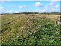
Remains of a Neolithic flint mine are located neer the top of Martin’s Clump. The site has been excavated in 1932. Traces of the shafts and heaps of spoil are still visible in various points of Martin’s Clump - one of the most significant shafts (SU 25043876) has been excavated in 1955.
Currently remains of the mine are located on military area and are inaccessible.
Read More at Pastscape.
You may be viewing yesterday's version of this page. To see the most up to date information please register for a free account.
Do not use the above information on other web sites or publications without permission of the contributor.
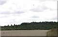
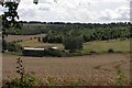
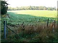
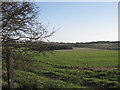
Nearby Images from Geograph Britain and Ireland:
©2008(licence)
©2008(licence)
©2008(licence)
©2011(licence)
©2008(licence)
The above images may not be of the site on this page, they are loaded from Geograph.
Please Submit an Image of this site or go out and take one for us!
Click here to see more info for this site
Nearby sites
Key: Red: member's photo, Blue: 3rd party photo, Yellow: other image, Green: no photo - please go there and take one, Grey: site destroyed
Download sites to:
KML (Google Earth)
GPX (GPS waypoints)
CSV (Garmin/Navman)
CSV (Excel)
To unlock full downloads you need to sign up as a Contributory Member. Otherwise downloads are limited to 50 sites.
Turn off the page maps and other distractions
Nearby sites listing. In the following links * = Image available
175m NNW 337° Martin's Clump Bowl Barrow Round Barrow(s) (SU25133896)
381m SSW 203° Martin's Clump Long Barrow Long Barrow (SU25053845)
2.1km NNW 338° Grateley Down Barrows* Barrow Cemetery (SU24414074)
2.3km NE 40° Palestine Bowl Barrow* Round Barrow(s) (SU26684060)
3.6km NNW 348° Barrow Field Clumps* Barrow Cemetery (SU2446242274)
3.6km NNE 16° Quarley Hill* Hillfort (SU262423)
4.0km SE 144° Lopcombe Disc Barrow Round Barrow(s) (SU27563561)
6.1km SW 230° Battery Hill Bowl Barrow Round Barrow(s) (SU20573485)
6.2km SW 230° Battery Hill Long Barrow Long Barrow (SU20493481)
6.7km E 95° Danebury West Long Barrow (SU319383)
6.8km E 94° Danebury East Long Barrow (SU320383)
7.0km SW 225° Thorny Down Enclosure Ancient Village or Settlement (SU203338)
7.2km E 99° Danebury Ring* Hillfort (SU32353769)
7.4km WSW 242° Horse Barrow Round Barrow(s) (SU18623533)
8.1km SW 232° Figsbury Rings* Hillfort (SU18833382)
8.2km NNW 335° Milston Down Long Barrows* Long Barrow (SU2171146251)
8.4km NNW 336° Devil's Ditch (Wiltshire) Misc. Earthwork (SU21744649)
8.7km SW 224° Fussell's Lodge* Long Barrow (SU19183247)
9.0km WNW 300° Bulford Stone* Standing Stone (Menhir) (SU17364318)
9.2km SSW 209° Clarendon Park Bowl Barrows Barrow Cemetery (SU20733079)
9.6km N 355° Tidworth Bowl Barrow Round Barrow(s) (SU24274837)
9.8km WNW 296° Watergate Long Barrow* Long Barrow (SU1635643051)
9.9km WNW 289° Ratfyn Barrow* Round Barrow(s) (SU15834194)
10.0km NW 323° Silk Hill Barrow Cemetery (SU1915246835)
10.3km WNW 285° Amesbury History Centre* Museum (SU1526841462)
View more nearby sites and additional images


 We would like to know more about this location. Please feel free to add a brief description and any relevant information in your own language.
 Wir möchten mehr über diese Stätte erfahren. Bitte zögern Sie nicht, eine kurze Beschreibung und relevante Informationen in Deutsch hinzuzufügen.
 Nous aimerions en savoir encore un peu sur les lieux. S'il vous plaît n'hesitez pas à ajouter une courte description et tous les renseignements pertinents dans votre propre langue.
 Quisieramos informarnos un poco más de las lugares. No dude en añadir una breve descripción y otros datos relevantes en su propio idioma.