


<< Our Photo Pages >> Moscar Moor - Stone Circle in England in Derbyshire
Submitted by Vicky on Wednesday, 18 September 2002 Page Views: 11520
Neolithic and Bronze AgeSite Name: Moscar MoorCountry: England
NOTE: This site is 0.9 km away from the location you searched for.
County: Derbyshire Type: Stone Circle
Map Ref: SK21608591 Landranger Map Number: 110
Latitude: 53.369617N Longitude: 1.676836W
Condition:
| 5 | Perfect |
| 4 | Almost Perfect |
| 3 | Reasonable but with some damage |
| 2 | Ruined but still recognisable as an ancient site |
| 1 | Pretty much destroyed, possibly visible as crop marks |
| 0 | No data. |
| -1 | Completely destroyed |
| 5 | Superb |
| 4 | Good |
| 3 | Ordinary |
| 2 | Not Good |
| 1 | Awful |
| 0 | No data. |
| 5 | Can be driven to, probably with disabled access |
| 4 | Short walk on a footpath |
| 3 | Requiring a bit more of a walk |
| 2 | A long walk |
| 1 | In the middle of nowhere, a nightmare to find |
| 0 | No data. |
| 5 | co-ordinates taken by GPS or official recorded co-ordinates |
| 4 | co-ordinates scaled from a detailed map |
| 3 | co-ordinates scaled from a bad map |
| 2 | co-ordinates of the nearest village |
| 1 | co-ordinates of the nearest town |
| 0 | no data |
Internal Links:
External Links:
I have visited· I would like to visit
elad13 would like to visit
")
The classification of this site is uncertain. Barnatt in his 1990 publication suggests it may either be a kerb cairn or a free standing stone circle that has had its interior filled in.
The site consists of a bank 6m by 6m in diameter with five equally spaced stones around the edge. Three still stand approximately half a metre high, the others have collapsed outwards.
You may be viewing yesterday's version of this page. To see the most up to date information please register for a free account.
Do not use the above information on other web sites or publications without permission of the contributor.
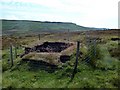
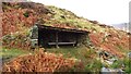
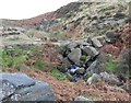
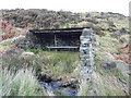
Nearby Images from Geograph Britain and Ireland:
©2011(licence)
©2023(licence)
©2012(licence)
©2012(licence)
©2012(licence)
The above images may not be of the site on this page, they are loaded from Geograph.
Please Submit an Image of this site or go out and take one for us!
Click here to see more info for this site
Nearby sites
Key: Red: member's photo, Blue: 3rd party photo, Yellow: other image, Green: no photo - please go there and take one, Grey: site destroyed
Download sites to:
KML (Google Earth)
GPX (GPS waypoints)
CSV (Garmin/Navman)
CSV (Excel)
To unlock full downloads you need to sign up as a Contributory Member. Otherwise downloads are limited to 50 sites.
Turn off the page maps and other distractions
Nearby sites listing. In the following links * = Image available
799m WNW 299° Priddock Wood Cairn (SK209863)
927m SW 229° Bamford Moor North Ring Cairn (SK209853)
944m N 356° Seven Stones Of Hordron* Stone Circle (SK2152486851)
1.1km S 185° Bamford Moor Central* Cairn (SK215848)
1.2km S 171° Stone on Bamford Moor* Standing Stone (Menhir) (SK21798470)
1.3km SSE 162° The Old Woman Stone* Standing Stone (Menhir) (SK22018467)
1.5km SSE 160° Bamford Moor South* Stone Circle (SK22118453)
1.6km NW 310° Ladybower Tor* Rock Art (SK204869)
2.2km SSE 147° Dennis Knoll* Cairn (SK228841)
2.2km SE 141° Sheepwash Bank Cairn (SK230842)
2.9km SE 141° North Lees Romano British Village* Ancient Village or Settlement (SK2343083673)
3.1km SE 145° Trinity Well (Hathersage)* Holy Well or Sacred Spring (SK234834)
3.4km WNW 291° Crook Hill* Stone Circle (SK184871)
3.6km SE 130° Robin Hood's Cave* Cave or Rock Shelter (SK244836)
4.4km ENE 75° New Hagg (Hallam Moors)* Standing Stone (Menhir) (SK2581587058)
4.6km SSE 164° Healing Spring* Holy Well or Sacred Spring (SK229815)
4.7km ENE 78° Reddicar Clough (Hallam Moor) Cairn (SK26248688)
5.0km WSW 241° St Peter (Hope)* Ancient Cross (SK1725583445)
5.2km NW 317° Pike Low* Cairn (SK180897)
5.3km S 183° Offerton Moor East Cairn (SK213806)
5.3km E 87° Ash Cabin Flat* Stone Circle (SK2693186251)
5.4km S 185° Offerton Moor West Ring Cairn Ring Cairn (SK2115580550)
5.4km E 85° Ash Cabin standing stone* Standing Stone (Menhir) (SK270864)
5.4km S 183° Offerton Moor* Stone Circle (SK213805)
5.5km E 85° Ash Cabin Fort* Hillfort (SK271864)
View more nearby sites and additional images


 We would like to know more about this location. Please feel free to add a brief description and any relevant information in your own language.
 Wir möchten mehr über diese Stätte erfahren. Bitte zögern Sie nicht, eine kurze Beschreibung und relevante Informationen in Deutsch hinzuzufügen.
 Nous aimerions en savoir encore un peu sur les lieux. S'il vous plaît n'hesitez pas à ajouter une courte description et tous les renseignements pertinents dans votre propre langue.
 Quisieramos informarnos un poco más de las lugares. No dude en añadir una breve descripción y otros datos relevantes en su propio idioma.