Featured: Friendly specialist tours to ancient, mystical and historical sites in the UK and beyond

Friendly specialist tours to ancient, mystical and historical sites in the UK and beyond

Prehistoric Cumbria

Prehistoric Cumbria

Who's Online

There are currently, 224 guests and 0 members online.

You are a guest. To join in, please register for free by clicking here

Sponsors

<< Our Photo Pages >> Robin Hood's Stride - Rock Outcrop in England in Derbyshire

Submitted by vicky on Wednesday, 22 October 2014  Page Views: 29210

Natural PlacesSite Name: Robin Hood's Stride Alternative Name: Mock Beggar's Hall
Country: England
NOTE: This site is 0.2 km away from the location you searched for.

County: Derbyshire Type: Rock Outcrop

Map Ref: SK225624  Landranger Map Number: 119
Latitude: 53.158257N  Longitude: 1.664964W
Condition:
5Perfect
4Almost Perfect
3Reasonable but with some damage
2Ruined but still recognisable as an ancient site
1Pretty much destroyed, possibly visible as crop marks
0No data.
-1Completely destroyed
4 Ambience:
5Superb
4Good
3Ordinary
2Not Good
1Awful
0No data.
4 Access:
5Can be driven to, probably with disabled access
4Short walk on a footpath
3Requiring a bit more of a walk
2A long walk
1In the middle of nowhere, a nightmare to find
0No data.
3 Accuracy:
5co-ordinates taken by GPS or official recorded co-ordinates
4co-ordinates scaled from a detailed map
3co-ordinates scaled from a bad map
2co-ordinates of the nearest village
1co-ordinates of the nearest town
0no data
3

Internal Links:
External Links:

I have visited· I would like to visit

Marko visited on 21st Mar 2020 - their rating: Cond: 4 Amb: 4 Access: 3

emerald visited on 1st Jan 2019 - their rating: Cond: 3 Amb: 4 Access: 4

oldstoneman visited on 22nd Aug 2015 - their rating: Cond: 3 Amb: 4 Access: 4

elad13 visited on 17th May 2015 - their rating: Cond: 4 Amb: 5 Access: 4

Ballhc visited on 22nd Mar 2014 - their rating: Cond: 3 Amb: 4 Access: 3

k8marieuk visited on 31st Mar 2013 - their rating: Cond: 3 Amb: 4 Access: 3

mark_a Aurora_skygazer Bladup AngieLake nicoladidsbury TimPrevett have visited here

Average ratings for this site from all visit loggers: Condition: 3.33 Ambience: 4.17 Access: 3.5
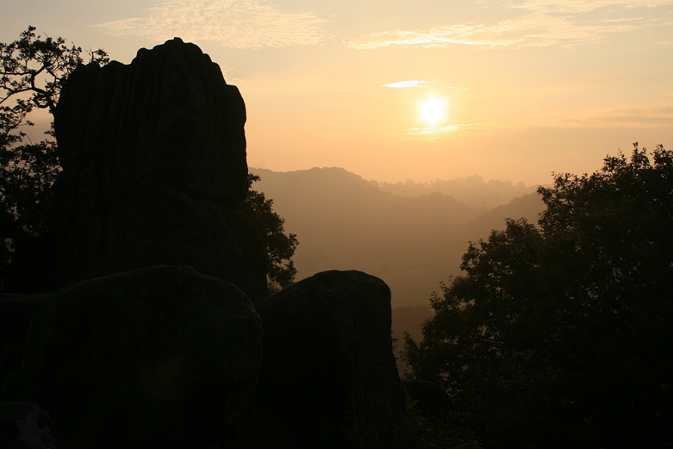
Robin Hood's Stride
Robin Hood's Stride submitted by postman : Autumn Equinox sunrise 2014. (Vote or comment on this photo)
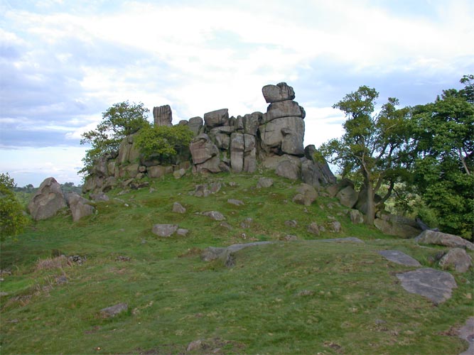
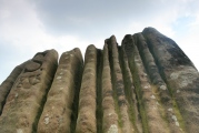
This imposing outcrop, also known as Mock Beggar's Hall, provides a spectacular backdrop for the Nine Stone stone circle. There is a great view of the circle from the top of the outcrop as well as the nearby hillfort of Cratcliff Rocks.

Text by Vicky

Note: Equinix sunrise photos, but a thoughtlessly parked trailer spoiled the view at nearby Nine Stones Close.
You may be viewing yesterday's version of this page. To see the most up to date information please register for a free account.
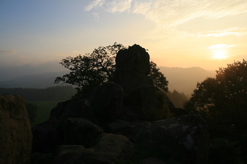
Robin Hood's Stride
Robin Hood's Stride submitted by postman : Autumn Equinox sunrise 2014 (Vote or comment on this photo)

Robin Hood's Stride
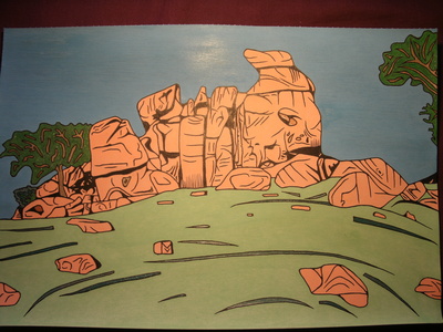
Robin Hood's Stride submitted by Bladup : Robin Hood's Stride. This Original Artwork in a glass frame is £49.99 + Postage (Just whatever it costs), and is 29 and a half cm x 20 cm. A limited (to a 100) edition print in a 8" x 10" glass frame would be £19.99 + £2.90 postage, E-mail me at paul.blades@rocketmail.com if interested. (Vote or comment on this photo)

Robin Hood's Stride
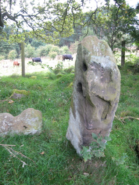
Robin Hood's Stride submitted by AngieLake : On the east side of the hill, on the left of the pathway approaching Robin Hood's Stride, is this lonely stone. It looks as if it might just have gone 'walkabout' from the Nine Stones on the west of the hill. Seems to have been used as a gatepost at some point. (The cattle were 'free to roam' further up the lane, and quite threatening!) (Vote or comment on this photo)

Robin Hood's Stride
Robin Hood's Stride submitted by nicoladidsbury : A view of Robin Hoods Stride. The area around the stride contains many ancient features. An old track way called The Portway Track, runs under the stride and continues northwest towards a feature called Castle Ring. To the Northeast there is a hermits cave, Cratcliff Rocks Hillfort, a magical dew pond and nine stones close to the north. What a place! (3 comments - Vote or comment on this photo)

Robin Hood's Stride
Robin Hood's Stride submitted by postman : Equinox sunlight bathes the Stride.

Robin Hood's Stride
Robin Hood's Stride submitted by postman : Only kudos for spotting the stone circle.

Robin Hood's Stride
Robin Hood's Stride submitted by Bladup : Robin Hood's Stride.

Robin Hood's Stride
Robin Hood's Stride submitted by AngieLake : Another view of the stone on the east side of Robin Hood's Stride. (See comments under today's other posting.)

Robin Hood's Stride
Robin Hood's Stride submitted by TimPrevett : Robin Hood's Stride 28th Feb.

Robin Hood's Stride
Robin Hood's Stride submitted by nicoladidsbury : View to Robin Hoods Stride from Rocking Stone hill, showing the ancient portway path, which leads over the hill and past Nine Stones Close. There is also a path through the trees on the right of the picture to the Hermits Cave, which hides beneath two ancient yews under Cratcliffe cliff and Hillfort.

Robin Hood's Stride
Robin Hood's Stride submitted by Antonine : Inaccessible Pinnacle, 2011

Robin Hood's Stride
Robin Hood's Stride submitted by Antonine : These twin gritstone outcrops were sacred to the Druids. One outcrop is known as The Weasel, the other is known as The Inaccessible Pinnacle. They get the name Robin Hood’s Stride from the folk tale that claims Robin Hood bridged the 20m gap between the pinnacles in a single step. Photo taken in 2011

Robin Hood's Stride
Robin Hood's Stride submitted by postman : Autumn Equinox sunrise 2014

Robin Hood's Stride
Robin Hood's Stride submitted by postman

Robin Hood's Stride
Robin Hood's Stride submitted by postman : Possible cup marks and on the vertical side a circle of the same dimensions as the better known one.

Robin Hood's Stride
Robin Hood's Stride submitted by postman : Deep water runnels

Robin Hood's Stride: Wastcliff Rock Shelter
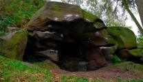
Robin Hood's Stride: Wastcliff Rock Shelter submitted by jackdaw1 : Wastcliff Rock Shelter, Derbyshire next to Robin hood's stride.The white patches one sees in this shot are chalk and not spray paint. (4 comments)

Robin Hood's Stride: Wastcliff Rock Shelter face
Robin Hood's Stride: Wastcliff Rock Shelter face submitted by jackdaw1 : The hermit cast in stone as I perceive who stands frozen next to the cave itself. When facing the cave it stands to the far left, guarding the entrance somewhat. (1 comment)

Robin Hood's Stride
Robin Hood's Stride submitted by jackdaw1 : A megalith that one passes on the stroll up to Hermit's cave. It appears to have been used as a gatepost in later times as there's a hole dug into it as seen in the shot.

Robin Hood's Stride
Robin Hood's Stride submitted by jackdaw1 : Another upload of the interior of the cave afoot of the stride.

Robin Hood's Stride
Robin Hood's Stride submitted by AngieLake : This stone caught my eye as I was climbing the east side of the hill towards Robin Hood's stride. (Following the footpath uphill, after parking in a slight layby beside the north/south road (Alport to Elton?) between Stanton Moor and Robin Hood's Stride.) The stone is well to the left of the path, over halfway up the hill. It looks as if it may have been used as a gatepost at some time. (1 comment)

Robin Hood's Stride
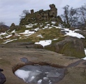
Robin Hood's Stride submitted by nicoladidsbury : Strange carved saucer, with liquid exit channel, and view over to the Stride. (5 comments)

Robin Hood's Stride
Robin Hood's Stride submitted by nicoladidsbury : The Goddess of Robin Hood's Stride! (2 comments)

Robin Hood's Stride
Robin Hood's Stride submitted by nicoladidsbury : Strange circluar carving high up on the Tor's east side, hidden from view, but accessable when accessing the Stride via the rock cut foot holds

These are just the first 25 photos of Robin Hood's Stride. If you log in with a free user account you will be able to see our entire collection.

Do not use the above information on other web sites or publications without permission of the contributor.
Click here to see more info for this site

Nearby sites

Click here to view sites on an interactive OS map

Key: Red: member's photo, Blue: 3rd party photo, Yellow: other image, Green: no photo - please go there and take one, Grey: site destroyed

Download sites to:
KML (Google Earth)
GPX (GPS waypoints)
CSV (Garmin/Navman)
CSV (Excel)

To unlock full downloads you need to sign up as a Contributory Member. Otherwise downloads are limited to 50 sites.


Turn off the page maps and other distractions

Nearby sites listing. In the following links * = Image available
 73m ESE 106° Robin Hoods Settlement* Ancient Village or Settlement (SK22576238)
 153m SSW 192° Robin Hood's Stride* Rock Art (SK22476225)
 223m ESE 117° Cratcliff Rocks* Hillfort (SK227623)
 246m N 9° Nine Stones Close* Stone Circle (SK2253762643)
 412m SSW 194° Dudwood* Stone Circle (SK224620)
 442m N 5° Nine Stones Cup Mark (Harthill) Rock Art (SK22546284)
 462m N 6° Harthill Cairn* Cairn (SK22556286)
 565m NW 315° Castle Ring (Derbyshire)* Hillfort (SK221628)
 792m ESE 115° Rockingstone Farm* Rock Outcrop (SK2322062065)
 1.1km ESE 104° Rowtor Rocks* Rock Art (SK23556215)
 1.1km ESE 106° St Michael’s Church (Birchover)* Carving (SK23576210)
 1.1km ESE 106° The Megalithic Portal Live in the Derbyshire Peak District Natural Stone / Erratic / Other Natural Feature (SK236621)
 1.4km ENE 71° Doll Tor* Stone Circle (SK2383062873)
 1.6km ENE 69° Andle Stone (Stanton Moor)* Natural Stone / Erratic / Other Natural Feature (SK2403162993)
 1.8km ENE 77° Stanton Moor Cairn T14* Cairn (SK24306281)
 1.9km ENE 75° Stanton Moor Cairn T13* Round Cairn (SK243629)
 1.9km ENE 78° Cork Stone* Natural Stone / Erratic / Other Natural Feature (SK2434662788)
 2.2km E 80° Stanton Moor Cairn (TBC)* Cairn (SK2467562791)
 2.2km ENE 75° Stanton Moor Cairn T25* Cairn (SK24656297)
 2.3km ENE 77° Stanton Moor 4* Ring Cairn (SK24716290)
 2.4km NNW 327° All Saints Church (Youlgreave)* Carving (SK21206437)
 2.4km W 275° Larks Low Bowl Barrow* Round Barrow(s) (SK20086260)
 2.4km ENE 73° Stanton Moor Cairn T55* Round Cairn (SK24826313)
 2.4km ENE 70° Stanton Moor 3* Stone Circle (SK24806326)
 2.5km ENE 68° Stanton Moor Cairn T24* Cairn (SK24806333)
View more nearby sites and additional images

<< Weston henge

Hanehaug >>

Please add your thoughts on this site

Kilmartin Sounds of Ancient Scotland Ancient Music CD

Kilmartin Sounds of Ancient Scotland Ancient Music CD

Sponsors

Auto-Translation (Google)

Translate from English into:

"Robin Hood's Stride" | Login/Create an Account | 7 News and Comments
  
Go back to top of page    Comments are owned by the poster. We aren't responsible for their content.
Re: Robin Hood`s Stride by Anonymous on Sunday, 19 February 2017
I think robin hood stride rowter rocks are linked and rock art looks like maps
[ Reply to This ]

Re: Street View by coldrum on Wednesday, 13 October 2010
(User Info | Send a Message)
http://www.pastscape.org.uk/hob.aspx?hob_id=1182175
[ Reply to This ]

Street View by coldrum on Wednesday, 24 March 2010
(User Info | Send a Message)

View Larger Map
[ Reply to This ]

Re: Robin Hood`s Stride by Anonymous on Friday, 24 August 2007
we went there 2day, u visted the hermit cave?
[ Reply to This ]

Re: Robin Hood`s Stride by nicoladidsbury on Monday, 04 September 2006
(User Info | Send a Message)
Sorry that I got that wrong :(
What an amazing place to live - it has to be my most favorite place in the whole of the uk :)
[ Reply to This ]

Re: Robin Hood`s Stride by Anonymous on Monday, 04 September 2006
Hi nicola
just for the record, on your picture no five it showes my drive not the portway track which lies to the left near the hedge and is mostly buried.
Regards Roy
[ Reply to This ]

Re: Robin Hood`s Stride by Anonymous on Wednesday, 04 June 2003
I recently visited Robin Hoods Stride. What a magical place. We noticed some notches cut on a steep rock which look like foot holes, using these we climbed up to a ledge above which was a strange round carving, (or was it natural). The Tor is covered in carvings old and new, and unusual round holes. The light was incredible as I sat on the Tor, great patches of light came racing towards me, washing over the stones and racing away. It was an incredible place, truely moving. There must be a strong connection with the stone circle below. Did the ancient people build the circle there, because the stones were already venerated and the site already a site of worship. This is a place that makes you think deeply, even the small dew pond cast its own magic!

Nik
[ Reply to This ]

Your Name: Anonymous [ Register Now ]
Subject:


Add your comment or contribution to this page. Spam or offensive posts are deleted immediately, don't even bother

<<< What is five plus one as a number? (Please type the answer to this question in the little box on the left)
You can also embed videos and other things. For Youtube please copy and paste the 'embed code'.
For Google Street View please include Street View in the text.
Create a web link like this: <a href="https://www.megalithic.co.uk">This is a link</a>  

Allowed HTML is:
<p> <b> <i> <a> <img> <em> <br> <strong> <blockquote> <tt> <li> <ol> <ul> <object> <param> <embed> <iframe>

We would like to know more about this location. Please feel free to add a brief description and any relevant information in your own language.
Wir möchten mehr über diese Stätte erfahren. Bitte zögern Sie nicht, eine kurze Beschreibung und relevante Informationen in Deutsch hinzuzufügen.
Nous aimerions en savoir encore un peu sur les lieux. S'il vous plaît n'hesitez pas à ajouter une courte description et tous les renseignements pertinents dans votre propre langue.
Quisieramos informarnos un poco más de las lugares. No dude en añadir una breve descripción y otros datos relevantes en su propio idioma.