 with our Megalithic Portal iPhone app")


<< Text Pages >> Graffa Plain (Hartwith) - Cairn in England in Yorkshire (North)
Submitted by Anne T on Monday, 30 October 2017 Page Views: 1800
Neolithic and Bronze AgeSite Name: Graffa Plain (Hartwith)Country: England
NOTE: This site is 1.0 km away from the location you searched for.
County: Yorkshire (North) Type: Cairn
Nearest Town: Summerbridge Nearest Village: Warsill
Map Ref: SE211642
Latitude: 54.073302N Longitude: 1.679041W
Condition:
| 5 | Perfect |
| 4 | Almost Perfect |
| 3 | Reasonable but with some damage |
| 2 | Ruined but still recognisable as an ancient site |
| 1 | Pretty much destroyed, possibly visible as crop marks |
| 0 | No data. |
| -1 | Completely destroyed |
| 5 | Superb |
| 4 | Good |
| 3 | Ordinary |
| 2 | Not Good |
| 1 | Awful |
| 0 | No data. |
| 5 | Can be driven to, probably with disabled access |
| 4 | Short walk on a footpath |
| 3 | Requiring a bit more of a walk |
| 2 | A long walk |
| 1 | In the middle of nowhere, a nightmare to find |
| 0 | No data. |
| 5 | co-ordinates taken by GPS or official recorded co-ordinates |
| 4 | co-ordinates scaled from a detailed map |
| 3 | co-ordinates scaled from a bad map |
| 2 | co-ordinates of the nearest village |
| 1 | co-ordinates of the nearest town |
| 0 | no data |
Internal Links:
External Links:
Cairn in Yorkshire (North)
Located near Brimham Rocks, Pastscape Monument 52021 records this site as 'an alleged cairn cemetery', adding: "Two cairns, forming part of a group on Graffa Plains: one, 12 ft. in diameter and situated about 150 yards north west of the first large group of rocks upon the south east boundary of Brimham Moor, and about 50 yards south east of the trackway leading to 'Riva Hill Farm'; the other cairn 9ft. in diameter and 100 yards south west of the first. Both excavated in 1908 by A. L. Armstrong. Nothing was found except 'black earth' and charcoal suggesting cremations and two shaped sandstone blocks, possibly grain rubbers."
The Northern Antiquarian (TNA) also features a page for this now little-known, possibly destroyed (?) tumulus - see their entry for Graffa Plain, Hartwith, North Yorkshire. TNA give directions for finding this site, together with an early OS map showing the location of the tumulus, and in their 'archaeology & history' section explore the different references for this site.
Note: Have you visited this site? Do you have any comments, historical drawings or photographs to add?
You may be viewing yesterday's version of this page. To see the most up to date information please register for a free account.
Do not use the above information on other web sites or publications without permission of the contributor.
Nearby Images from Geograph Britain and Ireland:
©2021(licence)
©2014(licence)
©2014(licence)
©2014(licence)
©2011(licence)
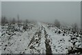
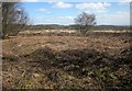
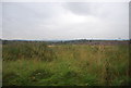
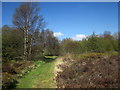
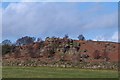
The above images may not be of the site on this page, they are loaded from Geograph.
Please Submit an Image of this site or go out and take one for us!
Click here to see more info for this site
Nearby sites
Key: Red: member's photo, Blue: 3rd party photo, Yellow: other image, Green: no photo - please go there and take one, Grey: site destroyed
Download sites to:
KML (Google Earth)
GPX (GPS waypoints)
CSV (Garmin/Navman)
CSV (Excel)
To unlock full downloads you need to sign up as a Contributory Member. Otherwise downloads are limited to 50 sites.
Turn off the page maps and other distractions
Nearby sites listing. In the following links * = Image available
707m N 352° Brimham Rocks* Rock Outcrop (SE210649)
911m NW 310° Brimham Rocks Rock Art Rock Art (SE2039764782)
1.0km NNW 328° Brimham Rocks Circle Stone Circle (SE20566507)
1.5km S 175° Hartwith Moor* Standing Stone (Menhir) (SE2123362737)
3.1km SW 232° Bryan's Wood 01 Rock Art (SE1866362280)
3.2km SW 233° Eastwoods Farm 01 (Heyshaw) Rock Art (SE1855662240)
3.2km SW 232° Fertility Stone (CR-638)* Rock Art (SE1855262228)
3.2km SW 231° Eastwoods Farm 02 (Heyshaw) Rock Art (SE1857262168)
3.4km SW 230° Eastwoods Farm Cup (Heyshaw)* Rock Art (SE1852062010)
3.4km SW 230° Eastwoods Cross Base (Summerbridge) Rock Art (SE1850662013)
3.5km SW 227° Morphing Stone (Dacre)* Rock Art (SE1855961795)
3.6km SW 227° Eastwoods Rough 3 (Dacre) Rock Art (SE18506177)
3.6km SW 225° Tadpole Stone (Eastwoods Rough)* Rock Art (SE1860161644)
3.8km NNE 33° Wine Wife Well* Holy Well or Sacred Spring (SE23216742)
4.5km ESE 114° Cowgate Manor Barn (Shaw Mills) Rock Art (SE2525562397)
4.7km W 263° Guisecliff Wood (629)* Rock Art (SE1641563565)
5.0km W 259° Hayshaw Moor North (Dacre) Cairn (SE1621863253)
5.0km W 264° Guisecliff Wood (626)* Rock Art (SE1607863641)
5.4km SW 217° Dacre Top* Ancient Village or Settlement (SE179599)
5.6km NNW 342° Pateley Moor* Standing Stone (Menhir) (SE193695)
6.3km ESE 120° Deb Well* Holy Well or Sacred Spring (SE266611)
7.3km N 355° Cast Hills* Ancient Village or Settlement (SE20377147)
7.3km E 98° Cayton Gill carving* Modern Stone Circle etc (SE284632)
7.7km ENE 58° Robin Hood's Well ( Yorkshire)* Holy Well or Sacred Spring (SE2767868295)
7.8km WSW 249° Abbot's Hand* Marker Stone (SE138614)
View more nearby sites and additional images


 We would like to know more about this location. Please feel free to add a brief description and any relevant information in your own language.
 Wir möchten mehr über diese Stätte erfahren. Bitte zögern Sie nicht, eine kurze Beschreibung und relevante Informationen in Deutsch hinzuzufügen.
 Nous aimerions en savoir encore un peu sur les lieux. S'il vous plaît n'hesitez pas à ajouter une courte description et tous les renseignements pertinents dans votre propre langue.
 Quisieramos informarnos un poco más de las lugares. No dude en añadir una breve descripción y otros datos relevantes en su propio idioma.