


<< Our Photo Pages >> Haddon Fields Bowl Barrow 2 - Round Barrow(s) in England in Derbyshire
Submitted by twentytrees on Monday, 31 December 2007 Page Views: 5353
Neolithic and Bronze AgeSite Name: Haddon Fields Bowl Barrow 2Country: England County: Derbyshire Type: Round Barrow(s)
Nearest Town: Bakewell Nearest Village: Youlgreave
Map Ref: SK21726617
Latitude: 53.192177N Longitude: 1.676374W
Condition:
| 5 | Perfect |
| 4 | Almost Perfect |
| 3 | Reasonable but with some damage |
| 2 | Ruined but still recognisable as an ancient site |
| 1 | Pretty much destroyed, possibly visible as crop marks |
| 0 | No data. |
| -1 | Completely destroyed |
| 5 | Superb |
| 4 | Good |
| 3 | Ordinary |
| 2 | Not Good |
| 1 | Awful |
| 0 | No data. |
| 5 | Can be driven to, probably with disabled access |
| 4 | Short walk on a footpath |
| 3 | Requiring a bit more of a walk |
| 2 | A long walk |
| 1 | In the middle of nowhere, a nightmare to find |
| 0 | No data. |
| 5 | co-ordinates taken by GPS or official recorded co-ordinates |
| 4 | co-ordinates scaled from a detailed map |
| 3 | co-ordinates scaled from a bad map |
| 2 | co-ordinates of the nearest village |
| 1 | co-ordinates of the nearest town |
| 0 | no data |
Internal Links:
External Links:
I have visited· I would like to visit
stretchyboy visited on 21st Jun 2020 - their rating: Cond: 3 Amb: 3 Access: 3 There is no footpath here, but its fairly close.
")
Scheduled Monument 13361: Haddon Fields is located on the eastern shelves south of Wye Dale on the limestone plateau of Derbyshire. The monument includes the northernmost of two bowl barrows on Haddon Fields and is a sub-circular mound measuring 20.5m by 13m by c.0.6m high. Formerly, the barrow would have been somewhat higher and more uniformly round. However, it has been ploughed over in the past which has caused some distortion of the original form. It may have been the barrow on Haddon Fields partially excavated by Thomas Bateman in 1860 in which was found a contracted skeleton on a bed of charred wood accompanied by a flint arrowhead, a bone spatula and a bronze awl. This, however, has not been confirmed and it is the location and appearance of the barrow, and its proximity to others of the same kind, which date it to the Bronze Age.
You may be viewing yesterday's version of this page. To see the most up to date information please register for a free account.
")
")
")
Do not use the above information on other web sites or publications without permission of the contributor.
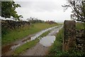
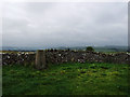
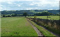
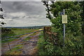
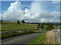
Nearby Images from Geograph Britain and Ireland:
©2011(licence)
©2014(licence)
©2011(licence)
©2014(licence)
©2011(licence)
The above images may not be of the site on this page, they are loaded from Geograph.
Please Submit an Image of this site or go out and take one for us!
Click here to see more info for this site
Nearby sites
Key: Red: member's photo, Blue: 3rd party photo, Yellow: other image, Green: no photo - please go there and take one, Grey: site destroyed
Download sites to:
KML (Google Earth)
GPX (GPS waypoints)
CSV (Garmin/Navman)
CSV (Excel)
To unlock full downloads you need to sign up as a Contributory Member. Otherwise downloads are limited to 50 sites.
Turn off the page maps and other distractions
Nearby sites listing. In the following links * = Image available
854m SSW 197° Haddon Fields Bowl Barrow 1* Round Barrow(s) (SK21486535)
1.4km W 259° Cranes Fort* Hillfort (SK203659)
1.9km SSW 196° All Saints Church (Youlgreave)* Carving (SK21206437)
1.9km NNE 12° St Peter's Well (Bakewell)* Holy Well or Sacred Spring (SK2209768025)
2.3km N 356° Bakewell Churchyard* Ancient Cross (SK2154768458)
2.4km N 2° Bath House Spring* Holy Well or Sacred Spring (SK218686)
2.9km WSW 241° Bee Lowe Round Cairn (SK19166473)
3.0km NE 39° Calton Pasture* Round Barrow(s) (SK236685)
3.1km NE 52° Calton Pasture II* Round Barrow(s) (SK24136805)
3.1km NNE 20° Ball Cross* Hillfort (SK228691)
3.4km S 174° Castle Ring (Derbyshire)* Hillfort (SK221628)
3.4km WSW 257° Calling Low Dale* Cave or Rock Shelter (SK184654)
3.4km SSE 166° Harthill Cairn* Cairn (SK22556286)
3.4km SSE 166° Nine Stones Cup Mark (Harthill) Rock Art (SK22546284)
3.6km SSE 167° Nine Stones Close* Stone Circle (SK2253762643)
3.8km SE 129° Stanton Moor Cairn T2* Round Cairn (SK247638)
3.8km SSE 169° Robin Hood's Stride* Rock Outcrop (SK225624)
3.9km SSE 168° Robin Hoods Settlement* Ancient Village or Settlement (SK22576238)
3.9km SSE 148° Doll Tor* Stone Circle (SK2383062873)
3.9km SE 144° Andle Stone (Stanton Moor)* Natural Stone / Erratic / Other Natural Feature (SK2403162993)
3.9km SSW 205° Larks Low Bowl Barrow* Round Barrow(s) (SK20086260)
4.0km S 169° Robin Hood's Stride* Rock Art (SK22476225)
4.0km SSE 166° Cratcliff Rocks* Hillfort (SK227623)
4.0km SE 128° Stanton Moor 1* Stone Circle (SK249637)
4.1km SE 131° The King (Stanton Moor)* Standing Stone (Menhir) (SK24876347)
View more nearby sites and additional images


 We would like to know more about this location. Please feel free to add a brief description and any relevant information in your own language.
 Wir möchten mehr über diese Stätte erfahren. Bitte zögern Sie nicht, eine kurze Beschreibung und relevante Informationen in Deutsch hinzuzufügen.
 Nous aimerions en savoir encore un peu sur les lieux. S'il vous plaît n'hesitez pas à ajouter une courte description et tous les renseignements pertinents dans votre propre langue.
 Quisieramos informarnos un poco más de las lugares. No dude en añadir una breve descripción y otros datos relevantes en su propio idioma.