


<< Our Photo Pages >> Burton Bole - Round Barrow(s) in England in Derbyshire
Submitted by DaveDunford on Monday, 05 June 2006 Page Views: 4204
Neolithic and Bronze AgeSite Name: Burton BoleCountry: England County: Derbyshire Type: Round Barrow(s)
Nearest Village: Abney
Map Ref: SK194806
Latitude: 53.321973N Longitude: 1.710223W
Condition:
| 5 | Perfect |
| 4 | Almost Perfect |
| 3 | Reasonable but with some damage |
| 2 | Ruined but still recognisable as an ancient site |
| 1 | Pretty much destroyed, possibly visible as crop marks |
| 0 | No data. |
| -1 | Completely destroyed |
| 5 | Superb |
| 4 | Good |
| 3 | Ordinary |
| 2 | Not Good |
| 1 | Awful |
| 0 | No data. |
| 5 | Can be driven to, probably with disabled access |
| 4 | Short walk on a footpath |
| 3 | Requiring a bit more of a walk |
| 2 | A long walk |
| 1 | In the middle of nowhere, a nightmare to find |
| 0 | No data. |
| 5 | co-ordinates taken by GPS or official recorded co-ordinates |
| 4 | co-ordinates scaled from a detailed map |
| 3 | co-ordinates scaled from a bad map |
| 2 | co-ordinates of the nearest village |
| 1 | co-ordinates of the nearest town |
| 0 | no data |
Internal Links:
External Links:
")
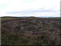
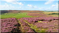
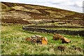
Insignificant bowl barrow on the southeastern end of Burton Bole (part of Abney Moor); apparently not a Scheduled Ancient Monument.
You may be viewing yesterday's version of this page. To see the most up to date information please register for a free account.
Do not use the above information on other web sites or publications without permission of the contributor.
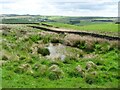
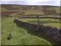
Nearby Images from Geograph Britain and Ireland:
©2006(licence)
©2023(licence)
©2022(licence)
©2013(licence)
©2023(licence)
The above images may not be of the site on this page, they are loaded from Geograph.
Please Submit an Image of this site or go out and take one for us!
Click here to see more info for this site
Nearby sites
Key: Red: member's photo, Blue: 3rd party photo, Yellow: other image, Green: no photo - please go there and take one, Grey: site destroyed
Download sites to:
KML (Google Earth)
GPX (GPS waypoints)
CSV (Garmin/Navman)
CSV (Excel)
To unlock full downloads you need to sign up as a Contributory Member. Otherwise downloads are limited to 50 sites.
Turn off the page maps and other distractions
Nearby sites listing. In the following links * = Image available
852m ESE 111° Abney Moor I* Stone Circle (SK202803)
919m ESE 103° Smelting Hill* Stone Circle (SK203804)
1.3km WNW 297° The Grey Ditch* Misc. Earthwork (SK182812)
1.8km E 92° Offerton Moor West Ring Cairn Ring Cairn (SK2115580550)
1.9km E 90° Offerton Moor East Cairn (SK213806)
1.9km E 93° Offerton Moor* Stone Circle (SK213805)
2.1km W 263° Hazlebadge Round Barrow 1* Round Barrow(s) (SK17268034)
2.2km ESE 104° Highlow Bank* Standing Stone (Menhir) (SK215801)
2.2km SW 215° Crow Chin cairns* Cairn (SK1815578818)
2.3km WSW 252° Hazlebadge Round Barrow 2* Round Barrow(s) (SK17257991)
2.4km NW 305° Bath Spring Holy Well or Sacred Spring (SK174820)
2.7km SSE 155° Derwic Well* Holy Well or Sacred Spring (SK2054978171)
2.8km SE 132° Stanage* Cairn (SK215787)
2.8km SSW 212° Burr Tor* Hillfort (SK179782)
2.9km WSW 241° Stan Low* Round Barrow(s) (SK169792)
3.0km W 265° Fissure Cave Cave or Rock Shelter (SK164803)
3.1km WSW 242° Cop Low* Round Barrow(s) (SK16627912)
3.5km NW 312° The Folly Round Barrow(s) (SK168829)
3.5km ESE 117° Eyam Moor Barrow* Long Barrow (SK22547900)
3.5km ESE 117° Wet Withens* Stone Circle (SK22557900)
3.6km NW 323° St Peter (Hope)* Ancient Cross (SK1725583445)
3.6km ENE 76° Healing Spring* Holy Well or Sacred Spring (SK229815)
4.1km ESE 113° Eyam Moor II* Stone Circle (SK232790)
4.2km ESE 116° Eyam Moor III* Stone Circle (SK232788)
4.4km SE 141° Mompesson's Well* Holy Well or Sacred Spring (SK222772)
View more nearby sites and additional images


 We would like to know more about this location. Please feel free to add a brief description and any relevant information in your own language.
 Wir möchten mehr über diese Stätte erfahren. Bitte zögern Sie nicht, eine kurze Beschreibung und relevante Informationen in Deutsch hinzuzufügen.
 Nous aimerions en savoir encore un peu sur les lieux. S'il vous plaît n'hesitez pas à ajouter une courte description et tous les renseignements pertinents dans votre propre langue.
 Quisieramos informarnos un poco más de las lugares. No dude en añadir una breve descripción y otros datos relevantes en su propio idioma.