


<< Our Photo Pages >> Sheldon 1 (Derbyshire) - Round Barrow(s) in England in Derbyshire
Submitted by Anonymous on Wednesday, 31 May 2006 Page Views: 4511
Neolithic and Bronze AgeSite Name: Sheldon 1 (Derbyshire)Country: England
NOTE: This site is 1.8 km away from the location you searched for.
County: Derbyshire Type: Round Barrow(s)
Nearest Town: Bakewell Nearest Village: Sheldon
Map Ref: SK16926898
Latitude: 53.217609N Longitude: 1.748067W
Condition:
| 5 | Perfect |
| 4 | Almost Perfect |
| 3 | Reasonable but with some damage |
| 2 | Ruined but still recognisable as an ancient site |
| 1 | Pretty much destroyed, possibly visible as crop marks |
| 0 | No data. |
| -1 | Completely destroyed |
| 5 | Superb |
| 4 | Good |
| 3 | Ordinary |
| 2 | Not Good |
| 1 | Awful |
| 0 | No data. |
| 5 | Can be driven to, probably with disabled access |
| 4 | Short walk on a footpath |
| 3 | Requiring a bit more of a walk |
| 2 | A long walk |
| 1 | In the middle of nowhere, a nightmare to find |
| 0 | No data. |
| 5 | co-ordinates taken by GPS or official recorded co-ordinates |
| 4 | co-ordinates scaled from a detailed map |
| 3 | co-ordinates scaled from a bad map |
| 2 | co-ordinates of the nearest village |
| 1 | co-ordinates of the nearest town |
| 0 | no data |
Internal Links:
External Links:
 (PID:21098)")
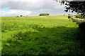
Well preserved Bronze Age bowl barrow albeit now covered in trees and surrounded by a dry stone wall on all wides, and on private land - a footpath runs very close. Excavation discovered two burials - one adult, one juvenile - and fragments of urns.
Excellent views at 330m - Arbor Low is visible som 3.25 miles away on the horizon.
You may be viewing yesterday's version of this page. To see the most up to date information please register for a free account.
Do not use the above information on other web sites or publications without permission of the contributor.
Nearby Images from Geograph Britain and Ireland:
©2017(licence)
©2013(licence)
©2017(licence)
©2009(licence)
©2017(licence)
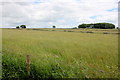
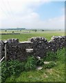
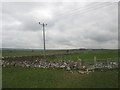
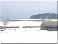
The above images may not be of the site on this page, they are loaded from Geograph.
Please Submit an Image of this site or go out and take one for us!
Click here to see more info for this site
Nearby sites
Key: Red: member's photo, Blue: 3rd party photo, Yellow: other image, Green: no photo - please go there and take one, Grey: site destroyed
Download sites to:
KML (Google Earth)
GPX (GPS waypoints)
CSV (Garmin/Navman)
CSV (Excel)
To unlock full downloads you need to sign up as a Contributory Member. Otherwise downloads are limited to 50 sites.
Turn off the page maps and other distractions
Nearby sites listing. In the following links * = Image available
284m NNW 342° Sheldon 2 (Derbyshire) Round Barrow(s) (SK16836925)
1.2km NE 40° Skinner's Well* Holy Well or Sacred Spring (SK177699)
1.5km N 359° Demons Dale Cave* Cave or Rock Shelter (SK16897045)
2.1km NNE 16° Fin Cop* Hillfort (SK175710)
2.4km NNE 14° Hob’s House Cave* Cave or Rock Shelter (SK175713)
2.6km S 181° Ringham Low* Chambered Cairn (SK169664)
2.7km WNW 302° Taddington Barrow* Round Barrow(s) (SK146704)
2.7km WSW 238° Monyash Round Barrow 2 Round Barrow(s) (SK146675)
2.8km SW 230° Monyash Round Barrow 1* Round Barrow(s) (SK148672)
3.1km NW 307° Taddington High Well* Holy Well or Sacred Spring (SK1442470824)
3.1km ENE 73° Sheepwash Well Holy Well or Sacred Spring (SK199699)
3.4km S 174° One Ash Shelter* Cave or Rock Shelter (SK17266559)
3.9km SSE 158° Calling Low Dale* Cave or Rock Shelter (SK184654)
4.0km NNE 20° Castlegate Lane* Round Barrow(s) (SK18267276)
4.5km NW 311° Priestcliffe Low* Round Barrow(s) (SK13497190)
4.6km SE 133° Cranes Fort* Hillfort (SK203659)
4.6km S 184° Cales Dale* Round Barrow(s) (SK16636437)
4.6km N 6° Ravenscliffe Cave Cave or Rock Shelter (SK174736)
4.6km E 97° Bakewell Churchyard* Ancient Cross (SK2154768458)
4.7km NNE 25° Longstone Moor* Round Barrow(s) (SK18887328)
4.8km SSE 152° Bee Lowe Round Cairn (SK19166473)
4.9km NNE 18° Rolley Low* Round Barrow(s) (SK18447362)
4.9km E 95° Bath House Spring* Holy Well or Sacred Spring (SK218686)
5.0km WNW 295° Five Wells* Chambered Tomb (SK1238671044)
5.1km N 11° Wardlow Hay Cop* Round Barrow(s) (SK17857397)
View more nearby sites and additional images


 We would like to know more about this location. Please feel free to add a brief description and any relevant information in your own language.
 Wir möchten mehr über diese Stätte erfahren. Bitte zögern Sie nicht, eine kurze Beschreibung und relevante Informationen in Deutsch hinzuzufügen.
 Nous aimerions en savoir encore un peu sur les lieux. S'il vous plaît n'hesitez pas à ajouter une courte description et tous les renseignements pertinents dans votre propre langue.
 Quisieramos informarnos un poco más de las lugares. No dude en añadir una breve descripción y otros datos relevantes en su propio idioma.