


<< Other Photo Pages >> Marlborough Common Barrows - Barrow Cemetery in England in Wiltshire
Submitted by SolarMegalith on Wednesday, 09 March 2011 Page Views: 5591
Neolithic and Bronze AgeSite Name: Marlborough Common BarrowsCountry: England County: Wiltshire Type: Barrow Cemetery
Nearest Town: Marlborough
Map Ref: SU1806770169
Latitude: 51.430240N Longitude: 1.74151W
Condition:
| 5 | Perfect |
| 4 | Almost Perfect |
| 3 | Reasonable but with some damage |
| 2 | Ruined but still recognisable as an ancient site |
| 1 | Pretty much destroyed, possibly visible as crop marks |
| 0 | No data. |
| -1 | Completely destroyed |
| 5 | Superb |
| 4 | Good |
| 3 | Ordinary |
| 2 | Not Good |
| 1 | Awful |
| 0 | No data. |
| 5 | Can be driven to, probably with disabled access |
| 4 | Short walk on a footpath |
| 3 | Requiring a bit more of a walk |
| 2 | A long walk |
| 1 | In the middle of nowhere, a nightmare to find |
| 0 | No data. |
| 5 | co-ordinates taken by GPS or official recorded co-ordinates |
| 4 | co-ordinates scaled from a detailed map |
| 3 | co-ordinates scaled from a bad map |
| 2 | co-ordinates of the nearest village |
| 1 | co-ordinates of the nearest town |
| 0 | no data |
Internal Links:
External Links:
Barrow Cemetery in Wiltshire
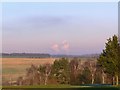
This Bronze Age barrow cemetery includes two bowl barrows and possible remains of a bell barow. The barrows are in poor condition, preserved up to 0,5 m of height. The site is located near Marlborough Golf Course.
You may be viewing yesterday's version of this page. To see the most up to date information please register for a free account.
Do not use the above information on other web sites or publications without permission of the contributor.
Andy B has found this location on Google Street View:
Nearby Images from Geograph Britain and Ireland:
©2015(licence)
©2020(licence)
©2007(licence)
©2019(licence)
©2007(licence)
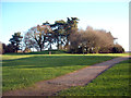
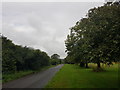
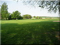
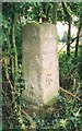
The above images may not be of the site on this page, they are loaded from Geograph.
Please Submit an Image of this site or go out and take one for us!
Click here to see more info for this site
Nearby sites
Key: Red: member's photo, Blue: 3rd party photo, Yellow: other image, Green: no photo - please go there and take one, Grey: site destroyed
Download sites to:
KML (Google Earth)
GPX (GPS waypoints)
CSV (Garmin/Navman)
CSV (Excel)
To unlock full downloads you need to sign up as a Contributory Member. Otherwise downloads are limited to 50 sites.
Turn off the page maps and other distractions
Nearby sites listing. In the following links * = Image available
454m SW 234° Seorfon Long Barrow (SU177699)
1.5km S 169° Merlin's Mount* Artificial Mound (SU18366865)
1.9km SW 236° Manton Round Barrow* Round Barrow(s) (SU165691)
2.3km NNE 19° Ogbourne St Andrew* Round Barrow(s) (SU188723)
2.3km WSW 240° Broad Stones (Clatford) Stone Circle (SU16096900)
2.5km WNW 301° Manton Circle* Modern Stone Circle etc (SU1587971446)
2.6km SW 230° Broadstones* Stone Circle (SU161685)
2.9km W 260° Devils Den* Burial Chamber or Dolmen (SU1521169654)
3.1km NNW 328° Rockley Plantation Barrows* Barrow Cemetery (SU1643372778)
3.1km WNW 293° Manton Long Barrow* Long Barrow (SU152714)
3.3km NNW 328° Rockley Down Barrows* Round Barrow(s) (SU16317300)
3.8km WNW 287° Long Tom (Avebury)* Standing Stone (Menhir) (SU1438371290)
3.9km WNW 282° Fyfield Down* Ancient Village or Settlement (SU142710)
4.2km WSW 248° Piggle Dene* Natural Stone / Erratic / Other Natural Feature (SU14126858)
4.4km W 275° Mother's Jam* Natural Stone / Erratic / Other Natural Feature (SU13697052)
4.6km WNW 291° Totterdown Wood dew pond holed stone* Sculptured Stone (SU13807179)
4.6km W 276° The Toad Stone* Natural Stone / Erratic / Other Natural Feature (SU135706)
4.7km SW 233° Lockeridge Grey Wethers* Natural Stone / Erratic / Other Natural Feature (SU143673)
4.8km WNW 286° Fyfield Down (Avebury)* Rock Art (SU13437152)
4.8km SW 216° West Woods (Hursley Bottom) Standing Stone* Standing Stone (Menhir) (SU15226625)
4.9km W 267° Pickledean Stone Circle (SU13196988)
5.0km W 274° Overton Downs Tumuli* Round Barrow(s) (SU13057051)
5.0km SW 221° West Woods Polissoir No.1* Polissoir (SU1476966380)
5.0km WSW 239° West Overton Bowl Barrow Round Barrow(s) (SU13736758)
5.1km ESE 112° East Croft Coppice Enclosure* Misc. Earthwork (SU2279968329)
View more nearby sites and additional images


 We would like to know more about this location. Please feel free to add a brief description and any relevant information in your own language.
 Wir möchten mehr über diese Stätte erfahren. Bitte zögern Sie nicht, eine kurze Beschreibung und relevante Informationen in Deutsch hinzuzufügen.
 Nous aimerions en savoir encore un peu sur les lieux. S'il vous plaît n'hesitez pas à ajouter une courte description et tous les renseignements pertinents dans votre propre langue.
 Quisieramos informarnos un poco más de las lugares. No dude en añadir una breve descripción y otros datos relevantes en su propio idioma.